

To be social is to be forgiving.
Robert Frost
The cold front that moved through yesterday left us with a beautiful fall day.
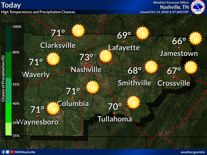
Tonight will be cool with a low of 46°.
Similar story Wednesday albeit a bit warmer. Maybe touching 80° by the afternoon.
Another Cold Front Late Thursday
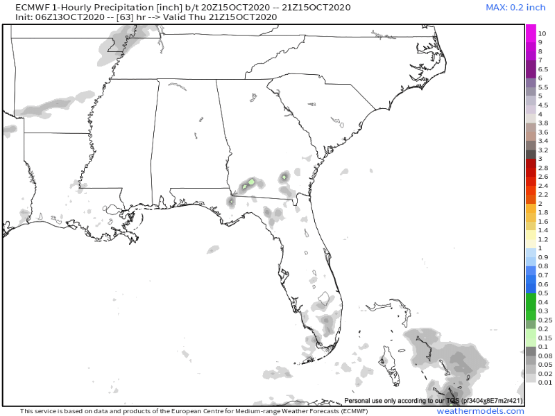
Cold front ETA Thursday night. Some light rain is possible with this passage.
Euro Model isn’t impressed, only light rain. Doesn’t look like a rainout.
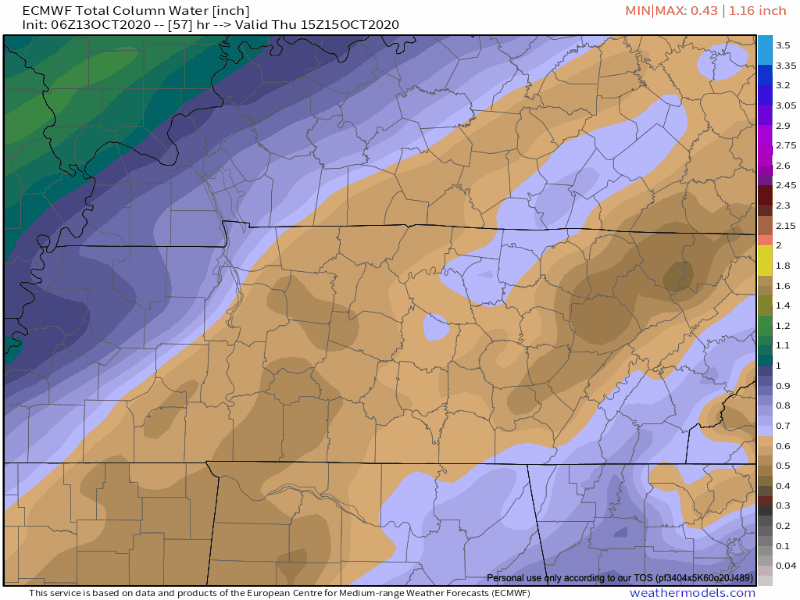
GFS also has the same idea. Precipitable Water (measure of moisture in the atmosphere) isn’t impressive, but enough for at least isolated showers.
Any rain will quickly exit the area by Friday morning.
Temperatures will fall behind the front.
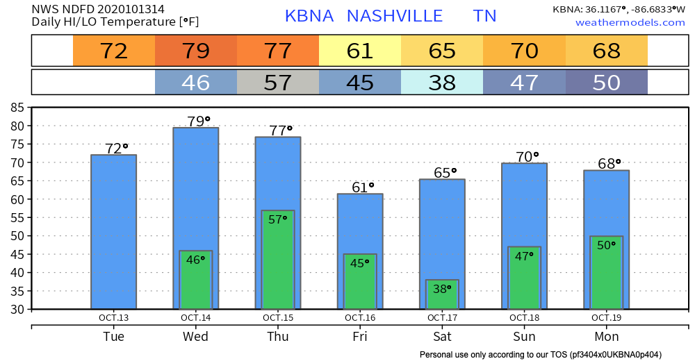
Notice that “38” Saturday morning! That’s the morning we’ll have to watch for a frost. NWS Nashville mentions this possibility in their discussion.
After a pretty warm weekend, highs Friday will be mainly in the upper 50s to lower 60s, with mid and upper 30s following Saturday morning. This will likely produce patchy frost across much of the area.
NWS AFD 10-13-2020
Grass seed/plant enthusiasts should take note. Still a little early for our typical first freeze but if you live outside of Nashville, your Saturday morning temp could be a couple degrees cooler. 38° is the official low at BNA, many backyards get colder than that. Not expecting anyone to freeze (at least right now, we aren’t), but frost is likely.
Categories: Forecast Blogs (Legacy)
You must be logged in to post a comment.