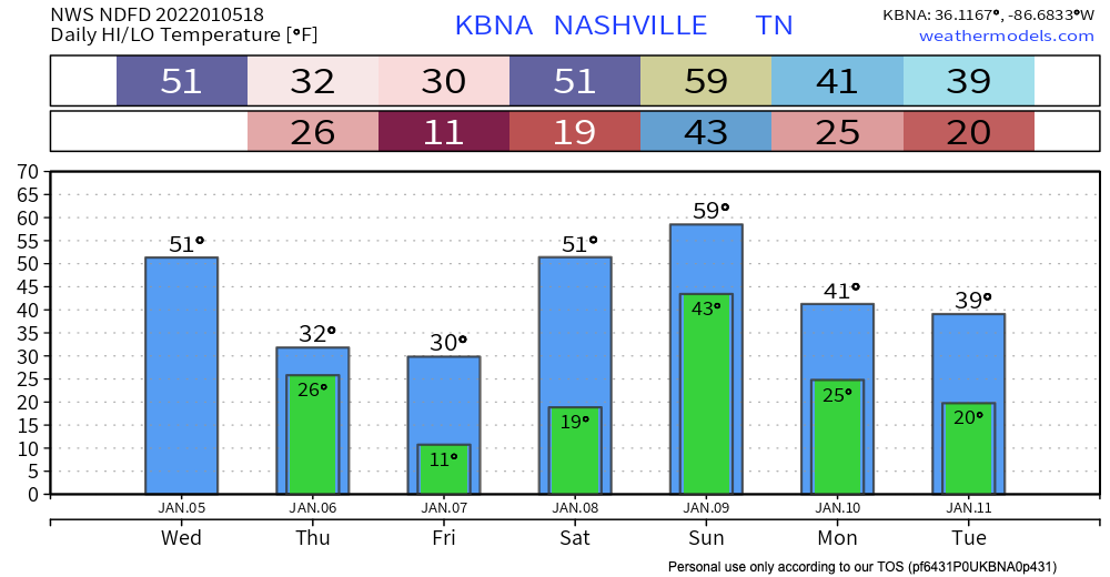
Last month seemed like never ending severe weather. This month seems like never ending winter weather.
Today’s weather is pretty plain and simple. Slightly warmer temps, a little breezy, and no rain. Now on to the fun stuff.

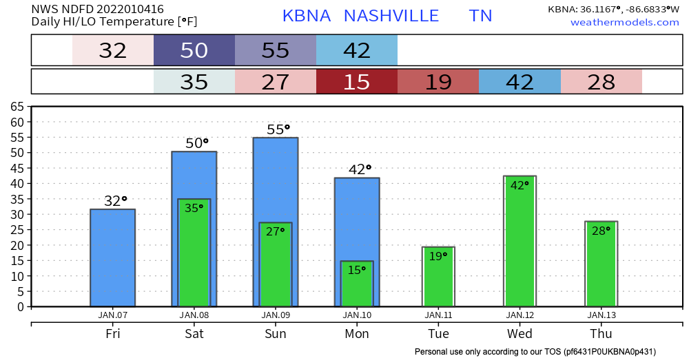
Last month seemed like never ending severe weather. This month seems like never ending winter weather.
Today’s weather is pretty plain and simple. Slightly warmer temps, a little breezy, and no rain. Now on to the fun stuff.
Put very scientifically by NWS-Nashville: “Yep, looks like old man winter will be taking another swing at the mid state on Thursday.”
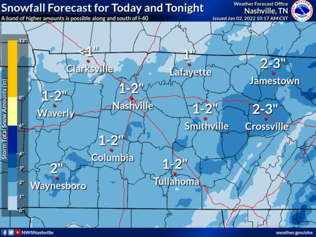
Middle Tennessee, in general, can expect this:
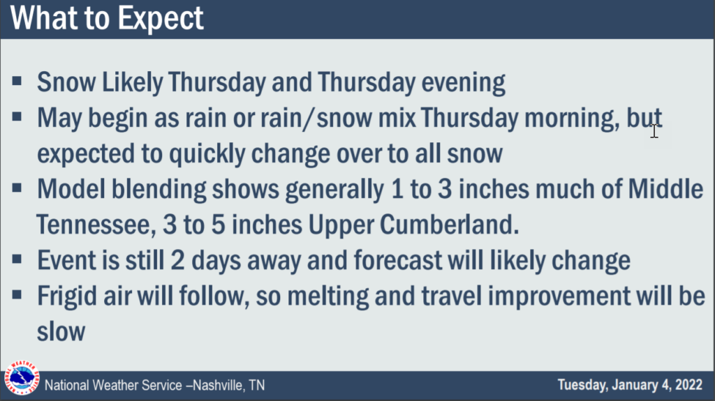
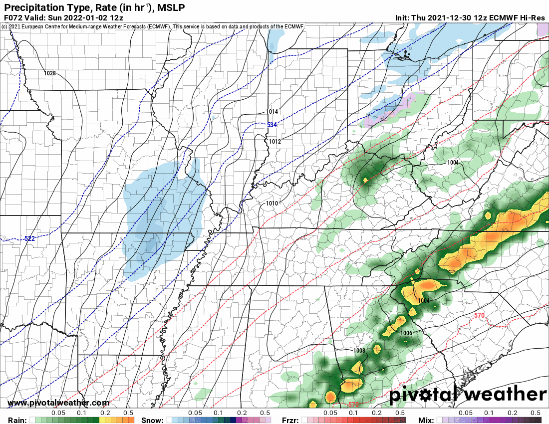
Timing remains iffy right now because we only have the lower resolution global models. Those models are the GFS and Euro. Both show a big blue blob (snow) moving through starting Thursday around 9 AM and lasting into early evening Thursday. Again, timing does not appear at all solid. Remember the above slide that says “Event is still 2 days away and forecast will likely change.” We will update you on changes on Twitter and in future blogs, as needed.

It is 32 at BNA as we publish this blog. Temps won’t get out of the 30’s today with a high around 39, so expect accellerating melting this afternoon. Although the sun will start to come out still watch out for some ice on the roads especially on bridges, overpasses and area of elevation.
Snow is coming.
The latest HRRR model run delivers snow earlier than the earlier 4-6 PM timeline. It thinks the wintry stuff could be here as early as 1 or 2 PM. See below:
Expect the first hour or so of snow to melt on contact. The ground is very warm. But heavy snowfall rates should supercool everything, and eventually allow for the snow to stick to all surfaces. NWS-Nashville increased snow totals.

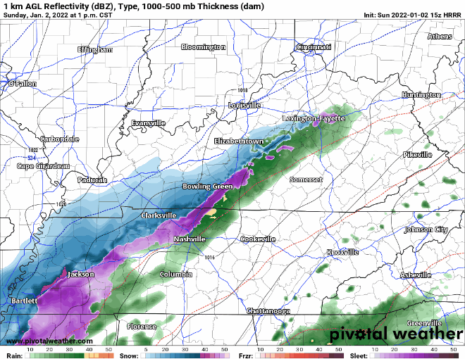
NEW YEAR’S DAY RECAP
Instability (not enough) – shear (way too much) combo was off today. Storms rotated and we had cause for the one tornado warning in west Williamson County, but by the time that storm got to the Will Co line it lost concerning tight rotation. We think Ned’s cap hung on just long to keep storms from exploding over 20kft, so we escaped New Year’s Day unscathed.
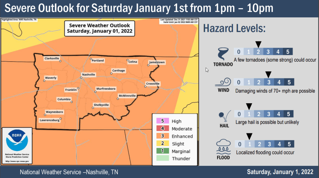
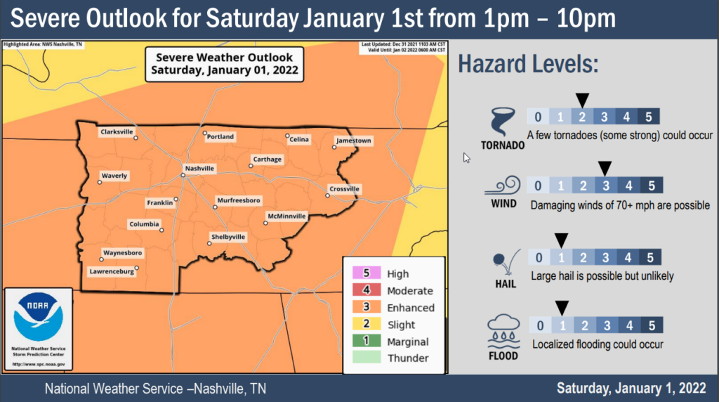
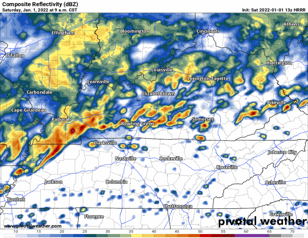
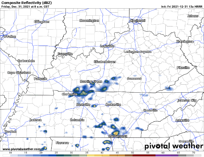
The 13z HRRR model run shows supercells and multicell storm clusters forming ahead of a cold front this afternoon.
These storms will rotate. Some rotating storms will be capable of producing damaging straight line winds, tornadoes, and hail.
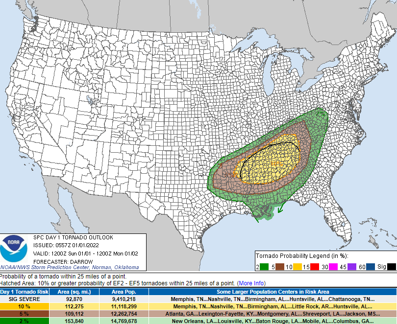
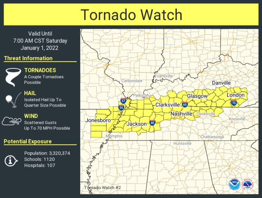
SPC issued a tornado watch that expires at 7:00 am for a large area that includes Davidson County. Williamson County is excluded.
The model trend throughout the day Friday has been for storms to develop increasingly north and west of Nashville. This has become the case as the new year has begun.
This morning we’ll be seeing some scattered showers around the area, which should clear out before lunch time.
Later into this evening, some heavier storms will make their way through. The HRRR currently has the rain moving in around 8pm and sticking around through that New Years toast. This unfortunately means outdoor parties are a no-go. Probably going to be hard to shoot fireworks in the pouring rain.
This is a complicated forecast that we make easy lol. Let me start off saying we’re relying on the HRRR model. I point this out because there are so many Somewhat Different Ideas from other weather models about Friday and Saturday. Were we to talk about all those that would make this weather briefing more annoying than it already is. I say that to ask you to please check back in the morning because timing and hazards may change, and I think the data might give you a clearer picture of what’ll be incoming. Saturday looks worse than Friday, generally speaking. I’m hoping this will at least help you plan your weekend.
You must be logged in to post a comment.