Today The King Returns, When Will The Rain?

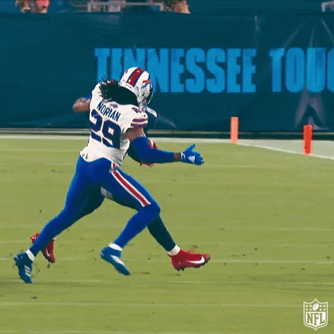
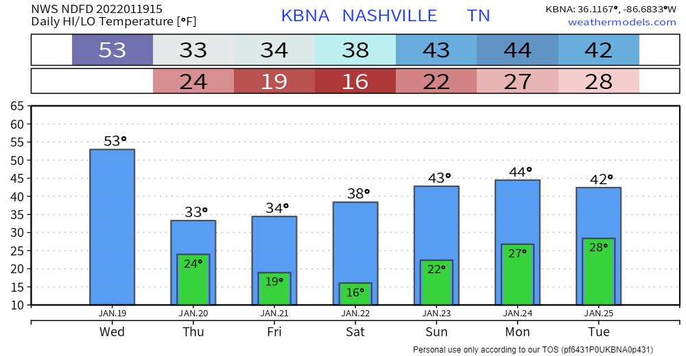
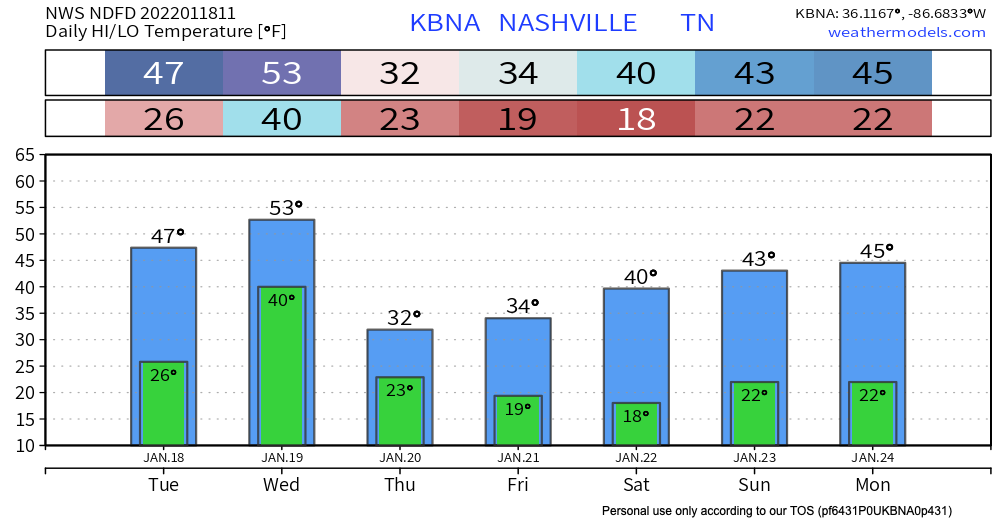
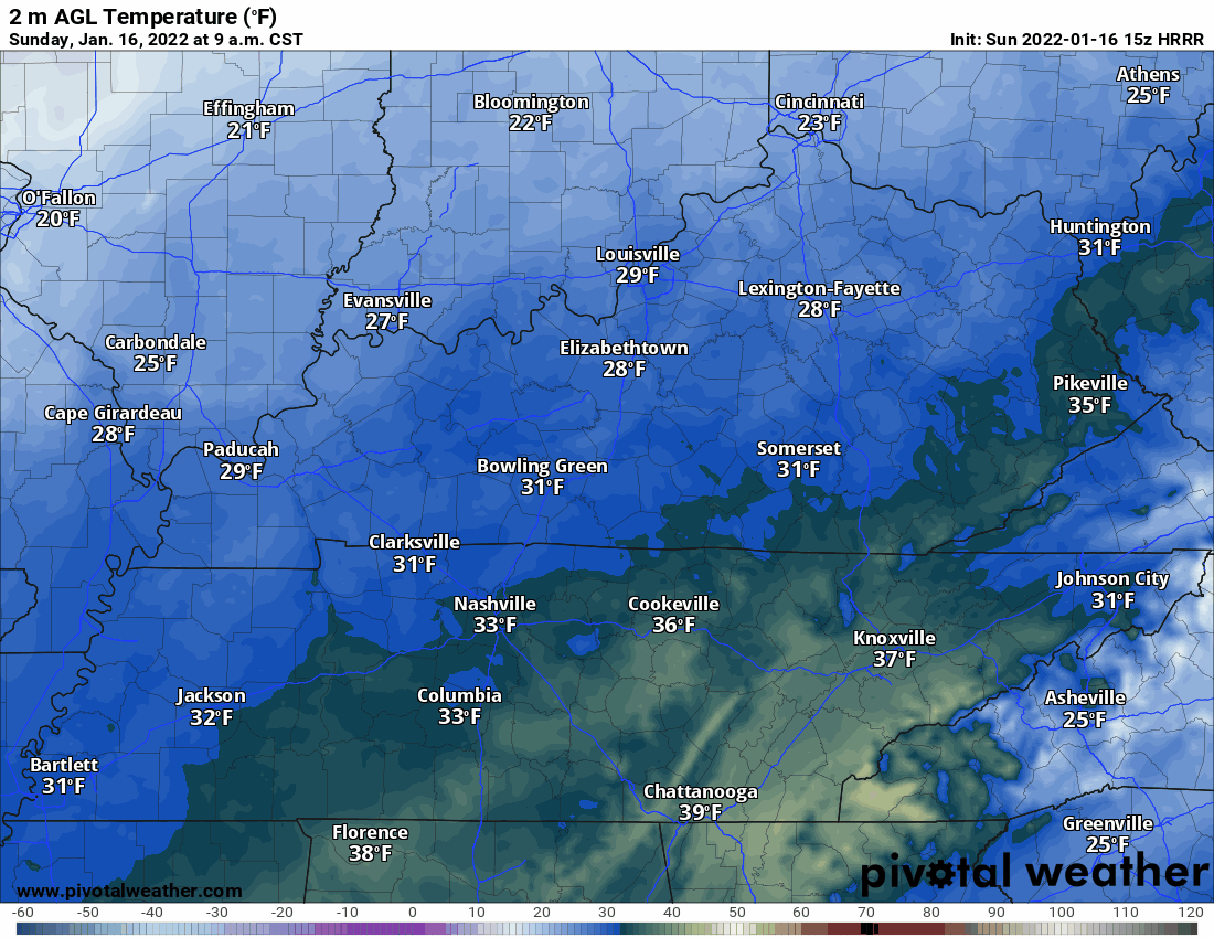
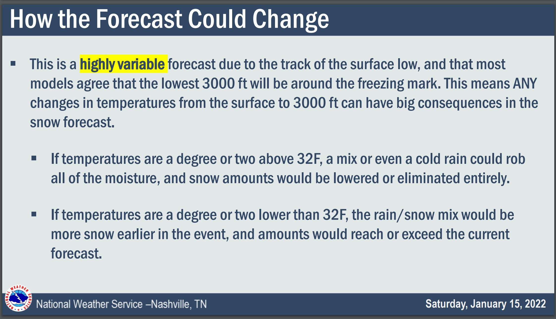
This cold weather may have you feeling like Josh Norman.

Regular Season No GIF by NFL

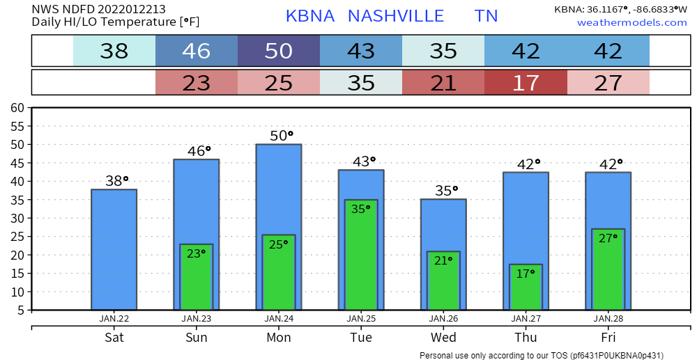
And these temps aren’t going anywhere, anytime soon.

However, besides the cold temps, today is a great day for some Titans football.

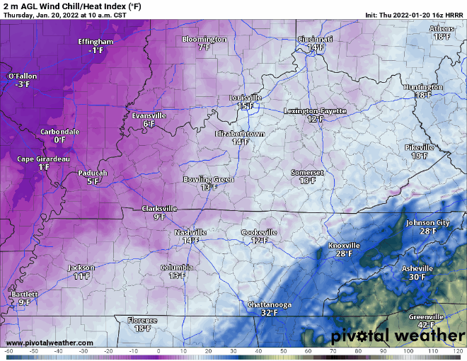
No rain or frozen precipitation today. Besides for maybe a few cirrus clouds streaming in, the sun will be out today which should help to make it not feel so cold. read more

Cold but Dry Weekend

It is definitely going to feel like winter out there today. Grab your hats, scarves, fuzzy socks, and gloves cause it is capital C Cold today. Temps will be in the 20s and 30s. This combines with the wind coming from the north, giving us some wind chill values in the teens. Here’s what that looks like on the HRRR. Blue is very cold, purple is very very cold. read more

Chilly and Dry Weekend Ahead

All the wintry stuff is well east of us by the time you are reading this. Now we are just left with the cold.

It is COLD out. The high temp today is expected to get up to freezing. If you take wind chill into account it’ll feel like it’s in the teens. The extremely blue and purple image below better illustrates this. read more

Showers Today, Wintery Mix Possible Tonight

A line of rain has arrived. No severe weather/flooding concerns. Can’t rule out an isolated thunderstorm here or there, but most will see just showers.

Showers transition into a wintry mix late tonight as temps dip to at/below freezing. Models are in pretty good agreement as far as precip type/accumulation goes. Not much more than a dusting expected for our area (less than a half inch). read more

Freezing Fog Advisory till 9; Wintery Mix Wednesday? Maybe

Freezing fog has already formed early this morning. A dense freezing fog advisory is in effect until 9am this morning. Some extra time for your morning commute may be needed. Patchy black ice is still a road hazard to look out for this morning. Overpasses, areas of elevation and neighborhood/back roads can have hazards stay around longer due to slower melting. Temps get up to the high 40’s today so significant melting is on the way as we go throughout the day. read more

Rain to Snow System Wednesday.

Temps get up to the mid 30’s today. Melting will be slow. Expect a refreeze tonight as temps dive into the low 20’s. This may continue dangerous road conditions into the morning commute tomorrow, especially in elevated areas and on secondary/neighborhood roads. Highs tomorrow in the upper 40’s will bring significant melting. read more

Transition to Snow, Variable Accumulation, Freezing/Travel Hazards Tonight/Overnight

Snow should, this afternoon, fall atop the rainy, slushy, mixyfrizzy precip we got this morning. Will Co got way more of the frozen stuff than Nashville. Will Co was colder at the surface and aloft, and Will Co got the heaviest precip bands. read more

Slightly Warmer Surface Temps Have Entered The Chat. Winter Storm Warning Update on Highly Variable Forecast.

Rain should change to snow Sunday right around sunrise, or a few+ hours after sunrise, and when it does surface temps are probably going to be at or above freezing. HRRR thinks the temp’ll be around 34° to 35° as the snow is falling. read more

Winter Storm Watch, But The Forecast Remains Highly Variable.

The Winter Storm Watch begins for all of Middle Tennessee tonight at 6 PM and ends Sunday at 6 PM.

Looks like rain today will pause for a few hours then resume tonight. Overnight into early Sunday morning it should changeover to a wintry mix, then snow. The snow will be a wet, heavy snow. Somewhere in Middle Tennessee it could lay down snowfall rates around 1″ to 2” an hour. read more

Winter Storm Watch Saturday Night to Sunday Night, Fresh Deets

By the time all the good model data comes out it’ll be way past midnight. So much so I considered not writing this blog. But obviously I went ahead with it because we have some new, good models in, most notably the Was Causing Forecast Problems Earlier But Has Straightened Out HRRR. read more