Rain & a Few Storms Look Likely As We Approach & Arrive at the Weekend

A Couple Showers This Afternoon?

Meh.

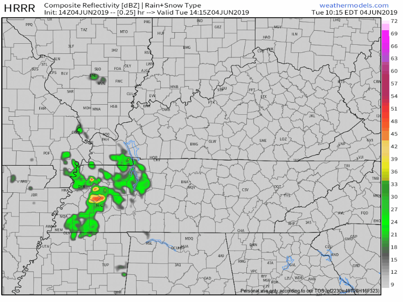
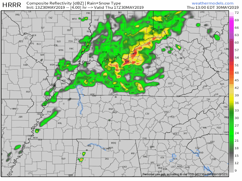
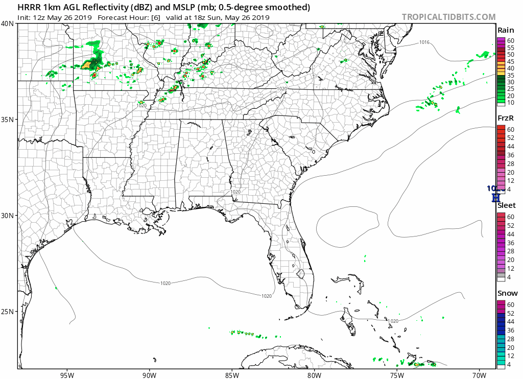
Our afternoon today is looking fairly warm and dry, despite some showers in west Tennessee marching east. The HRRR model is showing a few of these between 2 PM and 4 PM today:

However, our air is still pretty dry and no one really thinks that rain will get here. NWS-Nashville says chances are slight we’ll get a light shower. Unlikely to rain anything out. read more

No rain for 3 weeks, then downpours for #CMAFest2019. Seems about normal. -@jamiehallonline

RETURN TO NORMAL

June returns Tuesday.

Humidity increases – although still pretty comfy – but the high climbs to 90°.

TUESDAY RAIN?

A few earlier model runs had light rain trying to sneak in here Tuesday afternoon.

Like this one: read more

Cooler Monday; Warmer with Showers/Storms Mid-Late Week

Sunday

Remaining warm and humid with a high of 89° and dew points in the low 60°s. An isolated shower or thunderstorm is possible, but those should form southeast of us. Here is the latest NAM3 model:

This dewpoint chart shows how muggy it feels out there, with today feeling sticky. Not too bad. read more

Friday Night’s Bourbon Low, Weekend Forecast, A Look at Next Week

BEST NEWS

Less humidity Friday. High only 83°!

TONIGHT’S BOURBON LOW

Today and tonight, low pressure will be spinning over the Bourbon trail.

Because winds spin counterclockwise around a low, showers developed by the low should rotate into Middle Tennessee, including us (Nashville and Will Co) later this afternoon or tonight. read more

Scattered Storms Possible this Afternoon/Early Evening; Cooler Temperatures into the Weekend

Late morning rain is coming in now for those along and north of I-40. We are tweeting about that.

Later today there is a chance for scattered showers and thunderstorms. NWS-Nashville mentions the possibility for a few strong storms this afternoon: read more

Watching Rain Chances Thursday PM; Slight Cool Off This Weekend

Wednesday

Not too much to say here except hot and sunny:

The HRRR model shows rain staying to our north.

Note these storms are passing pretty close to us. We still think they’ll miss us but this will need to be watched in case the data is a bit off and we get surprised. read more

Rain Chances Increase Thursday, A Look at the Weekend

ALERT! INDULGENT STORY BY THE EDITOR!

If you just want the forecast, scroll beyond the blue.

Watching those Ohio tornadoes on radar last night took me back to when I was a small boy, living not that far from Dayton. Mom, dad, baby sister and I lived in Mason OH, not far from Xenia, not long after their F5. Tornadoes were on the mind in SW OH in the late 1970s. read more

Hot & Humid; Slim Rain Chances

Editor’s Note.

It’s Memorial Day.

You honor a sacrifice when you stop and remember the man and his sacrifice.

We remember Army Spc. Jason K. Edens.

He was born in Nashville. He graduated from Franklin High School in 2007. After a few semesters in college, he joined the Army then married Ashley.  Assigned to the 1st Squadron, 13th Cavalry Regiment, 3rd Brigade Combat Team, 1st Armored Division at Fort Bliss, Texas, he was deployed to Afghanistan in the fall of 2011. read more

Hot & Humid Conditions To Continue through Memorial Day; Next Chance of Rain Thursday

Sunday & Memorial Day

Remaining hot and humid with highs of 93 degrees both days. An isolated shower or thunderstorm can’t be ruled out due to the high heat and moisture in the atmosphere, but once again, we aren’t expecting anything significant. Be confident in any barbecue or pool plans.  read more

Hot & Humid Memorial Day Weekend

Temps are running around ten to fifteen degrees above normal.

Saturday & Sunday

Near record breaking heat expected with highs of 93 on Saturday and 94 Sunday.

If we hit 93 today it’ll tie the May 25 record set in 1926. read more