
Late morning rain is coming in now for those along and north of I-40. We are tweeting about that.
Later today there is a chance for scattered showers and thunderstorms. NWS-Nashville mentions the possibility for a few strong storms this afternoon:
A front comes through this afternoon and evening which finally moves the high that has been anchored over the Southeast US south and east. It is hard to get strong cold fronts through Middle TN this time of year. With that being said anytime a front makes it this far south there is a threat for thunderstorms. Dew points are well in the 60s…but instability and shear are not all that impressive. 21Z LIs are -1.5C to -3.5C and CAPE is 1000-1500 J/KG. 0-6 KM Shear is 6-7.5 kts/KM. 0-6 KM Helicity is barely 100 M^2/S^2. Storms just don/t seem that they will be that organized.
ETAs on this will be somewhere around late afternoon/early evening.
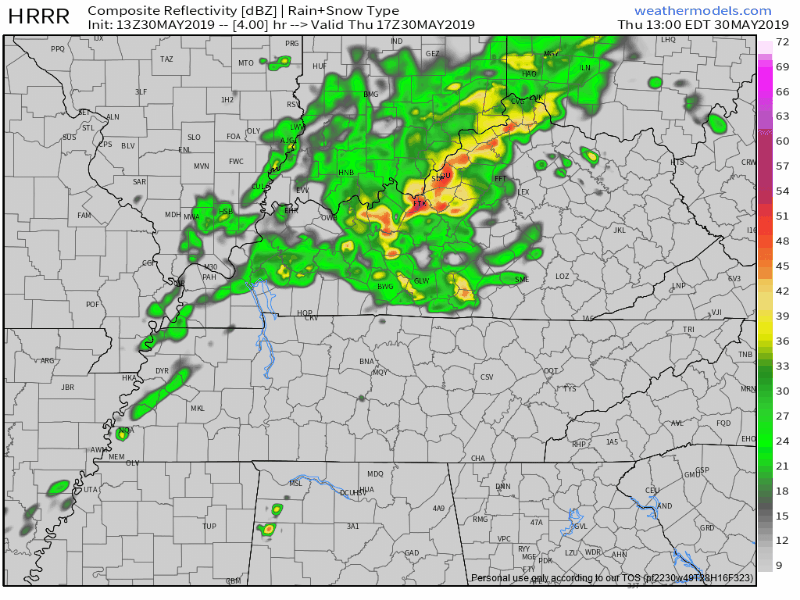
The HRRR model shows a little activity during that time. Here it is from noon to 8 PM:
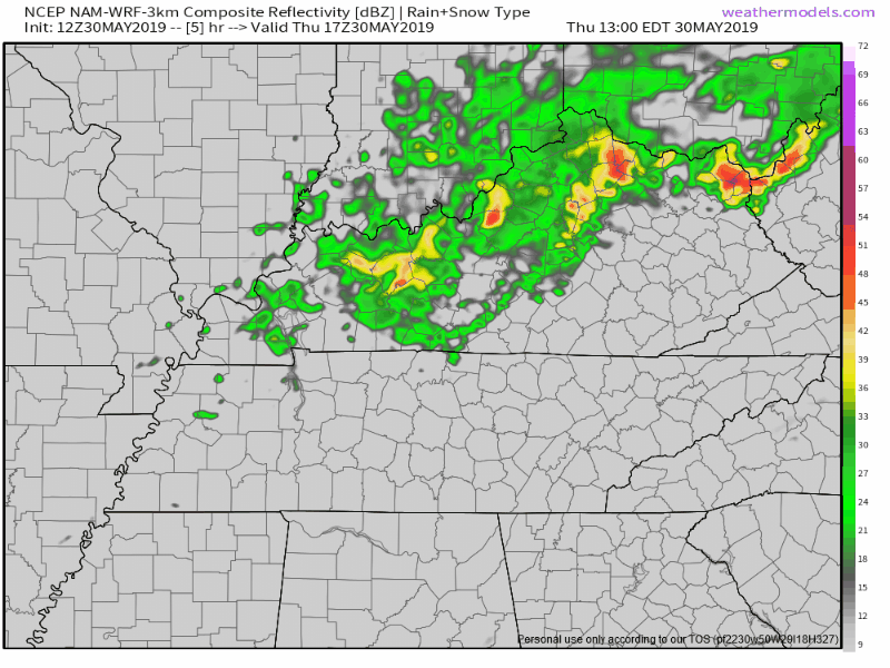
The NAM3 model, also from noon to 8 PM, shows some late afternoon showers trying to race through:
However, with this mid-morning rain event, it may soak up available storm fuel, leaving us with very little/nothing later today.
This entire setup is weak. I can’t rule out a graduation-ruining outdoor rain event tonight but I think that’s pretty unlikely, you’d have to be unlucky to get whacked by a stronger shower.
The Storm Prediction Center has a MARGINAL storm risk for our area, which means there is a 5% wind risk and 5% hail risk.
We are excluded from a tornado risk, here’s why:
- So for severe weather, you need four key ingredients. The acronym SLIM is used. It stands for Shear, Lift, Instability, and Moisture. We have barely two of those ingredients. Hence the lack of storm organization and the relatively low risk.
- The main threats for any storms this afternoon will be wind and small hail. Nothing like the rest of the country has been getting the past two weeks. Thank goodness.
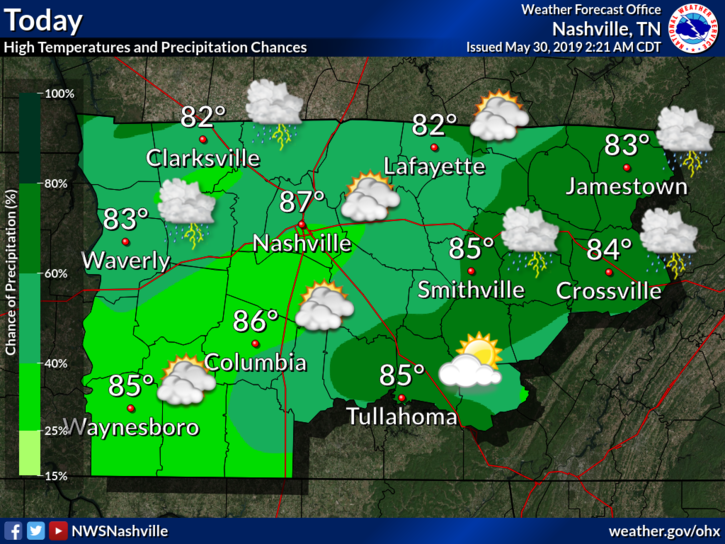
Cloud cover means cooler, more seasonal temperatures across the region:
The pattern is changing. The high pressure “death ridge” that tied high temp records will be going away… for now.
Friday
Friday should be the nicest day we’ve had in a while now. Our high should reach around 85° with a low around 62°. Should be a pleasant day!
But wait, what about the humidity?
Looks like the dew points will be hanging around 60° on Friday.

So just on the upper fringes of “comfortable”. I’ll take it!
Into the Weekend
Looks to be a slight warm up into the upper 80°s for Saturday and Sunday. Could see some afternoon “pop up” storms on Sunday. Other than that, more of that late spring/early summer weather!
As always, check back for updates and changes to the forecast! Enjoy the “cooler” weather.

Categories: Forecast Blogs (Legacy)
You must be logged in to post a comment.