Monday
As of 8:41 AM CDT, the temp is 79°F with a dew point of 73°F. Tropical moisture is here, ready for a cold front to tap into it.
This afternoon, cloud cover.
Late this afternoon, the rain begins.
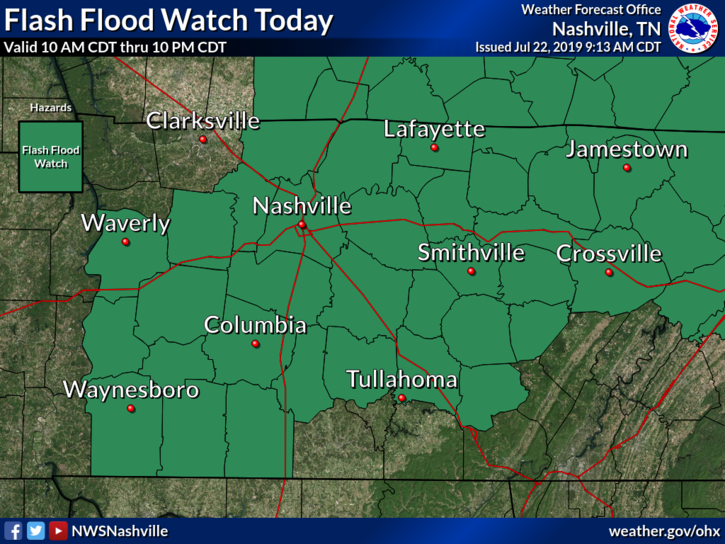
FLASH FLOOD WATCH

As of 8:41 AM CDT, the temp is 79°F with a dew point of 73°F. Tropical moisture is here, ready for a cold front to tap into it.
This afternoon, cloud cover.
Late this afternoon, the rain begins.
FLASH FLOOD WATCH
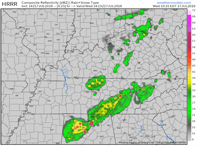
If you guessed more scattered showers for today, then you are correct.
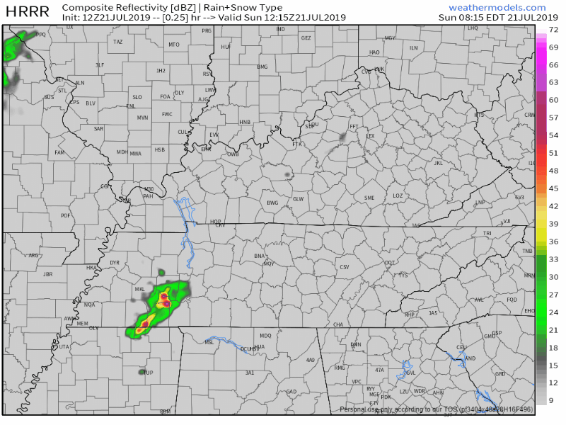
Here’s the HRRR model:
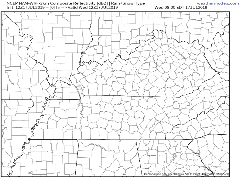
Here’s the NAM3 model, which keeps us drier during the day, but gives us some sprinkles of rain tonight:

More heat!
If you’re having a pool party for your birthday, you picked a pretty good one. Happy Birthday!
The temps will hover around 93 with a heat index of 101º. But, keep an eye on the radar this afternoon…there is also a chance for showers and thunderstorms this afternoon. If thunder roars, go indoors!
The National Weather Service in Nashville sum things up in a special weather statement issued early this morning.
ISOLATED TO SCATTERED SHOWERS AND THUNDERSTORMS WILL DEVELOP ACROSS MID STATE REGION THIS AFTERNOON. MAXIMUM AFTERNOON HEAT INDEX VALUES OF 99 TO 104 DEGREES ARE EXPECTED FOR LOCATIONS WEST OF CUMBERLAND PLATEAU
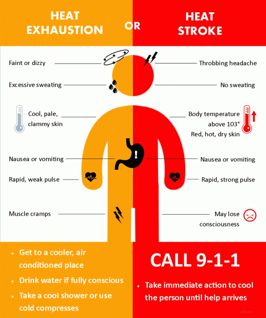
A Heat Advisory is in effect from 12 PM CDT to 7 PM CDT.
Dangerously hot and humid conditions will persist across the Mid State region today as a ridge of high pressure in the upper part of the atmosphere takes control of our weather. High temperatures will top out around 95 degrees this afternoon with dew points in the mid 70s. This will cause heat indices to soar to near 105 degrees making for oppressive and dangerous conditions.
A Heat Advisory will be in effect from 12 PM CDT to 7 PM CDT.
This means dangerously hot and humid conditions are possible in and around our area. Head indices could reach 105°F.
I use the word could because of uncertainty with where the heat index goes.

Unfortunately, scattered showers are still in the forecast for today.
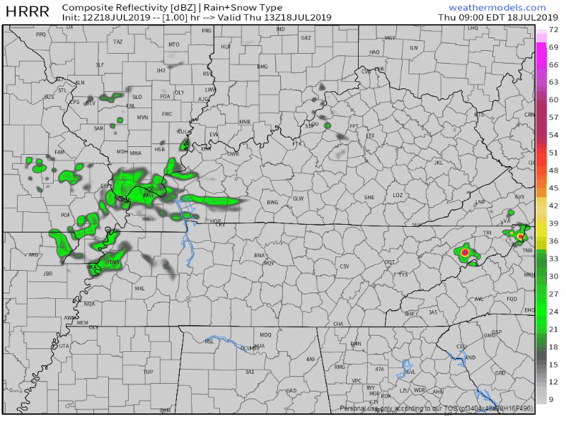
Here’s the HRRR model:
The NAM3 model keeps us a little drier.
Hope for the NAM3, but prepare for the HRRR today just in case more scattered showers find us.
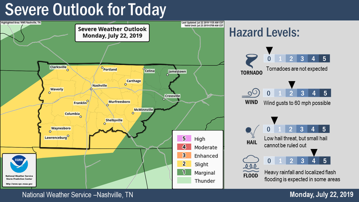
Remnants of Tropical Depression Barry will continue to affect our area today and the next couple of days. A band of broken showers and storms will move through late this afternoon into the early evening, sometime after 5 pm. A few storms could be on the stronger side, The Storm Prediction Center currently has the western edge of Davidson County under a Marginal risk (1/5) for some of these storms to become severe.
Our high today will reach into the mid 80°s. This is due to all of the cloud cover Tropical Depression (TD) Barry is bringing our area.
Rain will be the main story as the remnants of Barry moves further north.

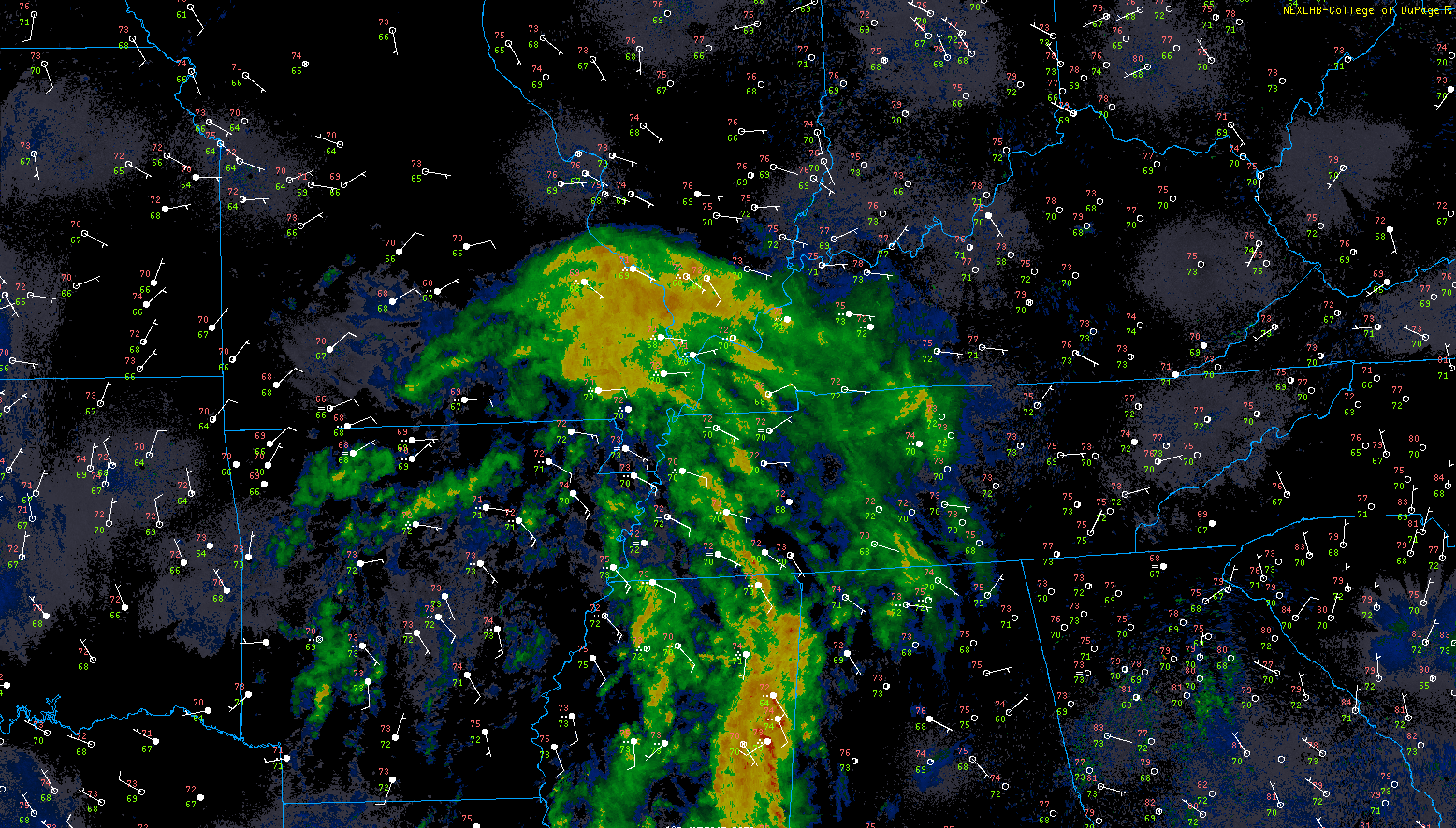
Ladies and Gentlemen, I present Tropical Storm Barry.
BTW: Only the WMO names storms, and only tropical cyclones. When the weather channel does it in the winter they’re trying to scare old people.
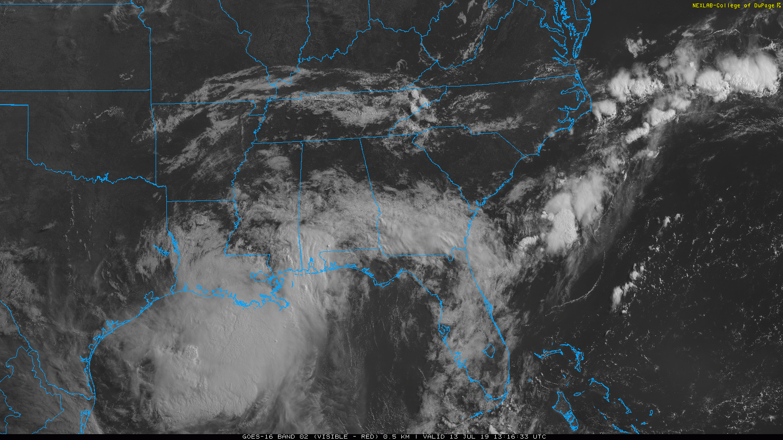
Barry is the big weather story.
WHAT BARRY IS DOING AND WHERE IT’S GOING
If you’re reading this Saturday afternoon, there may be updates to below National Hurricane Center (NHC) graphics, which you can find here.
You must be logged in to post a comment.