The HRRR shows some showers popping up around 6 pm Thursday. They’re expected to be out of the region by the midmorning hours Friday.
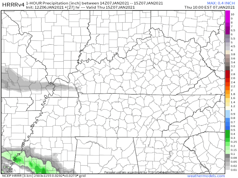
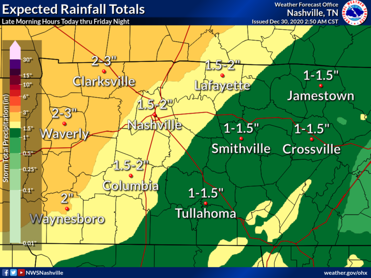
This doesn’t look to be a washout – rain totals will be anywhere from a tenth to a quarter of an inch.

The HRRR shows some showers popping up around 6 pm Thursday. They’re expected to be out of the region by the midmorning hours Friday.
This doesn’t look to be a washout – rain totals will be anywhere from a tenth to a quarter of an inch.
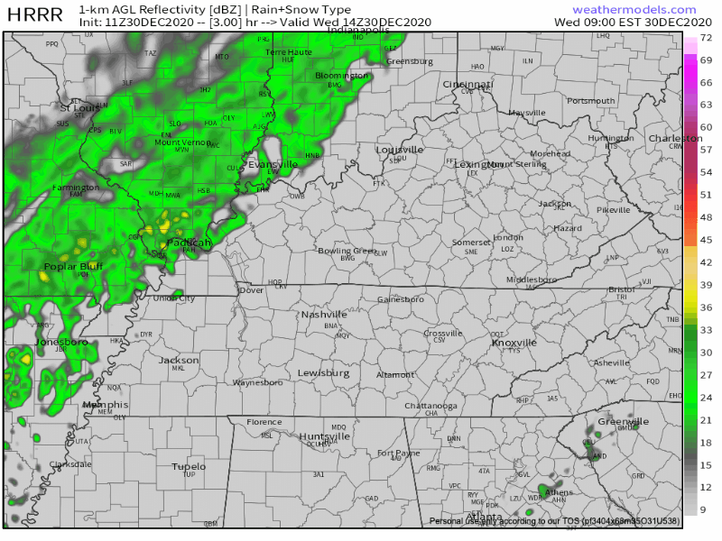
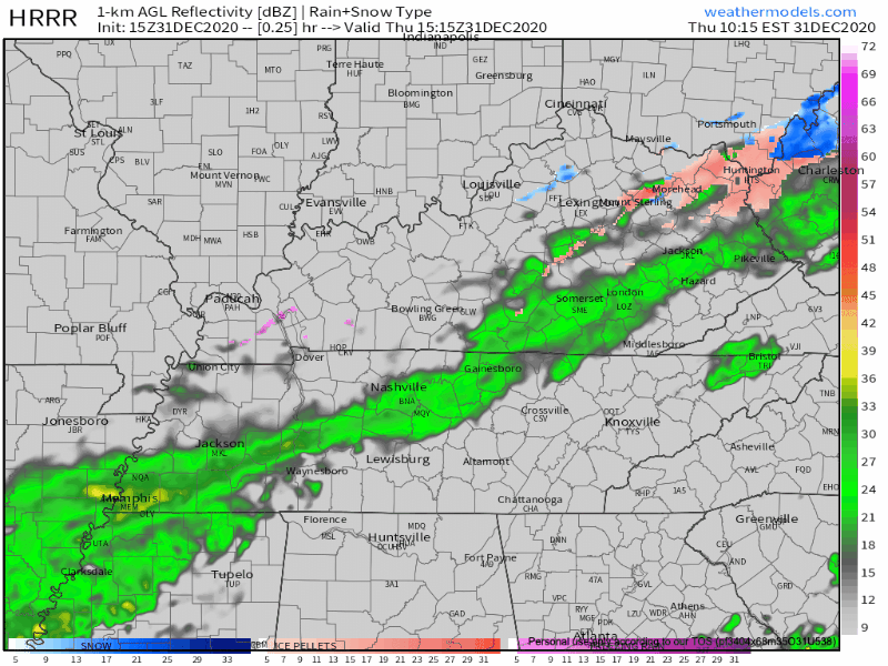
Thursday morning the HRRR model thinks our rain system will be near the MS/LA/AR intersection with rain on its northeast side. Notice it has a snow band in West Tennessee. That’s not expected to impact us (but yeah, we’re watching it).
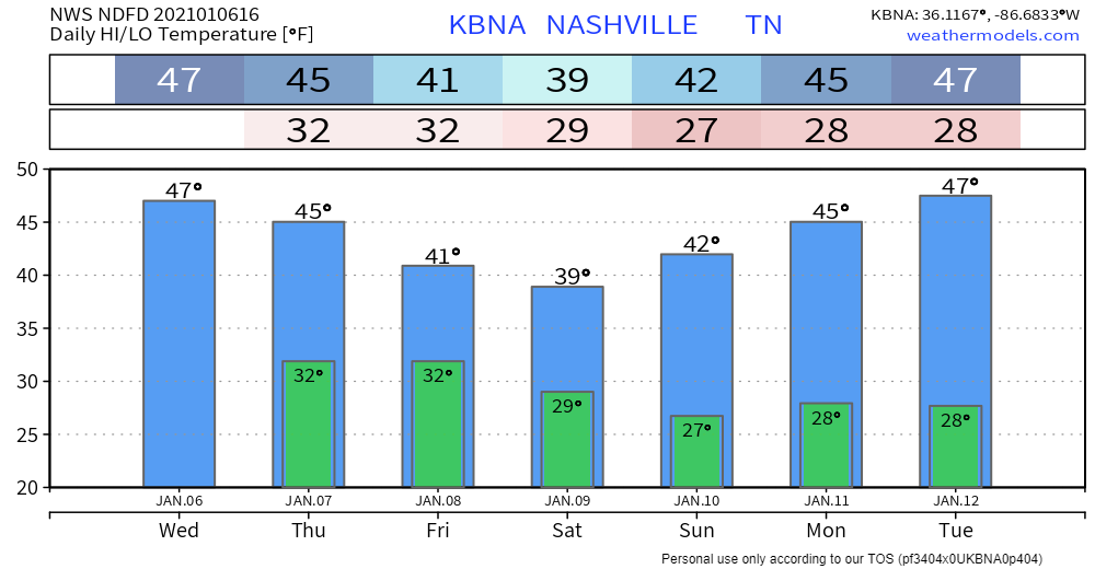
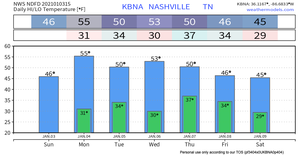
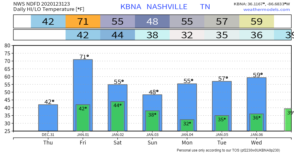
Today will be the warmest day in the next seven days ahead. We’re pushing a bit above average. That’ll change starting Tuesday.
Nothing but sunshine these next few days!

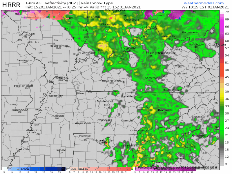
Both the Euro and GFS have rain beginning around noon Thursday moving out of Middle Tennessee by midnight.
You may have been graced by a few snowflakes this morning. Those are gone, and the rest of the day should be mostly sunshine.
Tonight, temperatures will dip below freezing, to around 31º.
* * * *
Clouds and cooler temps for this Saturday afternoon until rain chances increase for tonight.
Light rain showers could begin this evening begin after 7pm and may continue until 5am.
High today is 51 degrees.

Out with the old and in with the new. We wish you a happy and healthy new year!
Maybe you woke up to some moderate pattering on your window this morning, maybe you didn’t.
The last of the showers and thunderstorms from this system is pushing off to the east and leaving us with a really nice day outside.
Tornado probability remains 2% Friday morning. Meaning, two percent chance of a tornado happening within 25 miles of you. That’s from the Storm Prediction Center.
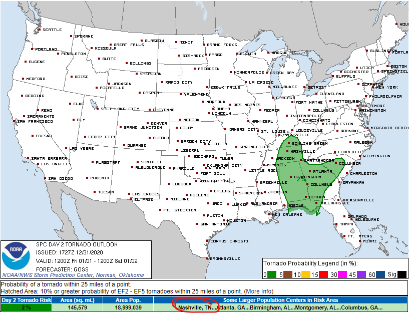
Damaging thunderstorm wind probability remains at 5%.

I know most of us are pretty excited to watch 2020 go and move into the New Year of 2021!
The weather, unfortunately, remains gross – rain, rain, and more rain.
HRRR model indicates some light rain/drizzle on and off until early afternoon hours. We’ll see a break in the rain from mid-afternoon until early this evening.
The morning weather balloon showed winds just off the surface at 50 knots. Some of that wind will find its way to the surface by mid day. Expect gusts to 33 MPH around noon, slackening off tonight. Morning temperatures in the 50’s will reach 65° this afternoon. That’s about 20° above climatological normal.
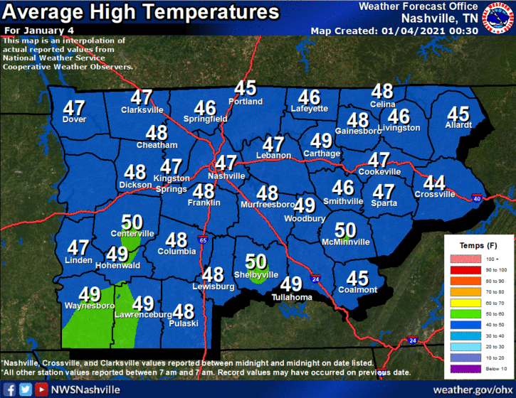
Beautiful today, high reaching 50º. This is near climatological norms:
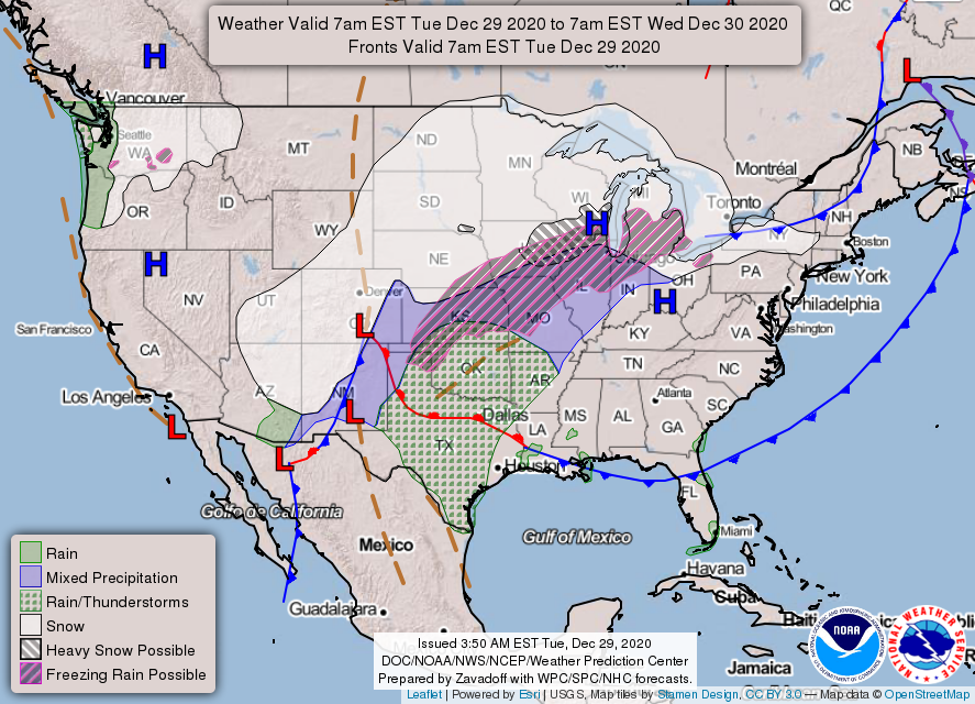
A surface high pressure is just to our north, which will fend off rain for one more day. Tomorrow’s a different story, though. All that “stuff” to our west on the map below will move towards Middle Tennessee.
You must be logged in to post a comment.