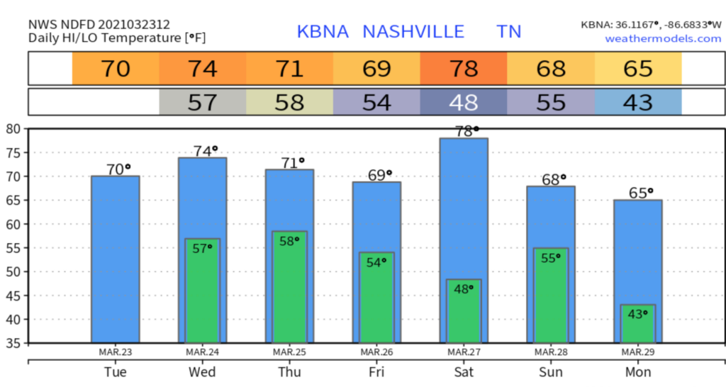
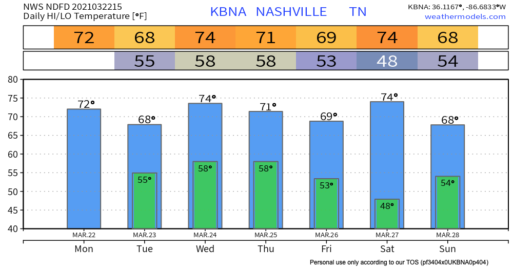
Look out for patchy frost this morning–your reminder that in Nashville, we can never really be sure what season it is. We will warm up this afternoon thanks to plenty of sunshine!
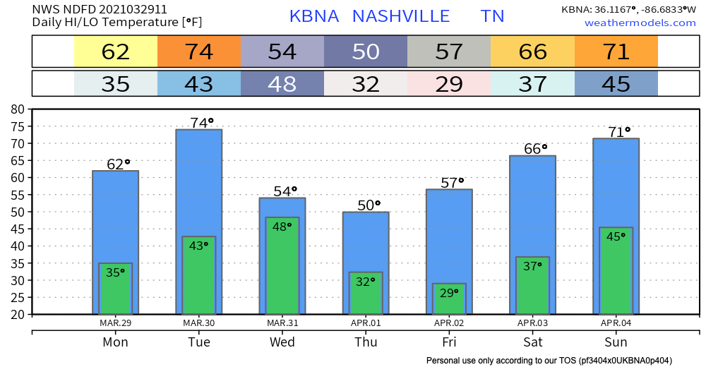
Tomorrow will look similar with even warmer temperatures.read more
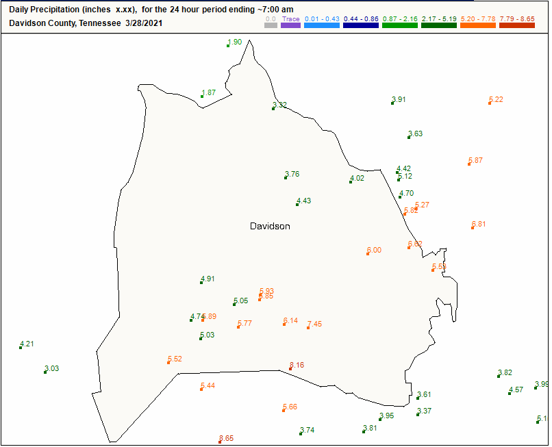
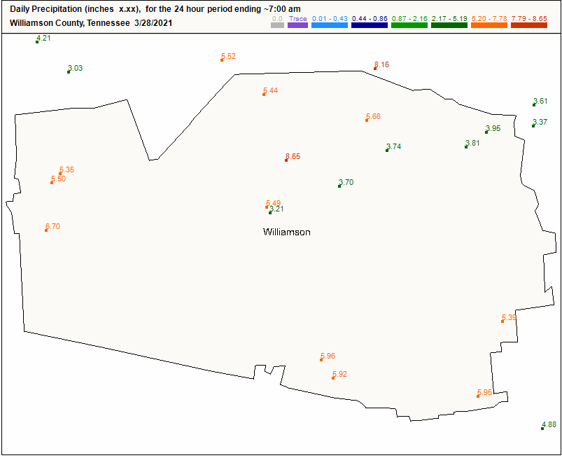
Editor’s Note: We lost 4 people in this flood, at least that’s how many we know about as of noon Sunday. Each immeasurably valuable. The Mayor held a noon press conference and promised thorough investigation to understand the circumstances of each person having lost their life due to flash flooding. Investigations improve future messaging. But right now I do not want to reduce the lives of each of these four people into a lesson we expect to be taught later. Nothing is more important than a life. When we lose one it seems to me the community should mourn the person and surround his and her loved ones with love, kindness, and support, regardless of circumstances. Same is true for those who woke up with water in their home, businesses, and cars. Donate, give, love. read more
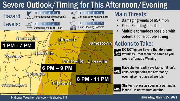
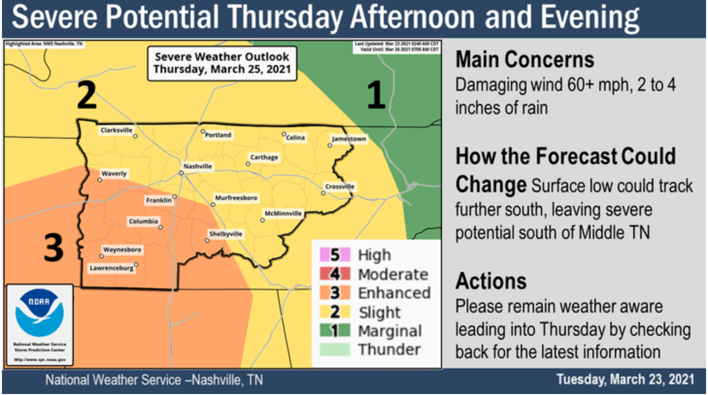
The team from @NashSevereWx and @Tamachick are doing a YTL briefing about tonight’s potential severe weather and flash flooding event. Probs around 4:30ish. It will available on our YouTube channel immediately after if you can’t make it. Questions welcome in the YT chat. ^wm pic.twitter.com/Fz4uKTmPMm
As I write this Andrew is on YouTube Live covering two Severe Thunderstorm Warnings. Will is on the tweeter, tweeting about them. These are hail storms. Lightning frequent and intense. Severe straight line winds are possible but there is no reason for early morning tornado concerns.read more
Check out today’s sunrise over the hills surrounding Grassland in Williamson county.
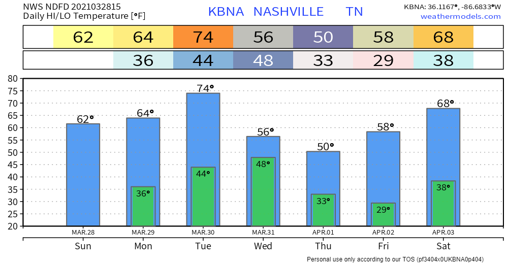
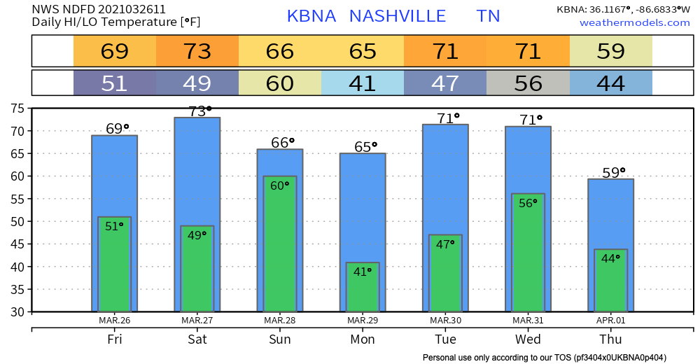
After last night’s severe weather, we dry out for most of today followed by decreasing clouds throughout the morning. We’ll be topping out near the upper 60s for our high temperature and the lower 50s for our low overnight tonight. read more
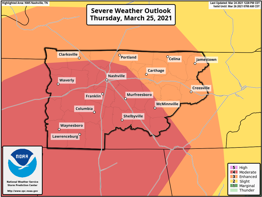
If you only take one thing away from this blog please remember this: Stay connected all day today. We will be updating you on Twitter (@NashSevereWx) all day. We will go on YouTube Live if a warning is issued in either of our two counties. Do not read this blog and tune out. Things will change as this situation develops.read more
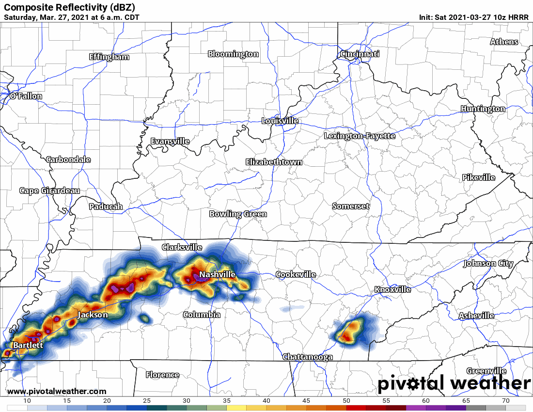
Our current thinking is that storms will come in two rounds. HRRR below shows round 1. We’ll see rain begin to move into the area around 8 am. Although this will not be the severe weather event, we will begin to see high rain totals. Do not mistake this for the main event. read more
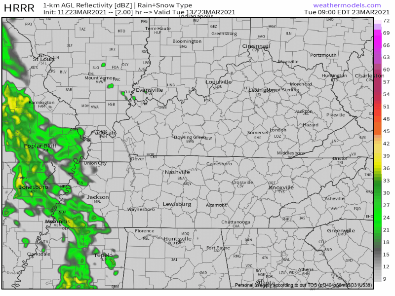
Rain is approaching from the west this morning. The HRRR model (below) thinks it’ll break up before it gets to us.
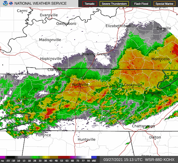
As we publish this, the rain line is two counties away, moving closer, and has not (yet) broken up. We’ll follow this through the morning on Twitter. read more
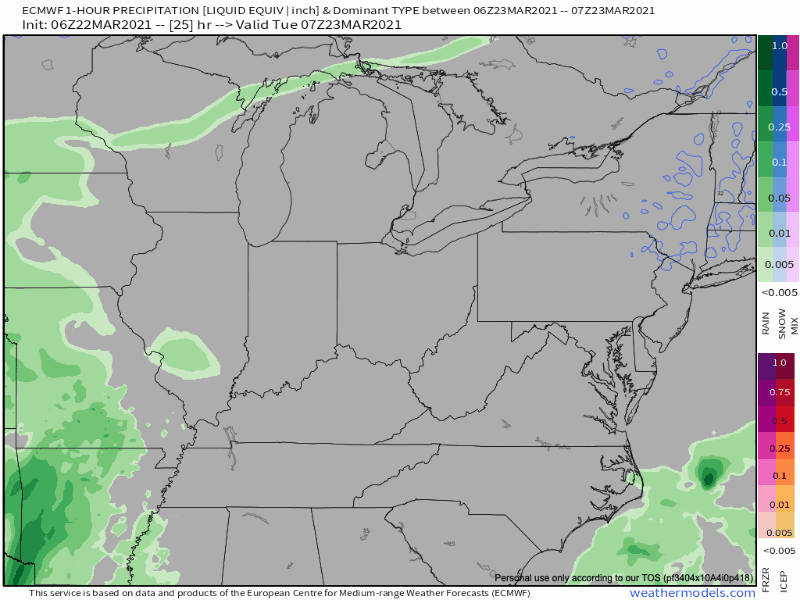
Rain is pretty likely Tuesday. Notice how it scatters and breaks up as it gets into Middle Tennessee on the Euro model (but we still get rained on):
The HRRR model doesn’t think it’ll break up. It thinks a heavier band of rain will cross through after lunch. read more
Subscribe to Blog via Email
Privacy & Cookies: This site uses cookies. By continuing to use this website, you agree to their use.
To find out more, including how to control cookies, see here:
Privacy Policy


You must be logged in to post a comment.