Today ’twas a lovely day for late January, dry and highs got up in the mid 60s.

Unfortunately, this weather cannot last forever, and rain chances return tomorrow.
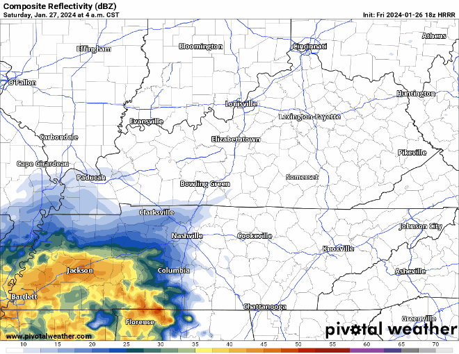
HRRR model (above) shows three rounds of rain tomorrow:

Today ’twas a lovely day for late January, dry and highs got up in the mid 60s.
Unfortunately, this weather cannot last forever, and rain chances return tomorrow.
HRRR model (above) shows three rounds of rain tomorrow:

We got some more beneficial rain today. Also, new drought monitor came out today.
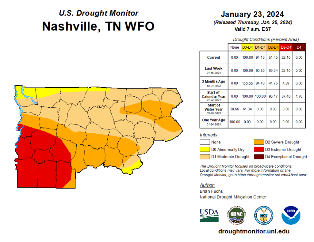
We are still in a Moderate to Severe drought. Granted, this does not include the rain we received today and yesterday. Hopefully next Thursday we can get a positive update.
We got some decent rainfall today, enough for a good soak, but escaped any flooding worries thankfully.
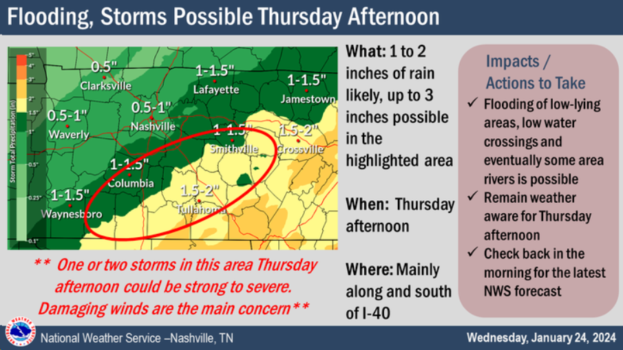
We’ll continue the trend of receiving manageable rain tomorrow, but with a very low-end chance of a strong storm with some damaging straight-line winds.

We’ve received a little rain today, not much, but there’s more to come.
Timing:
We should remain dry thru the rest of today, maybe a scattered shower or two.
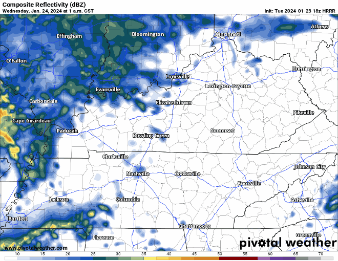
HRRR model (above) shows some rain arriving Wednesday morning, with the bulk of it coming Wednesday afternoon. Some more rain should swing around Thursday morning. Timestamp is in the upper left corner.
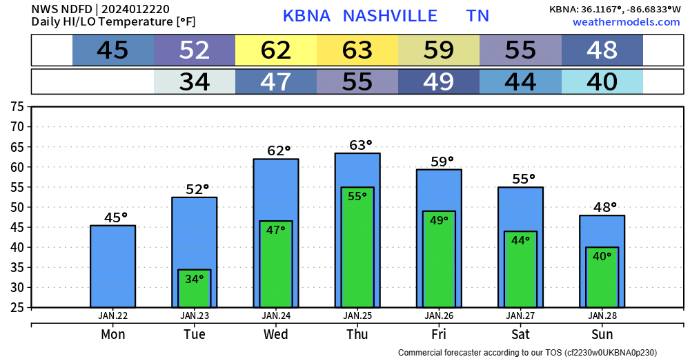
BNA got all the way up to 47° today, which feels like quite the accomplishment.
Snow melts at different rates at different places, most of it probably melted today, but some stubborn snow/ice could hold on until tomorrow.

Ice remains. It was 5° at BNA overnight. Many local areas colder than that.
Temps above freezing – barely, briefly – this afternoon. Sunlight and light winds will erode but not eliminate ice sheets. Back down to 20° overnight and Monday morning.
Most main and secondary roads are OK, but could contain “invisible” black ice in “hard freeze” (T<26°) temps today and Sunday morning. Neighborhood roads, sidewalks and decks remain icy, esp on hills and in shady areas.
The brutal cold is the big story. More on that in just a bit. First, quick note about the snow.
Light snow showers across the area have been stubborn to dissipate today with some sites still reporting light snow or flurries ongoing this afternoon. So a dusting or a quick half inch of snow isn`t out of the question still through this afternoon, but all of this should wind down within the next few hours. NWS NashvilleIf you get a quick burst of snow, roads can deteriorate quickly on a local level, even if just for a few minutes. Take it easy out there.
Freezing rain/drizzle is moving in our area and already causing travel issues.
Temperatures currently range from 30 – 33°, throughout our counties, impacts will differ from place to place.
Snow already on the ground will help ice accumulate either, freezing on top of the snow.
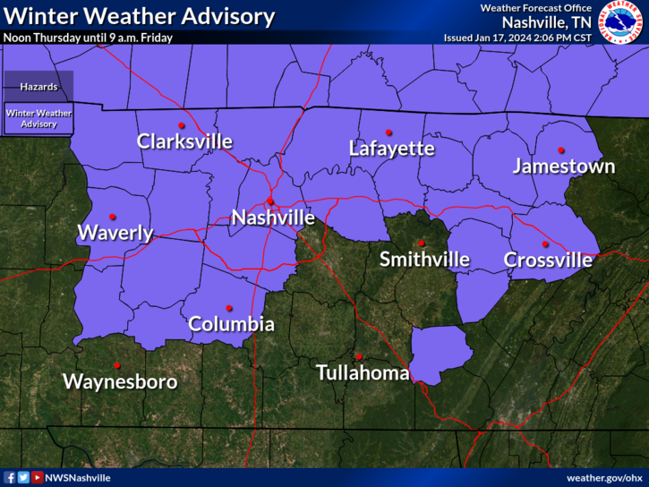
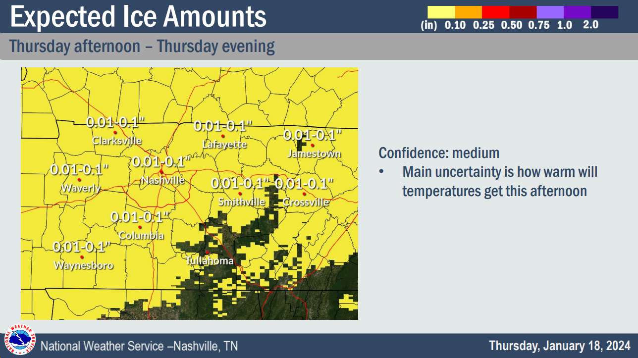
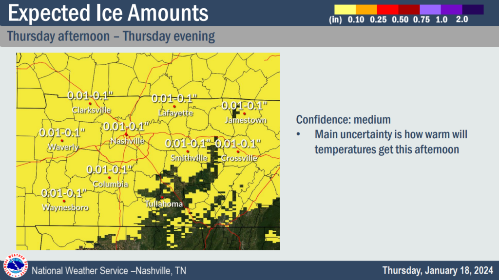
We have a Winter Weather Advisory for both of our counties from noon Thursday – 9am Friday.
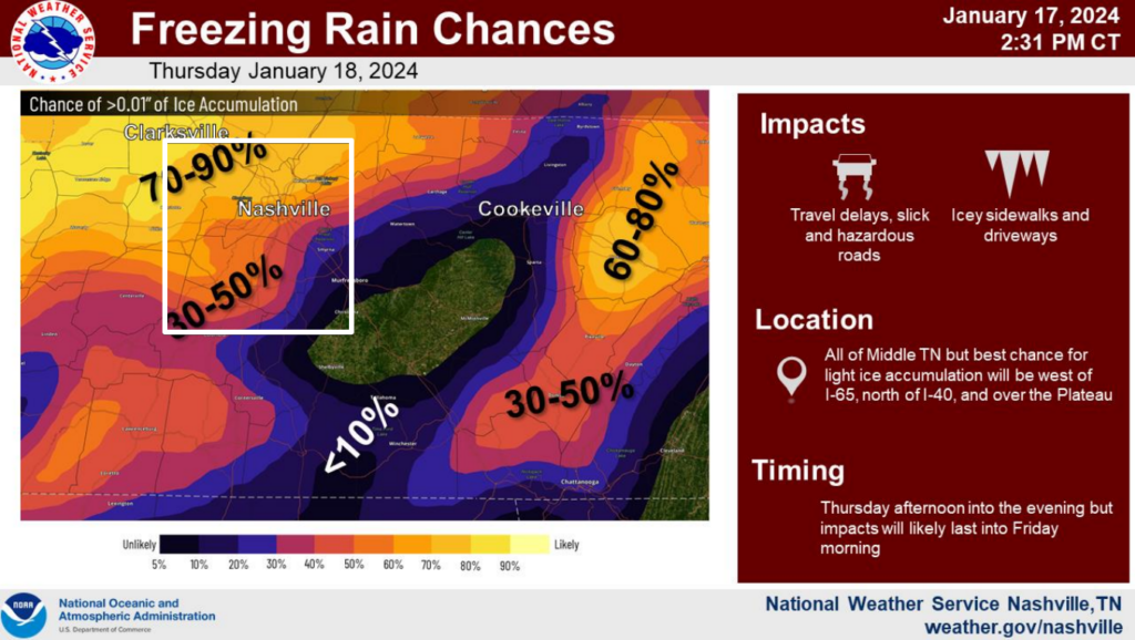
Across our counties, probabilities for >0.01″ of ice accumulation range from 30 – 70%.
Ice is a lot different from snow. All it takes is a glazing of ice to cause issues on the roads.
You must be logged in to post a comment.