
Freezing rain/drizzle is moving in our area and already causing travel issues.
Temperatures currently range from 30 – 33°, throughout our counties, impacts will differ from place to place.
Snow already on the ground will help ice accumulate either, freezing on top of the snow.
Road conditions will likely deteriorate throughout the day. Unlike snow, you may not see the ice on the roads/walkways. Even if going out to get the mail or walking the dog, be careful on sidewalks, ice shows no mercy.
As precipitation increases throughout the afternoon and evening, it will be best to stay off the roads. If you must travel, take it slowwww. You may not be able to see the slick spots. You can check the TDOT Smartway cams here.
Your reports will be vital today. Tweet what type of precipitation you are seeing, any ice accumulation with #tspotter.
Timing:
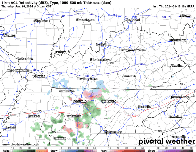
The latest HRRR model shows on/off mixed precipitation, likely mostly freezing rain/drizzle continuing on/off thru ~ 8 or 9 pm.
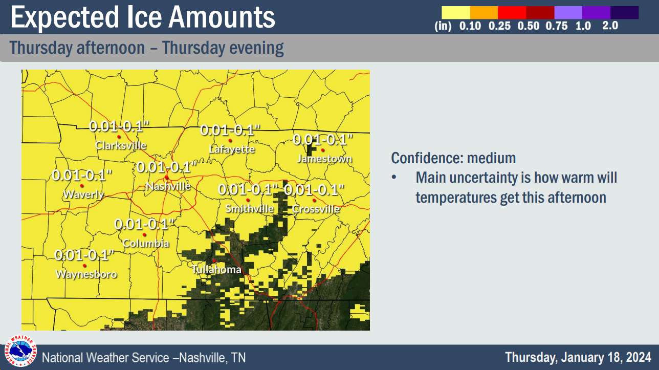
Thankfully ice totals will stay under 0.1″, so we are not worried about trees/power lines being weighed down, but travel is likely to be negatively impacted. Impacts will likely last thru the day Friday and linger into the weekend.
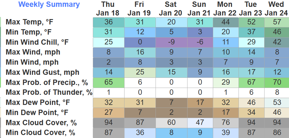
Brutal Cold Returns:
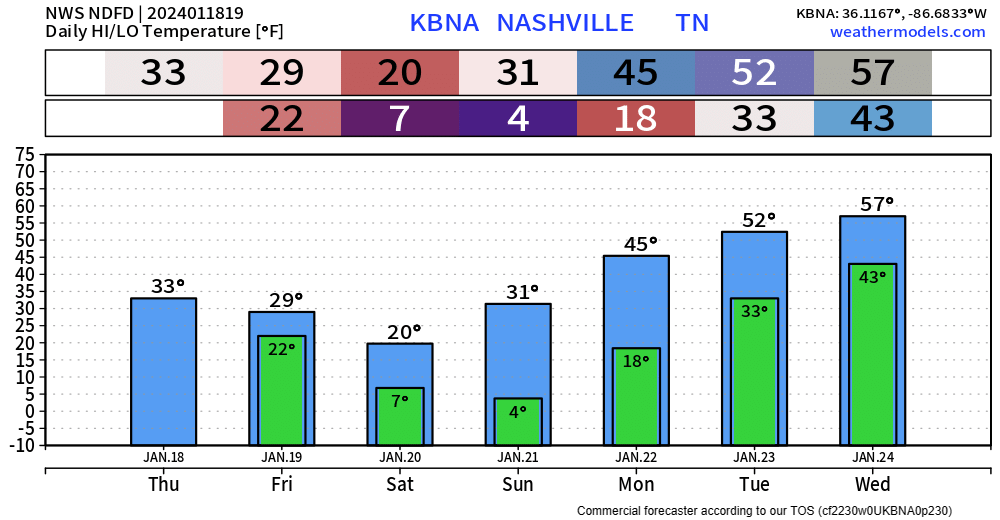
Sub-freezing temperatures will return this evening and we will likely stay below freezing until Monday (maybe Sunday afternoon if we are lucky).
- Temperatures will fall into the single digits Friday and Saturday night, with wind chills as low as -10° possible.
- A Wind Chill Advisory has been issued from 10pm Friday thru noon Saturday for these dangerous wind chills
- another Wind Chill Advisory may be needed overnight Saturday
Remember the 4 P’s – people, pets, pipes and plants. Check in on friends/family who may not have sufficient heat and make room for pets inside. Prepare any exterior pipes. Be careful with using any space heaters, don’t plug them into a power strip and make sure they stay far away from any objects.
Warm Up Next Week:

Some much needed warmer temperatures are expected next week.
Rain, just rain, chances will return Tuesday/Wednesday.
Quick References:
Weather changes constantly.
Follow @NashSevereWx on Twitter for any changes to this forecast.
Live coverage during tornado and severe thunderstorm warnings:

Look good.
Support the mission.

We are 100% community supported. No ads. No subscription fees. Keep it free for everyone.


Categories: Forecast Blogs (Legacy)
You must be logged in to post a comment.