
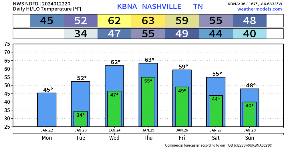
BNA got all the way up to 47° today, which feels like quite the accomplishment.
Snow melts at different rates at different places, most of it probably melted today, but some stubborn snow/ice could hold on until tomorrow.
Some places could get below freezing tonight, but that looks like the last time we’ll get below freezing for at least the next 6 days.
- High temps get up into the 50s tomorrow, and even the low 60s Wednesday + Thursday, time for the pool?
Rain, Maybe Too Much Rain
We need rain, but not all at once. Everything in moderation as my mother says.

While it won’t all come at once, it looks like the combination of snowmelt + 2 – 4″ of rain throughout the week, may cause some flooding problems.
“This could cause some hydro issues especially in the flood prone areas or areas with clogged drainage. A flood watch may become necessary particularly in the southern and eastern counties for Wednesday and Thursday.”
– NWS Nashville PM AFD
Timing:

Timestamp is in the upper left corner, HRRR model shows rain moving in Tuesday morning – it won’t rain the entire day. Another batch of heavier rain should come in Wednesday morning.
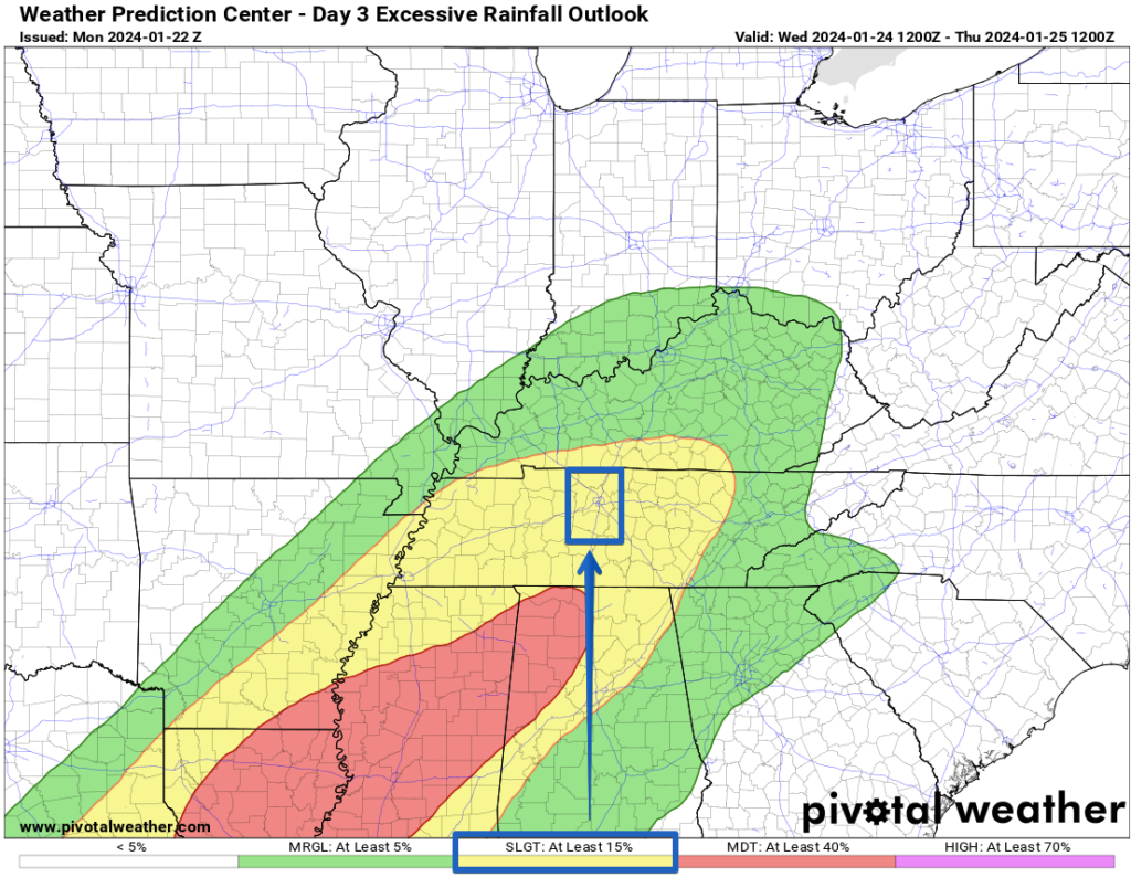
The Weather Prediction Center has outlooked both our counties with at least a 15% chance of flash flooding within 25 miles on Wednesday. This will need to be watched, especially in more flood-prone areas.
Rain chances stick around thru at least Thursday.
Currently, not any worries about severe weather. We’ll keep an eye on it though.

Quick References:
Weather changes constantly.
Follow @NashSevereWx on Twitter for any changes to this forecast.
Live coverage during tornado and severe thunderstorm warnings:

Look good.
Support the mission.

We are 100% community supported. No ads. No subscription fees. Keep it free for everyone.


Categories: Forecast Blogs (Legacy)
You must be logged in to post a comment.