
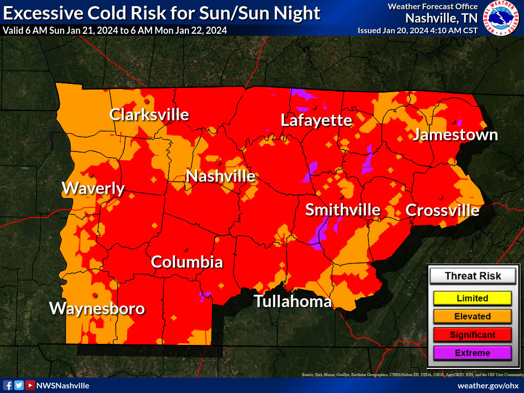
Most main and secondary roads are OK, but could contain “invisible” black ice in “hard freeze” (T<26°) temps today and Sunday morning. Neighborhood roads, sidewalks and decks remain icy, esp on hills and in shady areas.
Icy roads should mostly remain this weekend through Monday morning.
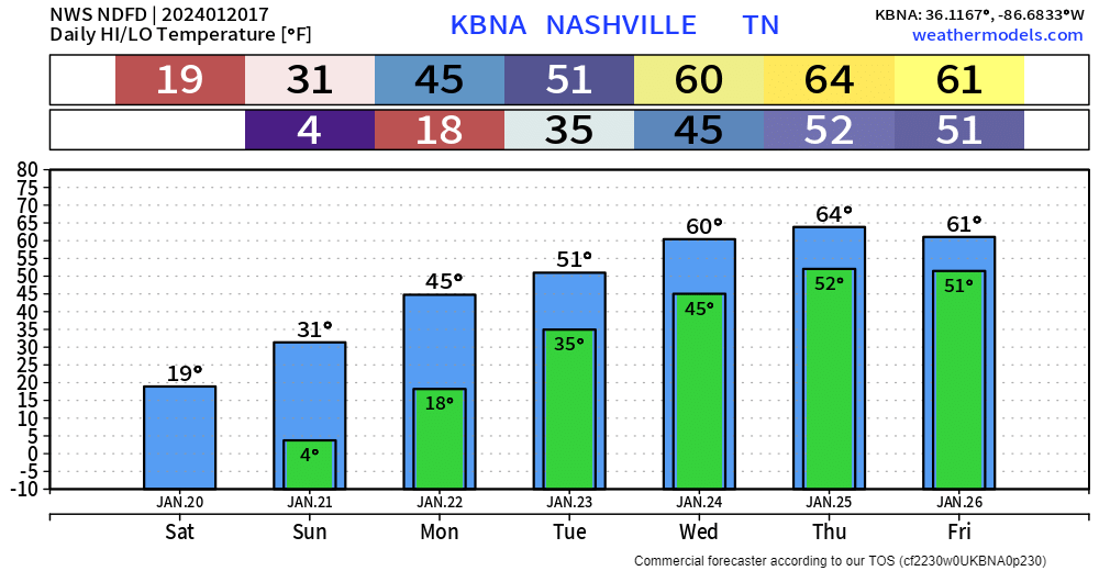
- High today 20°, tomorrow 32°.
- Winds, traffic, and sunlight will help erode – but won’t eliminate – icy snowpack. We need temps well above freezing to get rid of the ice.
- Some areas may slide above freezing briefly Sunday afternoon. The 1100+ sq mi of Davidson and Williamson Counties experience wide temp variance. Usually the variance is a distinction without difference, except in these situations where a few degrees +/- 32° is everything. The relative safety of your route will vary from mine.
- A Wind Chill Advisory is in effect today through tomorrow morning. Wind Chills will hit the negative numbers esp overnight and Sunday morning.
- Widespread melting ETA Monday afternoon. The eroding icepack should remain on neighborhood roads and concrete sidewalks for the Monday AM commute. Temps rise above freezing late Monday morning on our way to a high of 46° Monday afternoon. Ice will change to water, roads will be wet as water runs off or evaporates.
- Temps should bottom out Tuesday morning around 35° at BNA. Some areas around town may briefly dip to or below freezing. I expect few/no problems Tuesday morning but I’d like to wait and see what happens Monday before making a confident declaration.
- Tuesday will rinse away any remaining snow and ice as rain moves in and temps rise to 51°.
Warm and Raining Next Week
Tuesday – Thursday looks wet. Euro model below estimates ongoing total rainfall from Tuesday morning to Friday morning:
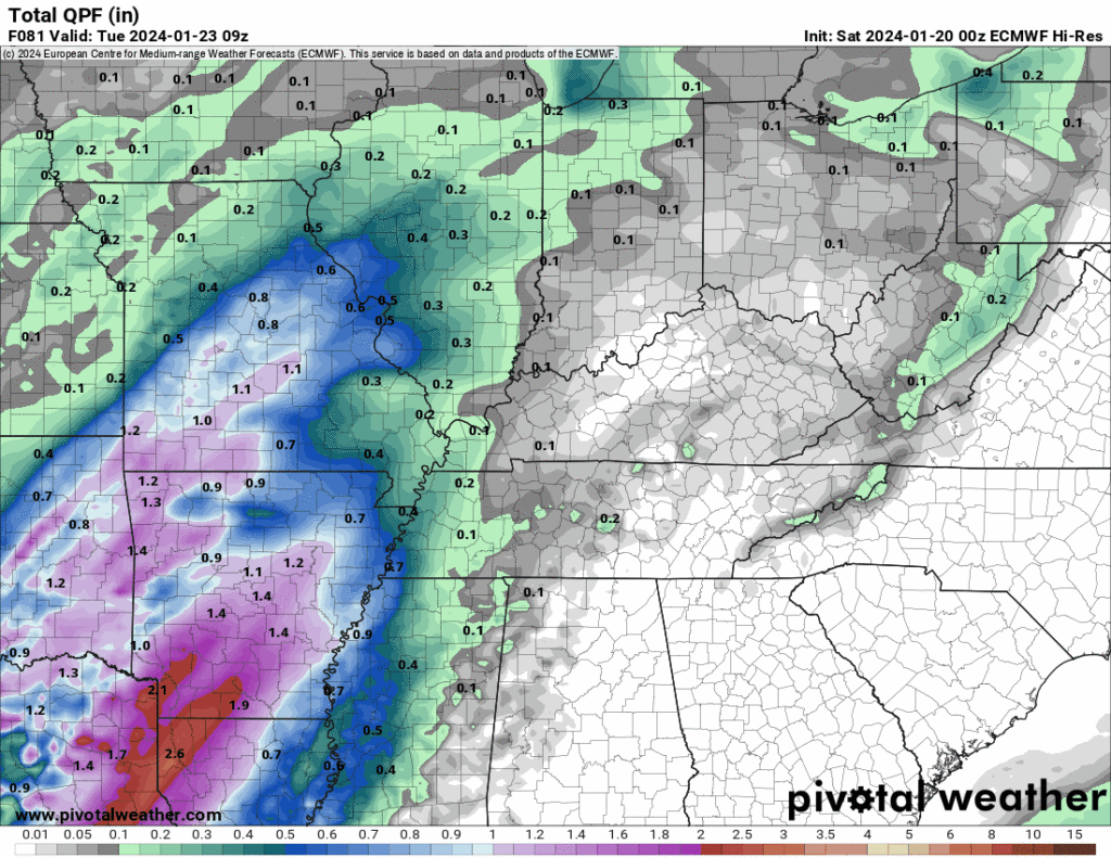
NWS-Nashville forecasts 2″ to 3″ of rain during this time. It won’t rain the entire time. We will need the higher resolution models to get in range for rough ETAs, etc.
Strong/Severe Storms With That Rain?
Probably not.
My only mild concern is Thursday afternoon.
- The 0z Euro model run drops in 500+ SBCAPE with 64° dewpoints, 200 SRH 0-1km, and low LCLs, but modest lapse rates. Those are many (not all!) ingredients for severe weather. Not ready to speculate on severe type (wind, hail, tornado).
- The GFS model has none of the bad stuff – it keeps severe ingredients south of TN/AL border.
- SPC has not outlooked us for severe weather, thinking instability will be confined to the Gulf states.
More on this tomorrow.
Week long snowpack to severe potential is not cool.

Quick References:
Weather changes constantly.
Follow @NashSevereWx on Twitter for any changes to this forecast.
Live coverage during tornado and severe thunderstorm warnings:

Look good.
Support the mission.

We are 100% community supported. No ads. No subscription fees. Keep it free for everyone.


Categories: Forecast Blogs (Legacy)
You must be logged in to post a comment.