

We’ve received a little rain today, not much, but there’s more to come.
- 2 – 3″ of rain is expected thru Saturday
- majority of the rain will fall Wednesday
- we are excluded from the Flood Watch (heaviest rain expected to stay to our south)
- “Areas north of the Flood Watch could see nuisance flooding issues, but the total rainfall amounts over that area are expected to be manageable…” – NWS Nashville
- no severe weather expected, some thunder possible
Timing:
We should remain dry thru the rest of today, maybe a scattered shower or two.
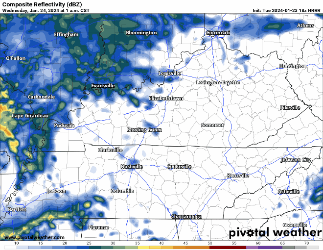
HRRR model (above) shows some rain arriving Wednesday morning, with the bulk of it coming Wednesday afternoon. Some more rain should swing around Thursday morning. Timestamp is in the upper left corner.
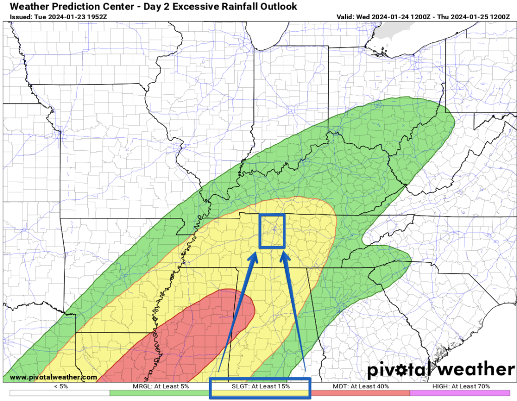
Weather Prediction Center still has both of our counties included in at least a 15% chance of flash flooding with 25 miles for Wednesday. The heaviest rainfall is expected to be to our south, but this will have to be watched.
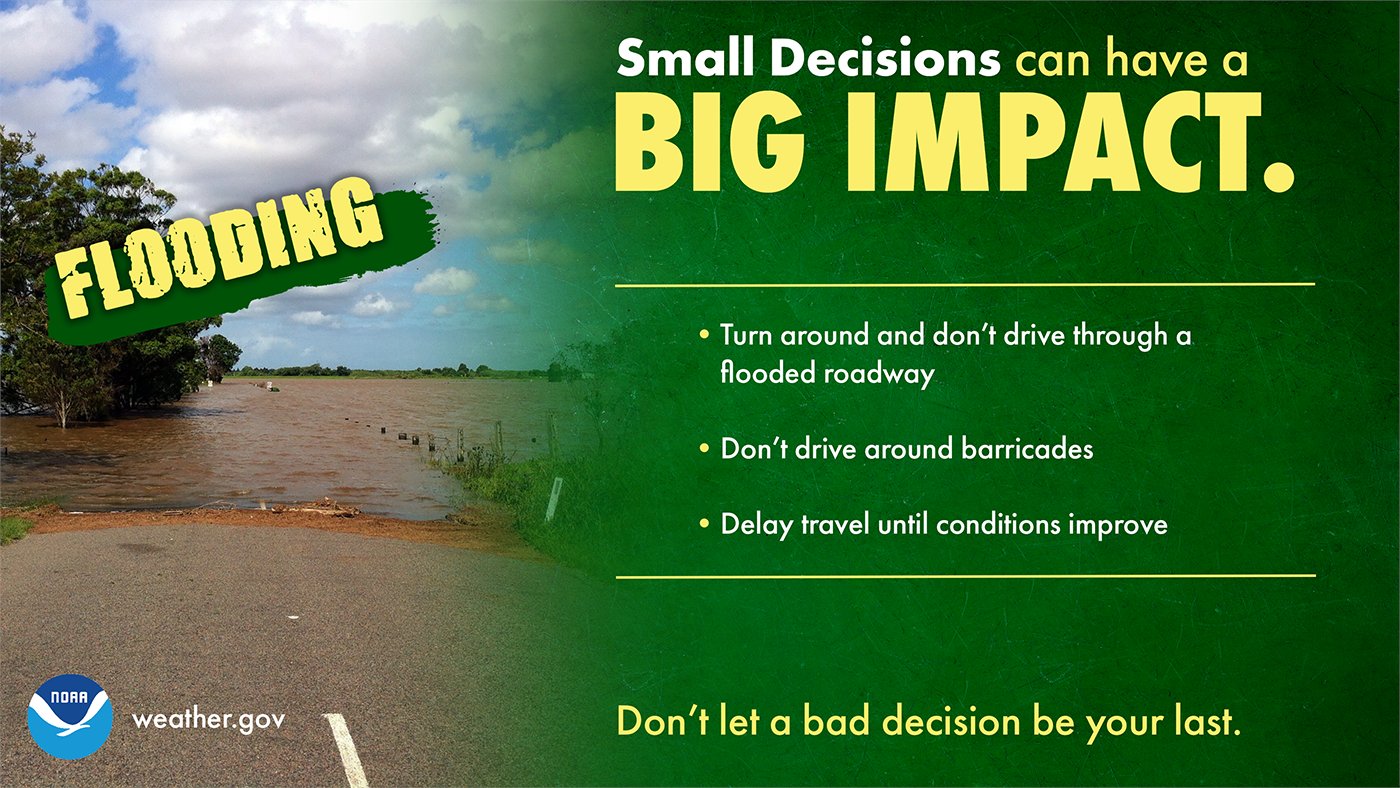
With recent snow melting, runoff from the rain may cause minor flooding issues, especially in the more flood-prone areas. If you do come across a flooded road, turn around, don’t drown.
Friday looks like we should get by with a dry day, with more rain returning Saturday.
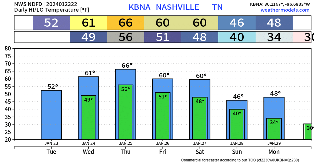
High temps are expected to reach the 60s(!!!) Wednesday – Saturday. I forgot what it feels like.
Quick References:
Weather changes constantly.
Follow @NashSevereWx on Twitter for any changes to this forecast.
Live coverage during tornado and severe thunderstorm warnings:

Look good.
Support the mission.

We are 100% community supported. No ads. No subscription fees. Keep it free for everyone.


Categories: Forecast Blogs (Legacy)
You must be logged in to post a comment.