
91° Monday, 92° Tuesday, 94° Wednesday, 95° Thursday, and please be kidding no we are not kidding 96° Friday.
These are in the shade temps. So if you’re in the sun, obviously, it’s going to be hotter than that.

91° Monday, 92° Tuesday, 94° Wednesday, 95° Thursday, and please be kidding no we are not kidding 96° Friday.
These are in the shade temps. So if you’re in the sun, obviously, it’s going to be hotter than that.

90° today, 91° Monday, 92° Tuesday, 94° Wednesday, 95° Thursday, and please make it stop 96° Friday.
Humidity will be “Uncomfortable” today through Thursday.
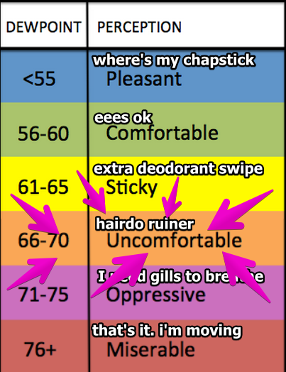
By Friday and Saturday, humidity will be “oppressive.”

Our Flash Flood Watch was originally set to expire at 7 PM. After lunch, the rain moved out, and the Watch was cancelled. We may see a few very light showers tonight as the cold front comes through, but that should not discourage your outdoor plans.
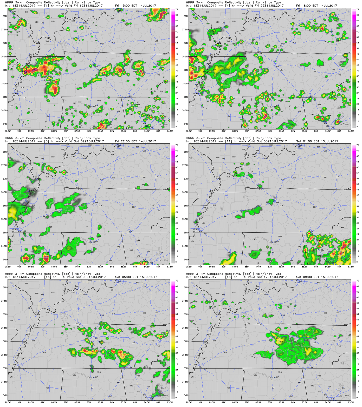
While we’ve already seen showers today, more could develop late this afternoon into the early evening.
Latest run of the HRRR has some more showers this afternoon, before having them die off around sunset.
SPC Day 2 Convective Outlook
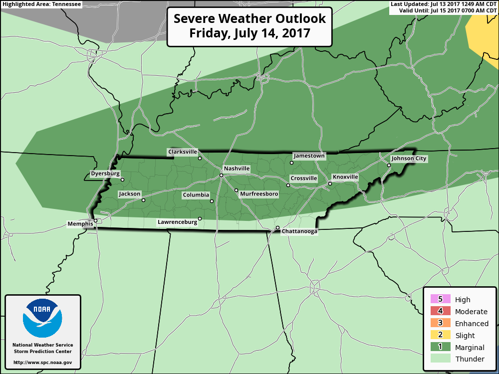
Widespread showers and storms are expected to develop late morning and into the afternoon once again tomorrow as a frontal boundary approaches from the north. A few of these storms could produce gusty winds so we will be keeping a close eye on anything that quickly sprouts up.

Tomorrow will be another one of those “oppressive” type days with dew points reaching the low 70s.
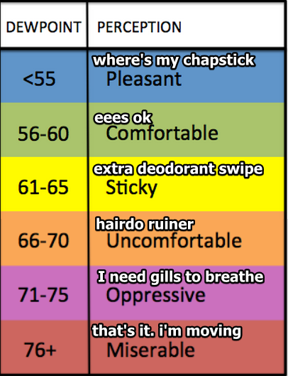
Prepare your gills.
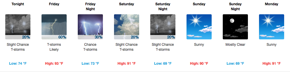
With this influx of moisture will once again bring those pop-up thunderstorm chances tomorrow. Most morning activities should remain rain-free, but once the afternoon arrives we will become fair game for Mother Nature’s rain lottery.
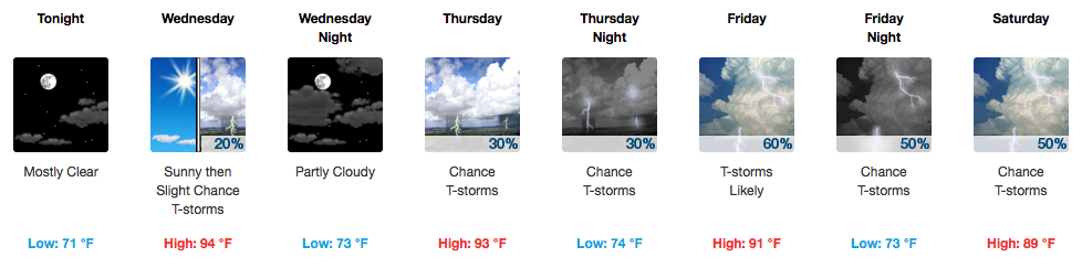

It’s definitely an A/C, waterpark, turn on the sprinkler kind of day. We’re already starting out a degree shy of 70ºF at the airport this morning. Temperatures this afternoon will soar well into the low-mid 90s — the official high for today is 94ºF, but I would not be surprised at all to see us reach 95ºF.

Tomorrow once again appears to be one of the hottest days we’ve seen so far this summer. Dew point temps will begin to creep back into the uncomfortable upper 60s. Our high will be around 94 tomorrow.

Today’s dewpoint stayed in the low 60°s.
It was almost, can I say, comfortable? The warm, kind embrace of a summer day.
Tomorrow….
Wait, what’s that mean for this week? How’s it looking?

Today will be the nicest day of the week. Low 60°s dewpoints = low humidity, but it’ll still feel like summer with a high near 90°.

Humidity will increase every day. Today will be on the low end of Sticky, but Monday-Wednesday it’ll be Uncomfortable:
You must be logged in to post a comment.