
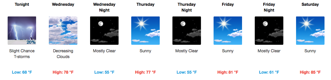
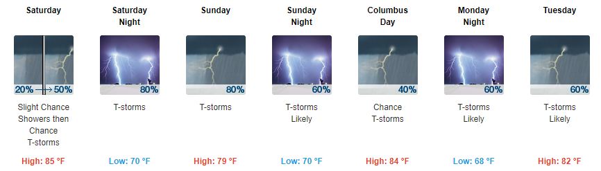
Gloomy and Rain-Filled Tuesday
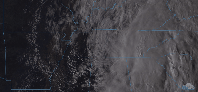
Regional Radar 11:30AM CDT
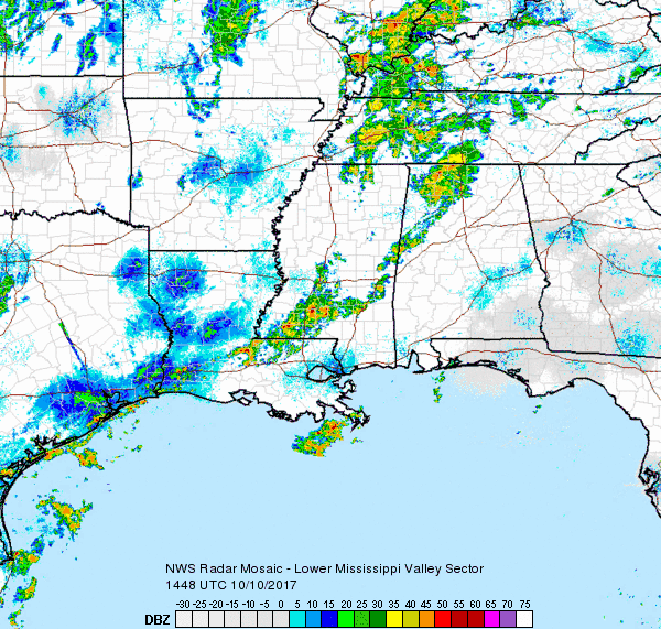
Rain has encompassed much of Middle Tennessee this morning and another heavier batch is moving in from the west for the lunch hour. Plus or minus a few more showers after this next rain swath, we will be largely done with measurable precipitation by late afternoon/evening. The HRRR is in good agreement with this scenario.


You must be logged in to post a comment.