
Tranquil Week, Tropics Advertising Activity Towards The Weekend…Maybe Bringing Us Rain
GOES 16 Visible Loop
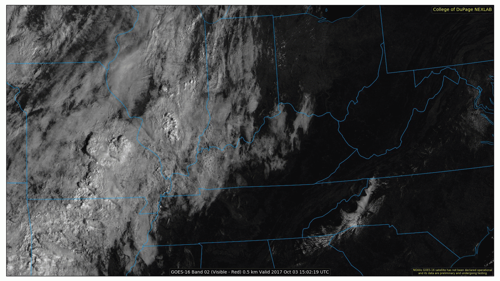

GOES 16 is busy this morning across the Mid-Mississippi Valley, as showers and a few storms are ongoing. An increase in moisture is evident over those areas, but high pressure holds strong for us here in Nashville.
WPC Surface Analysis
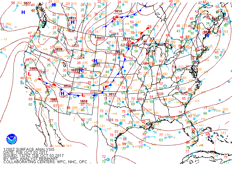
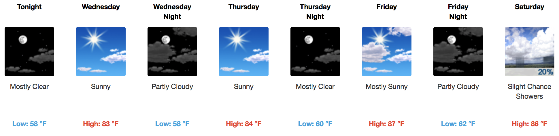
A cold front over the Plains will get slowed down by the dome of high pressure over the Ohio/Tennessee Valleys, keeping us rain-free for a better portion of the week. Temperatures are expected to warm a little more by Friday, but overall, afternoon temperatures in the 80s and overnight lows in the upper 50s/low 60s will be the norm.
Today/Tomorrow’s Temperature Trends
[av_textblock av_uid=’av-rolz0o’]
[cjtoolbox name=’Treg DONT DELETE’]
[/av_textblock]
The weekend and early next week is a different story…
Latest GFS Model Loop through Next Tuesday AM
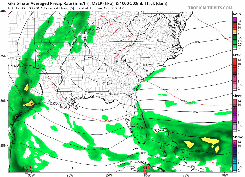
Southerly flow brings an increase in moisture by Saturday PM, leading to a chance for showers. Pay attention to potential development in the Gulf of Mexico, as this could be our next real rain maker. Sunday and Monday would be the “main event”, and wet weather would exit by sometime on Tuesday. It’s worth noting that this latest GFS solution is further west than the previous, and is further west than the latest European Model. Trends are our friend, so we will have to watch and see if the next runs of both global models shift at all. This will have implications on what type of rain/wind we would get from the system.
Also, this low pressure system in the Gulf has not yet formed…and it isn’t a guarantee to form. However, with more model runs comes more confidence in the idea of something developing there in the next 5 days.

WPC Accumulated Rainfall Through Next Tuesday
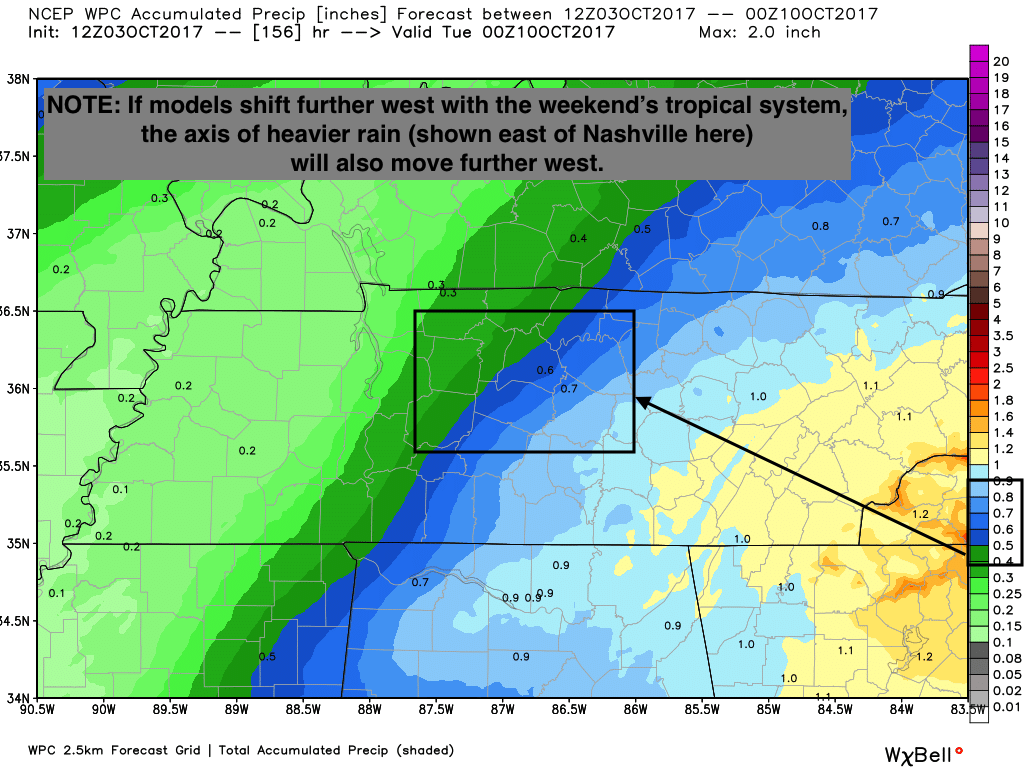
These estimates may be a bit on the lower side, depending on the advertised track of the possible tropical rain-maker. Stay tuned!

Categories: Forecast Blogs (Legacy)
You must be logged in to post a comment.