
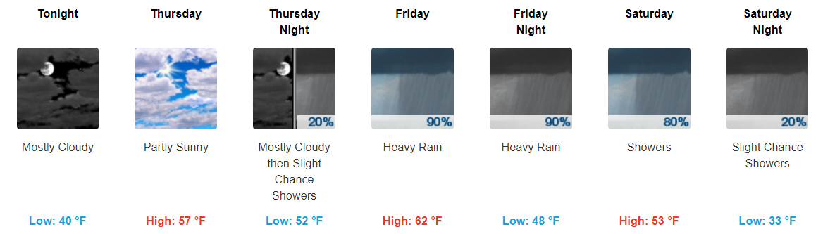
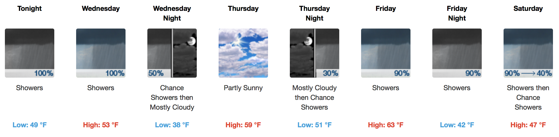
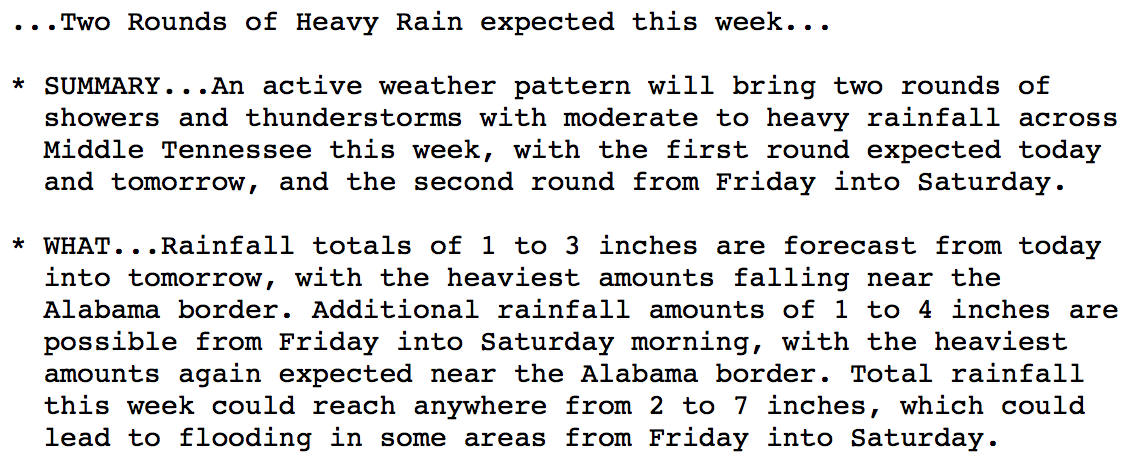
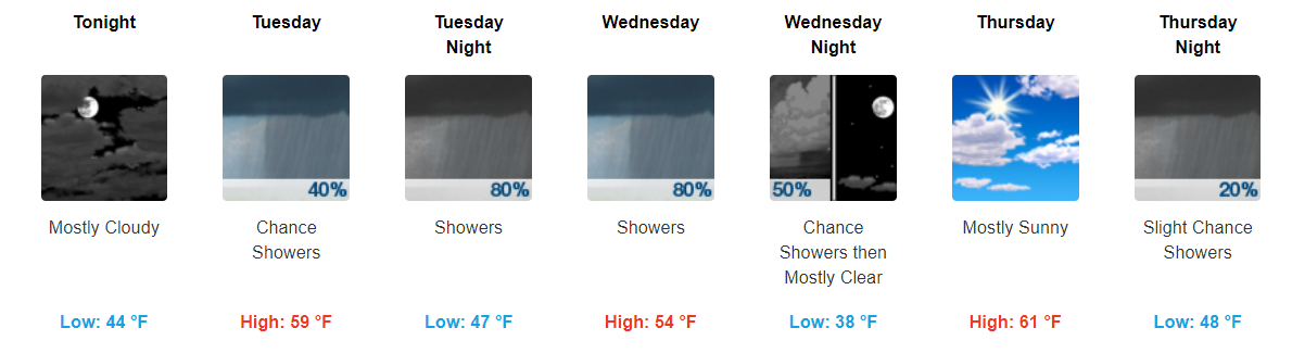
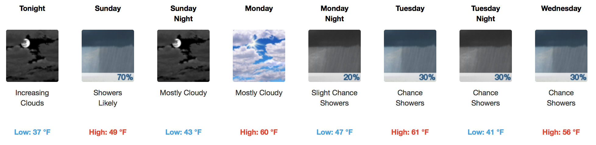
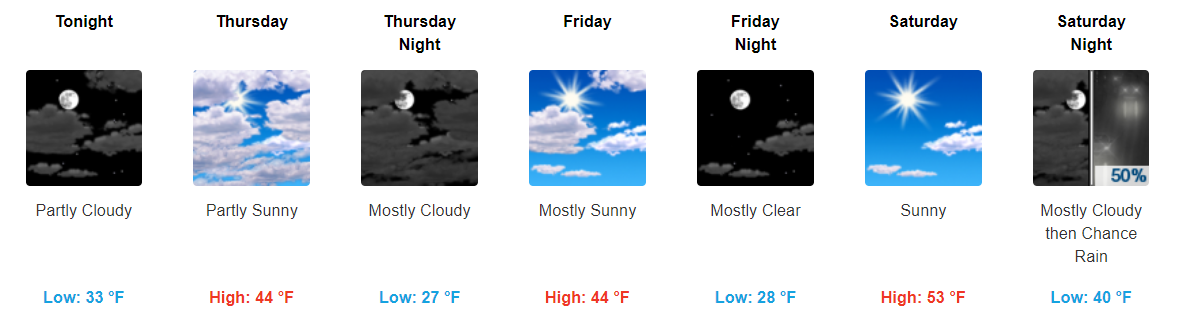
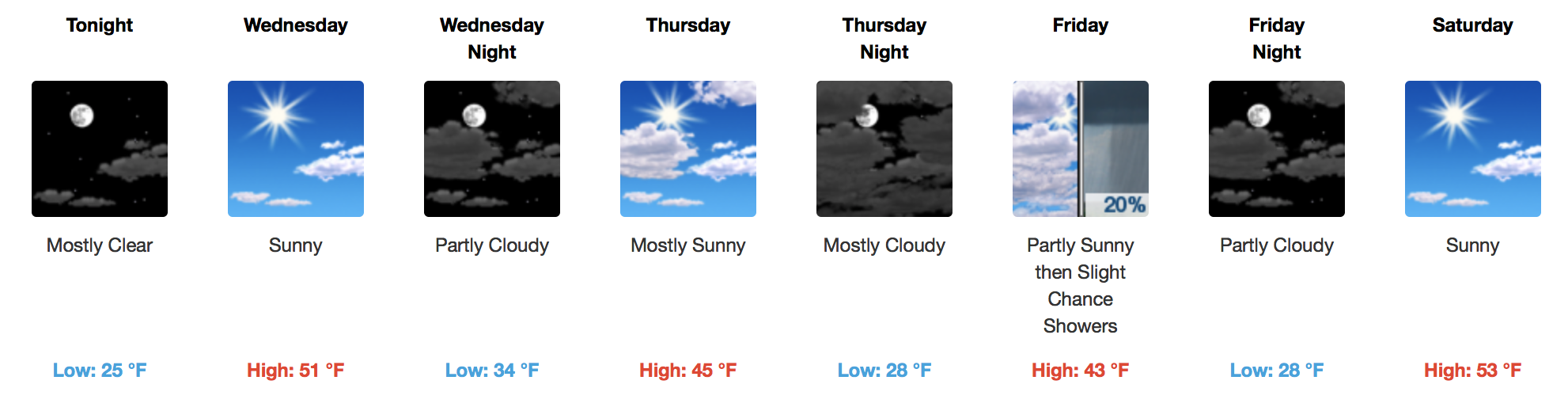
Scattered Showers Throughout the Day, Clearing This Evening
Fairly dreary day today with showers hanging around through the majority of it. You will want to keep those umbrellas handy.
https://giphy.com/gifs/willandgrace-episode-2-nbc-l1J9rMqPQ8c2HfxiE
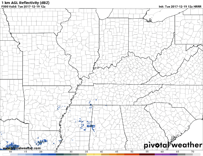
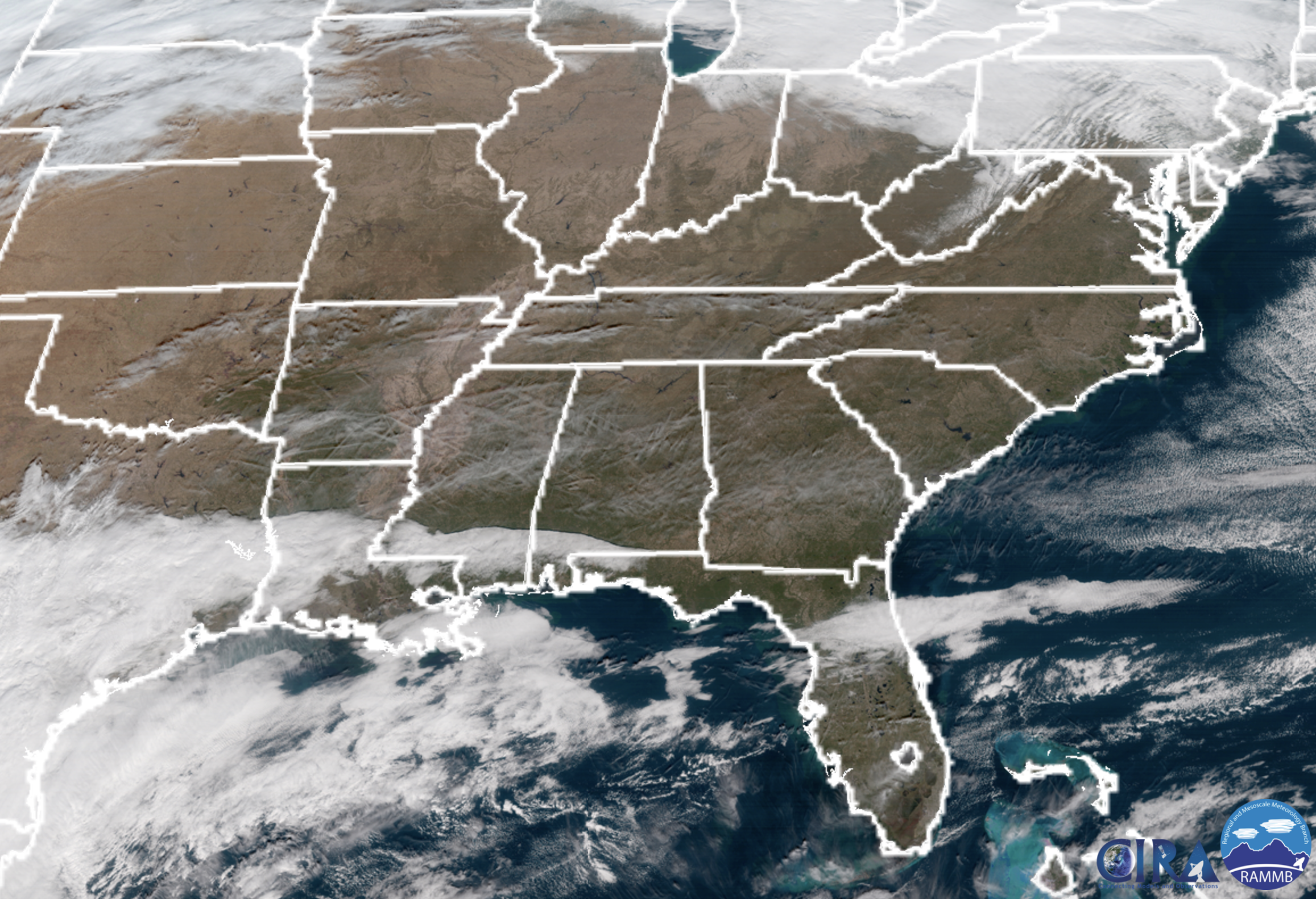
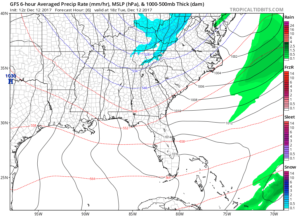
Bands of showers will continue to move through Middle TN at least through the afternoon hours. Most models show these showers tapering off as we reach the evening hours.
 \
\

You must be logged in to post a comment.