
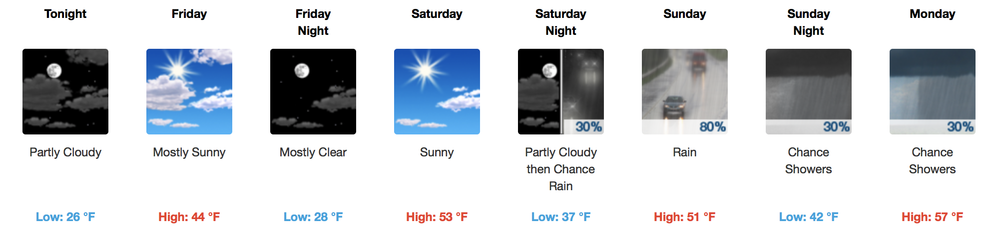
Cooler Through Friday, Warm Weekend
Clouds will have a difficult time breaking up today, but we may get a few peeks of sunshine in the late afternoon. Our area is behind a cold front, so colder temperatures are filtering in. 20s are expected overnight into tomorrow morning, and we’ll only rebound into the mid-40s Friday afternoon.
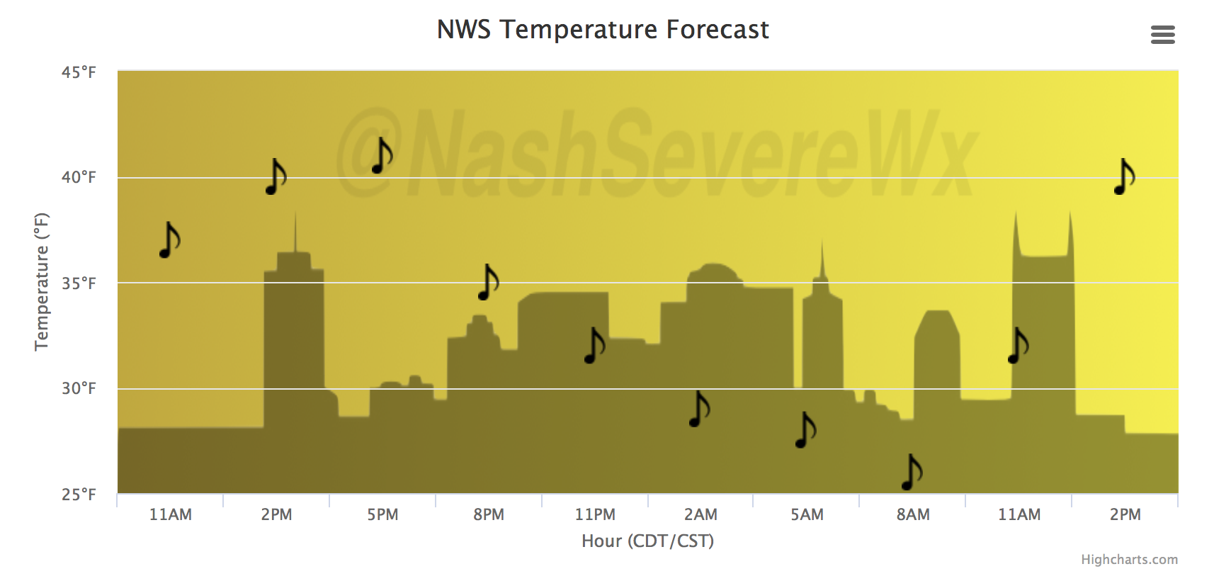
Temperature Trend
GFS Model Loop
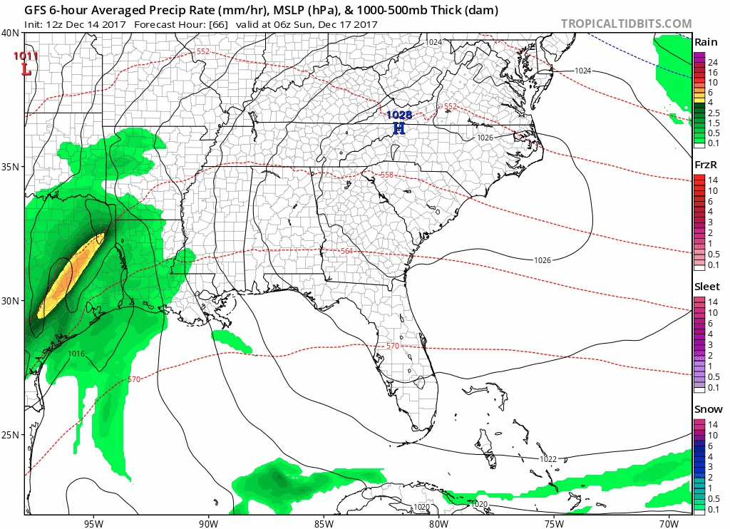
A developing low pressure system will spread rain activity towards us on Saturday night into Sunday. A lull in the showers should ensue late Sunday into Monday before a cold front sparks more rainfall Monday night into Tuesday.
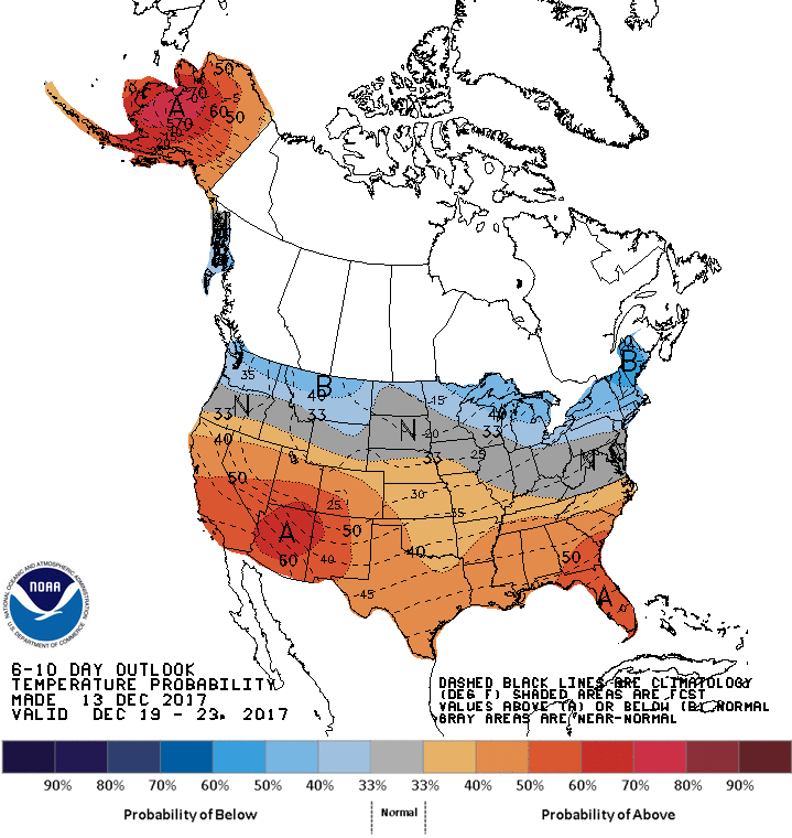
By Tuesday, we will dry out nicely and temperatures will be moderating all week next week. Expect a general trend of above normal temps the next 7 days with no major swings in the jet stream.

CPC 6-10 Day Temperature Outlook

Categories: Forecast Blogs (Legacy)
You must be logged in to post a comment.