A cold front will move east across Middle Tennessee today, bringing rain and awesome temps with it.
Rain is already underway this morning at 7:28 AM.
Rain should be off and on. Expect heavier rain at times, especially this morning.

A cold front will move east across Middle Tennessee today, bringing rain and awesome temps with it.
Rain is already underway this morning at 7:28 AM.
Rain should be off and on. Expect heavier rain at times, especially this morning.
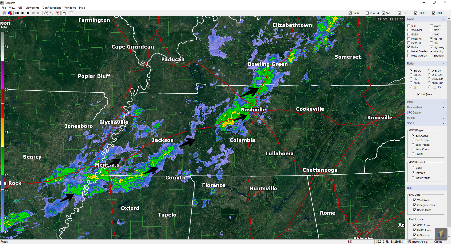
Rain is setting up to our west as a large frontal system is organizing over south Missouri.
For today, most rain chances will remain to our west. Daytime heating will cause some rain/thunderstorms to go up over our area in the afternoon. If you plan to be outdoors, pack the umbrella.

It’s still summer. Hot and humid.
Looking at a high of 91º in the city today with pop up showers and storms. Today is the type of day where we can’t tell you where and when due to their pulsing nature; it is something we just can’t forecast.
High temps in the upper 80s with clouds hanging overhead all day. TD Gordon keeping our dewpoints high; humidity is oppressive.
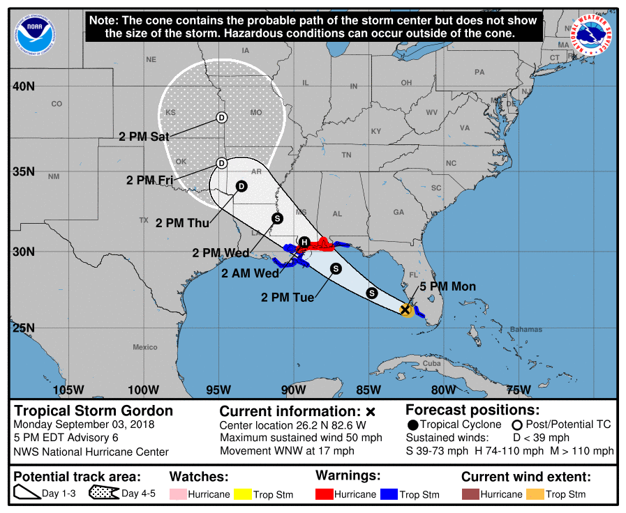
TD Gordon has moved into western Mississippi – seen here as the small area of blue and white convection over the MS delta. Today it’ll move further west into Arkansas, pushing more moisture into Davidson and Williamson counties.
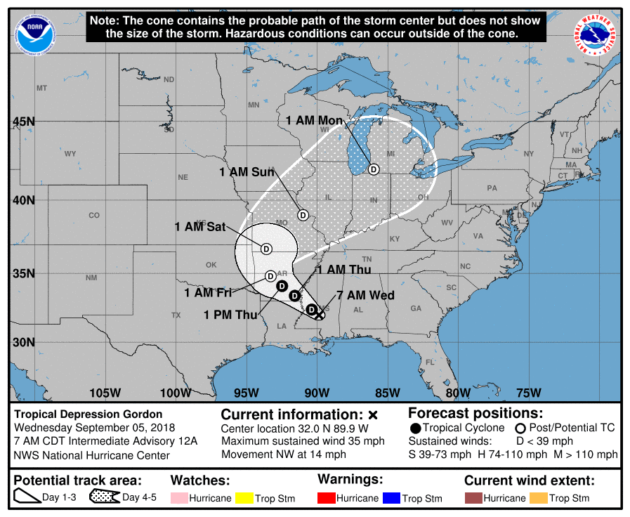
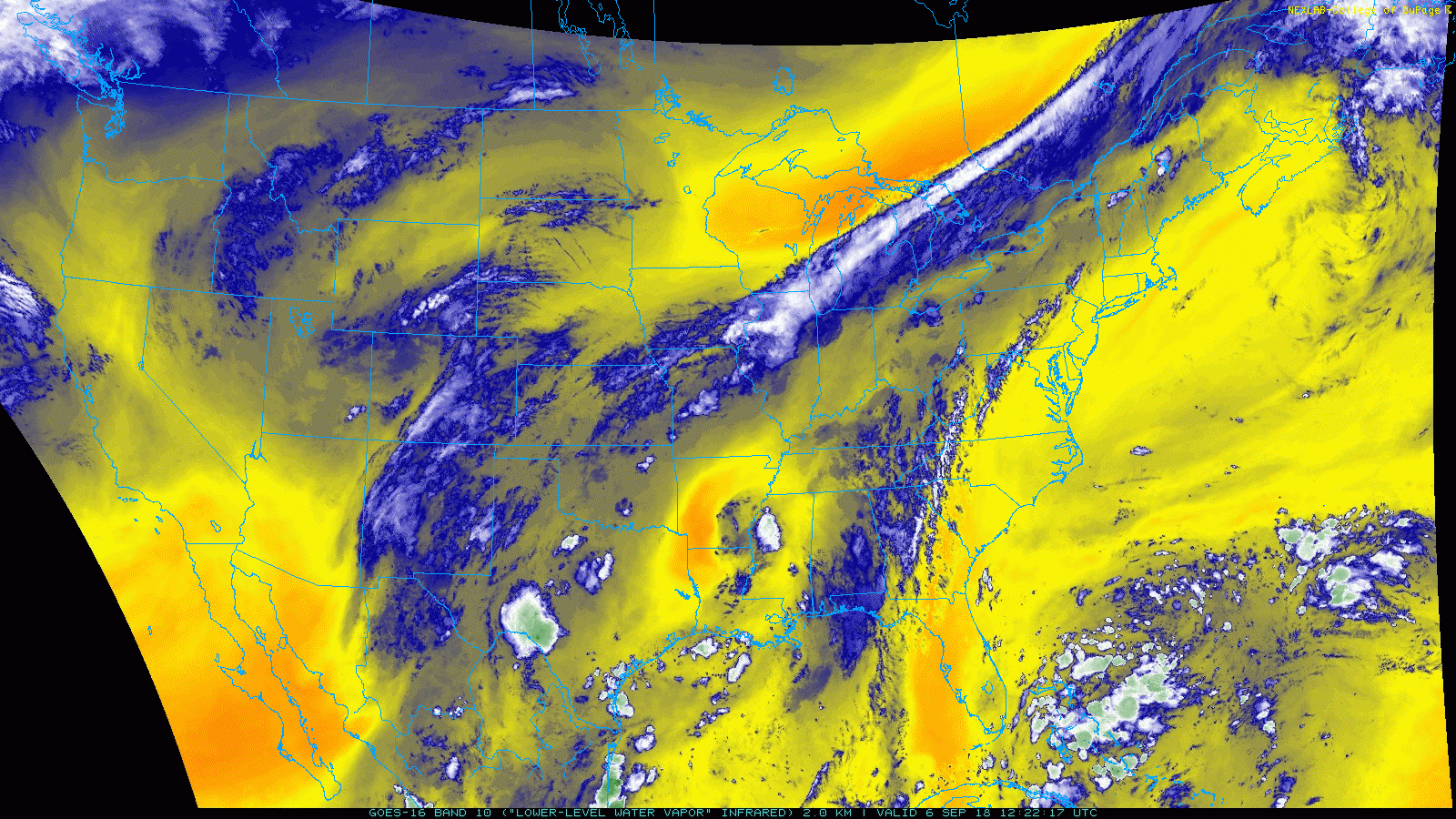
Tropical Storm Gordon made landfall last night just west of the Alabama/Mississippi state line. This morning, the center was located near Jackson, Mississippi and is working its way toward Louisiana and Arkansas.

Hot and muggy. High temps in the low 90s with a heat index in the upper 90s.
The HRRR model thinks we could see a few scattered storms this afternoon/evening. This model thought the same thing yesterday and nothing happened. But, it could be right today. Any storms that go up will be traveling quickly from south to north.
Today is turning out “Sweaty not Wetty.” High pressure defeated any effort to sprout storms. A few defiant cells may sprout over the next few hours. We’ll tweet them @NashSevereWx (and here) if they do.

It’s hot today but not sure it’s a “scorcher.”
We wrote “Sweaty Not Wetty” last night only to wake up this morning to HRRR model runs popping off isolated late afternoon/early evening downpours and thunderstorms:
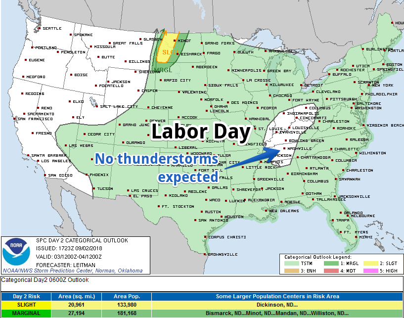
The Storm Prediction Center does not think we will see Labor Day thunderstorms:
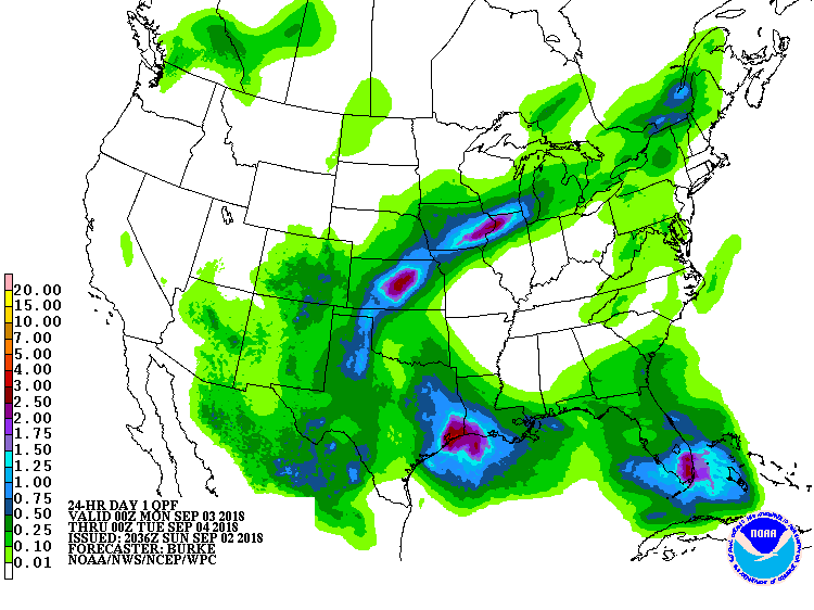
The Weather Prediction Center forecasts for us no Labor Day rain:
NWS-Nashville agrees, figuring only a 10% probability of precipitation (black arrow) and betting no rain will actually hit the pavement (red arrow):
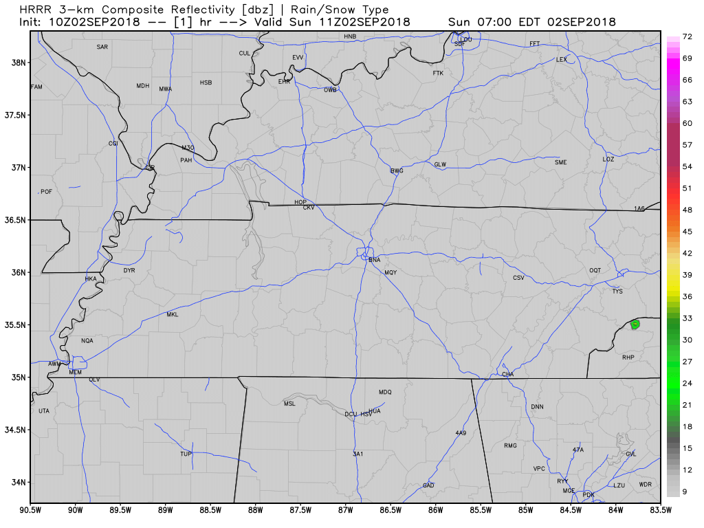
It’s possible an isolated shower or storm will pop up this afternoon. The HRRR model thinks so:
As usual for summer, shower/storm locations are unknown. Buy a lottery ticket and hope for the best.
You must be logged in to post a comment.