
Today and This Weekend
It’s still summer. Hot and humid.

Looking at a high of 91º in the city today with pop up showers and storms. Today is the type of day where we can’t tell you where and when due to their pulsing nature; it is something we just can’t forecast.
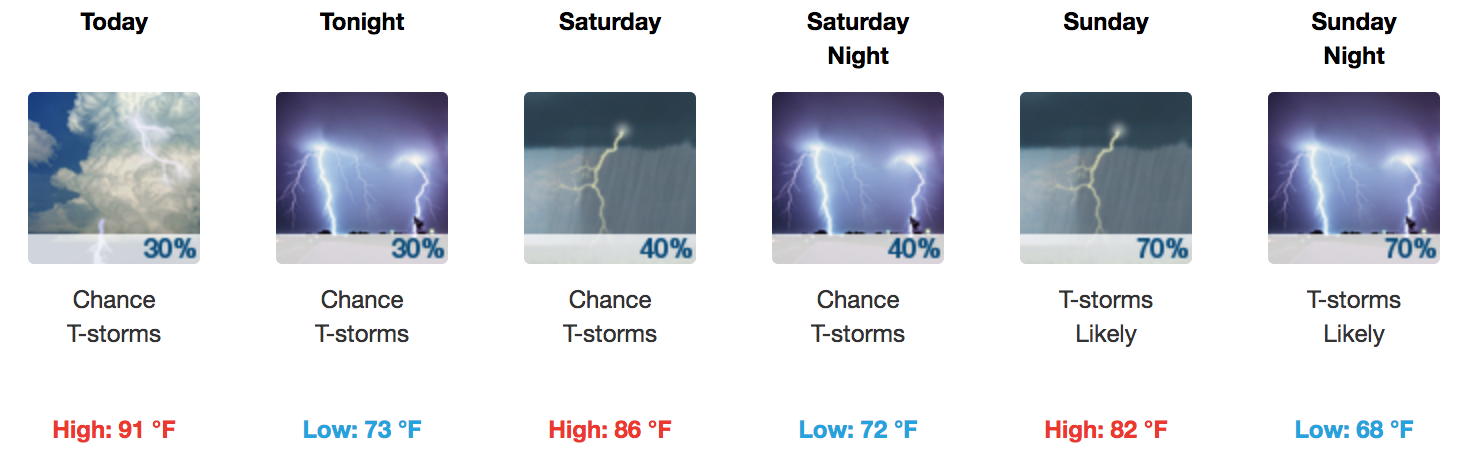
This weekend, a cold front will gather what remains of Gordon and approach from the northwest. From NWS Nashville:
The developing front will slowly move our way with the [frontal passage] scheduled for sometime Sunday night or Monday. Prior to that time, we will see an increasing moisture trend. Look for relatively low probabilities of rain today and tonight. Then, likely probabilities of rain will begin to show up in our northwest on Saturday and expand through Sunday.
NAM3 and HRRR model runs into Saturday show lines of rain and thunderstorms forming in west Tennessee and moving into Middle Tennessee Saturday morning, then dissolving before they get here. Hard to say exactly where those rain bands will fall apart — or if they’ll even fall apart — but the models think most of Saturday should be free of a soaking rain. Instead look for hot and humid with a chance of something random and disorganized popping up. Retain outdoor plans Saturday.
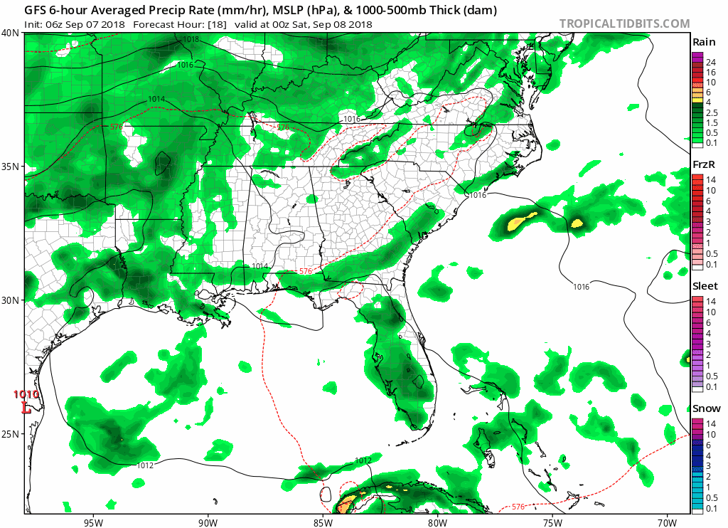
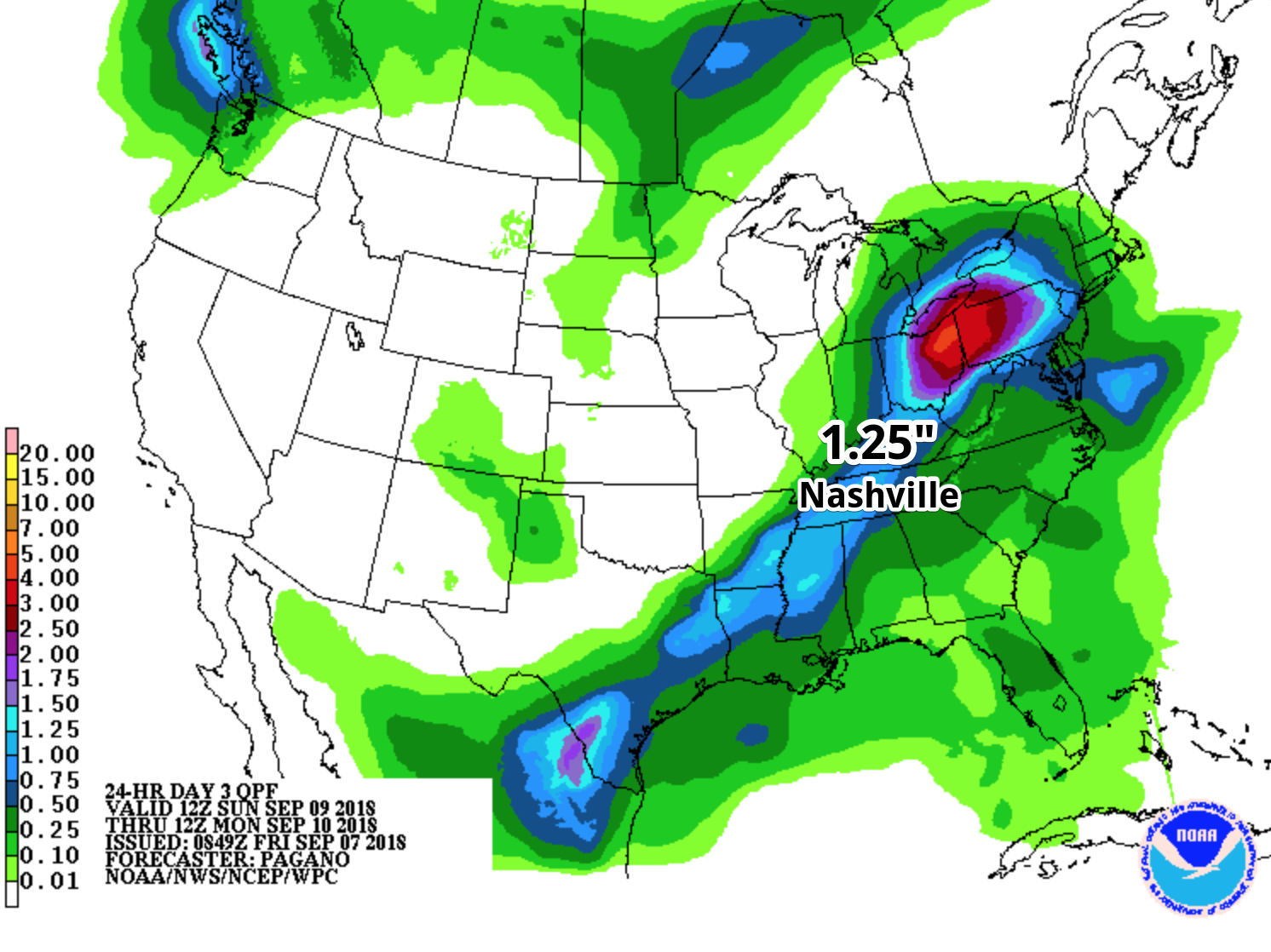
Above is this morning’s run of the GFS model. Both the GFS and European Models bring the rain in around the same time with the same totals: Late Saturday night and early Sunday through Sunday afternoon. Sunday looks like a potential washout. It is not out of the question to see up to an inch and a half in some spots.
We keep an eye on things. Check back for updates on weekend rain chances at @NashSevereWX on Twitter for the ever-evolving forecast.

Categories: Forecast Blogs (Legacy)
You must be logged in to post a comment.