
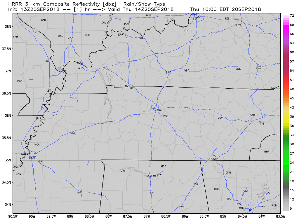
The party is premature. Our transition to a fall airmass is currently underway *only at the surface" — aloft, summer/tropical/wet is hanging on. This jerk "overrunning" pattern means rain should redevelop Thu morning and may not end until tomorrow night. /ducks/ pic.twitter.com/NTNRaWUmzN
Some More Rain Today in this Tropical Airmass; Cold Front Tomorrow; Cooler Late Wednesday and Thursday!

It’s still exceptionally humid. Dewpoints are in the low 70°s. That’s:
And here comes another wave of moisture through our area.
The HRRR model (see below) thinks rain will move through late this afternoon. The atmosphere does have energy stored up, and with a slight increase in wind shear just to the north of Nashville, a few strong storms could be in the mix. Yet the stronger storms should be pretty far north of us.
Flash Flood Watch Expired, One More Shot of Rain (Likely Wednesday AM)

The Flash Flood Watch expired at 7 PM tonight.
Rain slowly moving east. "The Flash Flood Watch that's in effect will be allowed to expire at 7pm as the threat for flooding across much of the area decreases. However, rainfall will continue off and on throughout the day on Tuesday." —@NWSNashville
Flash Flood Watch Until 7 PM Monday
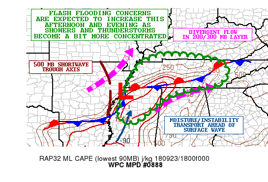
A Flash Flood Watch is now in effect until 7 PM Monday.
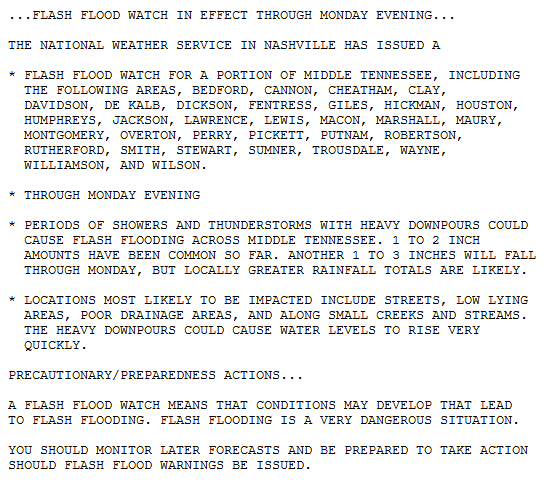
NWS-Nashville explains:
Models are indicating another batch of heavy rain and storms moving across the area tonight and tomorrow, and with the ground now wet and saturated flooding will become more likely with any additional rainfall.
Rain!
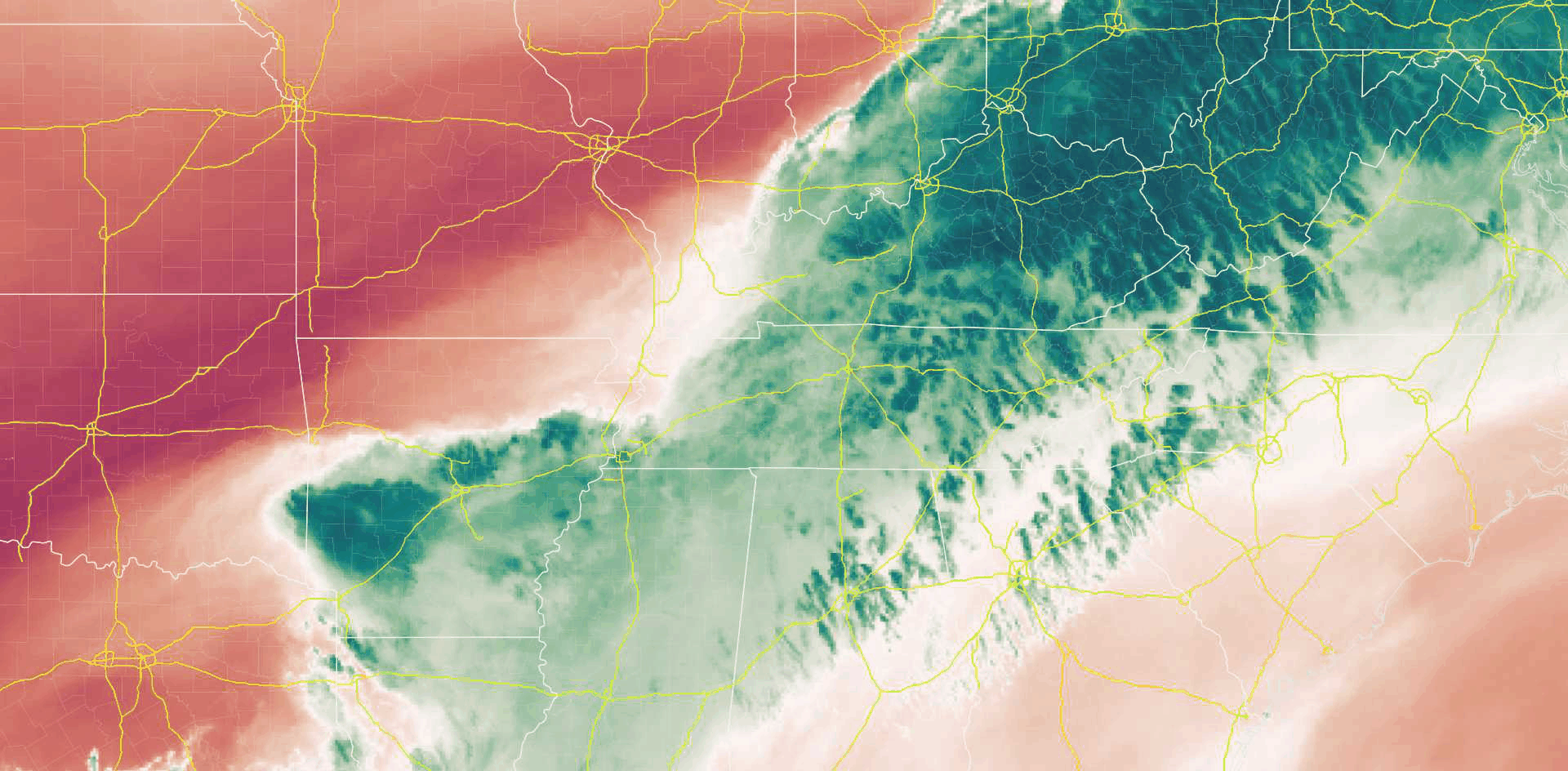
Mid-level water vapor infrared imagery shows moisture streaming in from Arkansas and West Tennessee.
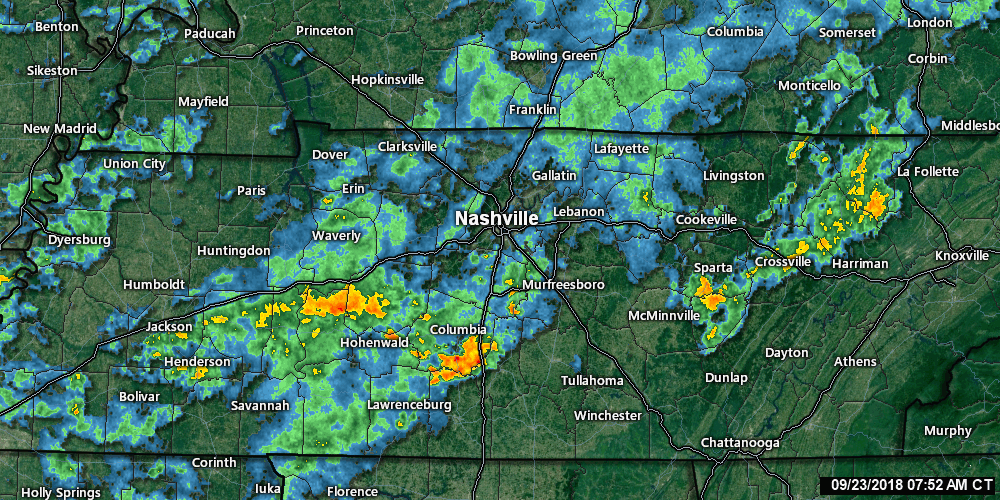
Radar looked like this as of 8:30 AM:
It’s going to rain more today.
This morning, in its Hazardous Weather Outlook, NWS-Nashville wrote “there is low confidence on the exact location of the heaviest rain, [but] training storms will increase the flooding risk.”
Rainy First Day of Fall; Wet, But Cooler Week Ahead

We’ve seen a few showers across the midstate this morning as a surface front has settled in right over Tennessee. This will be our main rainmaker through the weekend and into next week.
Widespread cloud cover will knock our high temps down into the upper 70s, with a low temps in the upper 60s. That a drastic improvement from this past week.
Rainy, Humid Weekend Ahead, but Don’t Cancel All Plans

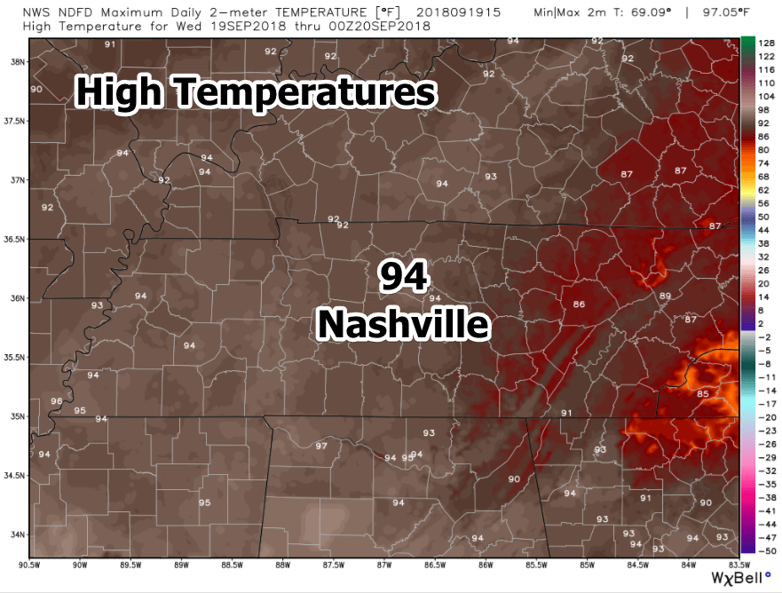
Rojoice! Today is the last day temperatures will hit 90º in the foreseeable future.
Clouds and moisture are arriving ahead of a cold front. That front will show up late tonight or in the wee hours of Saturday morning, slow down and maybe stall out, all setting off a wet, unstable weather weekend where rain chances are definitely there, but there is no real good idea when they’ll arrive, how long they’ll stay, and where exactly they will be.
Unseasonably Hot Temperatures on the Way Out, Dodging Weekend Rain, Cooler Temps on the Horizon
Keep the water close by today. We are headed for a high of 96º in Nashville. This is 10º+ above average for the middle of September. Dew points will remain high causing it to feel like the triple digits outside. Bottom line, today is going to feel awful for late September.
Hot and Humid, Rain By the Weekend
Today
Here we are, 3 days from fall and we are looking at a high of 94º in Nashville today. Yes, you read that correctly.

Dew points will be flirting with the oppressive range, as well, today and tomorrow. Overall, the temperature outside will feel like the mid to upper 90s in the afternoon hours. Keep a bottle of water close by if you are going to spend any extended period of time outside.
Hot, Dry Week with Low Rain Chances; Rain Chances Increase a Bit This Weekend; Fall Temps Far Away
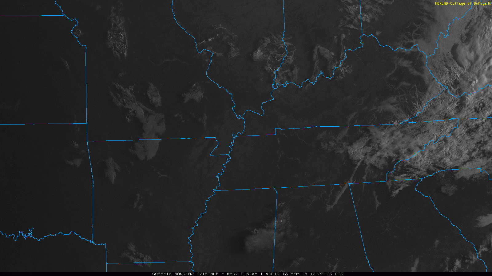
We’ve got quite the clear morning over Nashville. A few pockets of fog are mixing out with the rising sun just to our north.
Expect mostly clear skies today. A few puffy clouds could work their way into our skies.
You must be logged in to post a comment.