

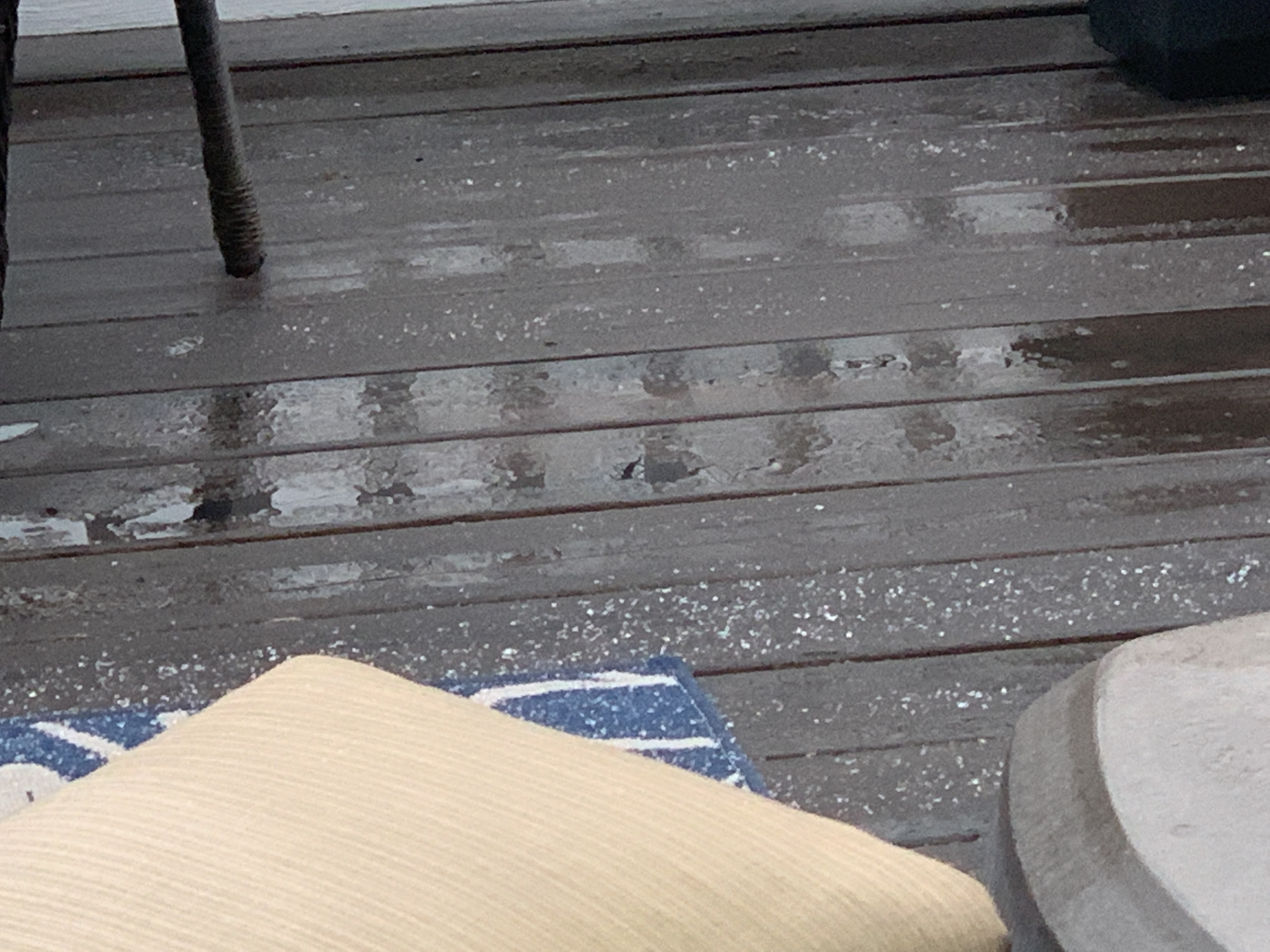
Merry Christmas! Some in Will Co got a White Christmas!
In this edition:
- Nice Christmas & Boxing Day
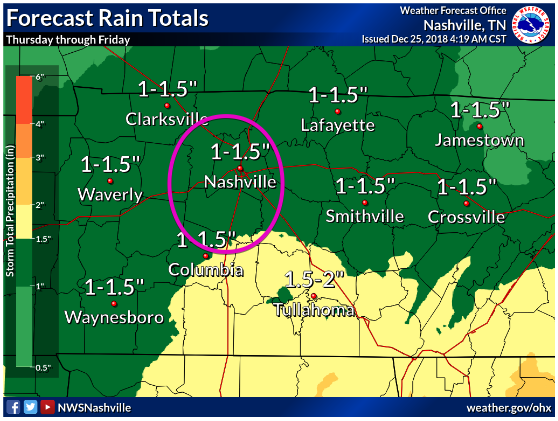
- Rain Thursday through Friday Morning: 1″ to 1.5″ Total
- Music City Bowl & Colts/Titans Forecasts
Christmas & Boxing Days
Sleet streaked through Williamson County this morning, but is long gone. Uneventful weather will follow today and tomorrow.
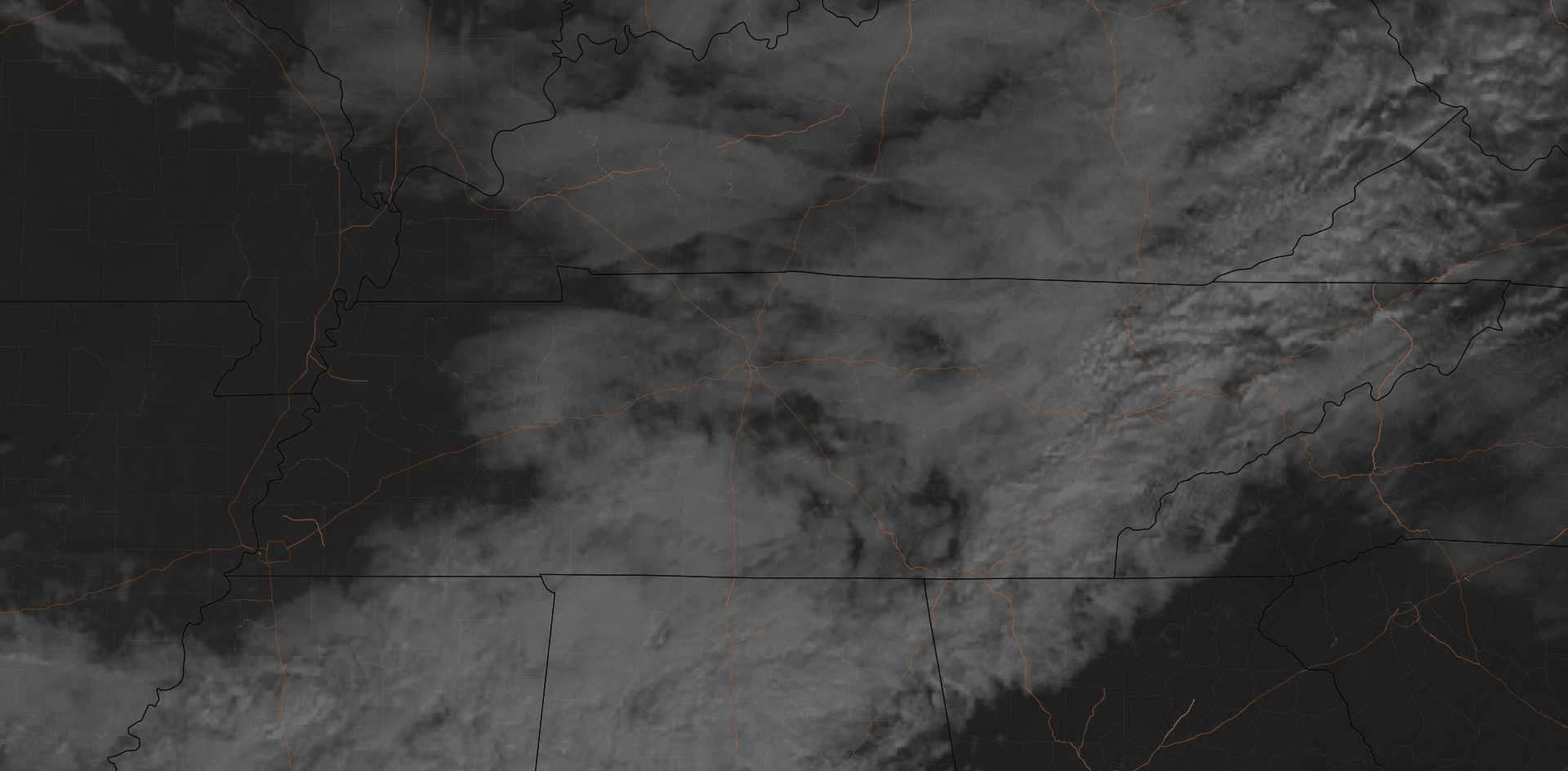
We may even see the sun. Satellite through 11 AM:
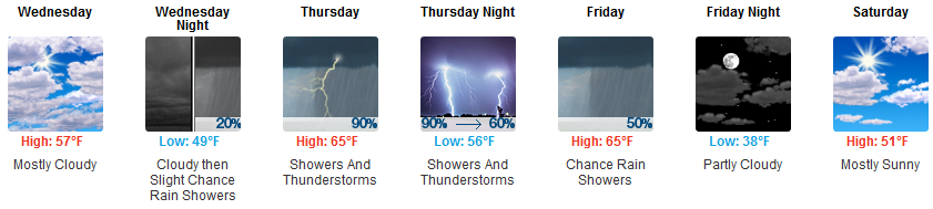
Unseasonably warm temps arrive Wednesday through Friday. Yes, mid-60° highs.
Rain, Maybe Storms, Thursday – Friday
Start Time? Light rain begins as early as Thursday morning. Throughout the day Thursday, there will be off and on rain showers — coming through in waves.
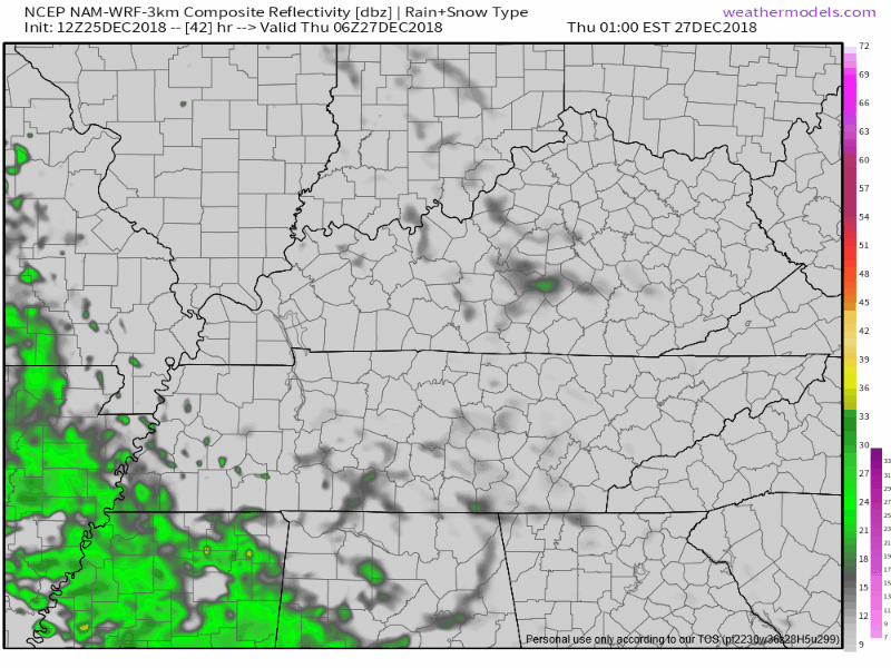
The heaviest rain expected Thursday late afternoon lasting into Thursday night. Below is simulated radar for 1 AM Thursday through 7 PM Thursday:
Windy? Yes, especially in the afternoon. Wind gusts approaching 30 MPH.
Storms? We may see a thunderstorm or two late-day Thursday, nothing strong or severe. Why? The parent surface low is way too far north. Not even the dramatic NAM3 model predicts surface instability in Middle Tennessee Thursday. So yeah, storms? Meh.
Flooding? No. But it’ll be a soaker.
End? The NAM3 model above appears to suggest rain will shut off shortly after dark Thursday night, but that only because that’s the limit of the NAM3 model’s range. The Euro model runs further, and it redevelops rain overnight into Friday morning, then pulls all rain east of us and out of here around 9 AM Friday.
Music City Bowl? Those arriving Thursday obviously should be prepared for rain, but right now we think (but cannot promise) the rain will be gone before the 12:30 PM kickoff Friday. Unlike most late December systems, this one is relatively weak, and warm temps will stay around for the game. Mid-60°s!
The Weekend & Colts at Titans Sunday Night
Winds turn north Saturday, which will deliver cooler but season-appropriate temps: morning lows just above freezing, afternoon highs around 50°.
Very light rain is unlikely, but possible, Saturday night into Sunday morning. A larger rain system will pass southeast of us and we may catch its northwestern edge. The Euro model thinks we’ll get just a little rain, but the GFS model predicts nothing (it has the system further southeast).
There’s a tiny chance a few snowflakes will fall if a series of unlikely events verify (i.e., the Euro is right + the system is further north + it slows down + overcomes dry air aloft + arrives during the coldest, pre-dawn hours Sunday), but even this Series of Unlikely Events Happens it would be like what we saw this morning: a little mix/sleet, melting everywhere on contact (except on decks, mailboxes, and garden gnomes), and of no travel consequence.
As for Colts at Titans: no precip of any type is currently expected, although with one system departing late Saturday and another system expected Monday, there’s “slight chance” the models have the timing wrong and we could get some precip in here in time for Sunday Night Football. For now expect around 40° with a light north wind, and nothing falling out of the clouds except Colts punts and Titans kickoffs.

Categories: Forecast Blogs (Legacy)
You must be logged in to post a comment.