
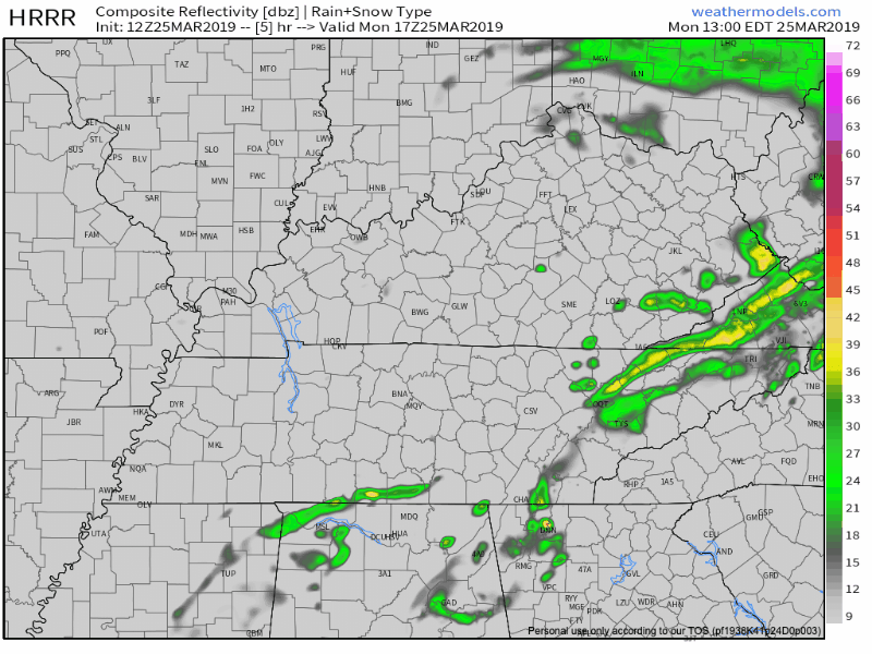
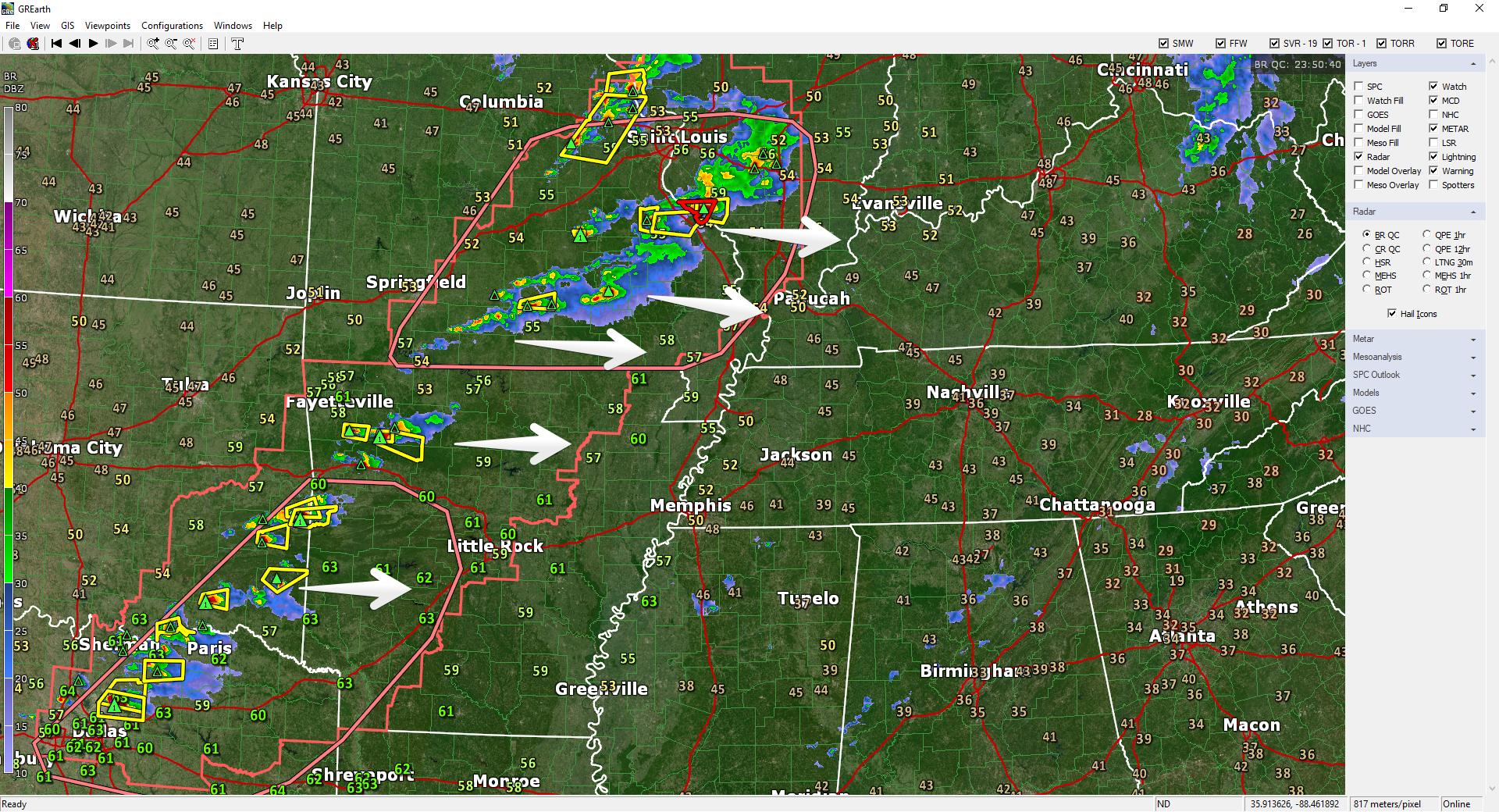
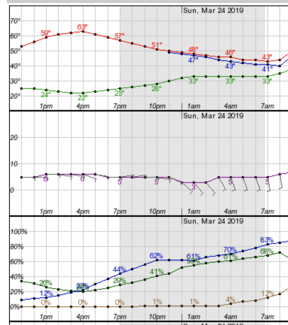
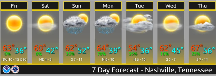
Today, a low pressure center will pass to our north, bringing showers and some storms this afternoon/evening and then cold weather tomorrow.
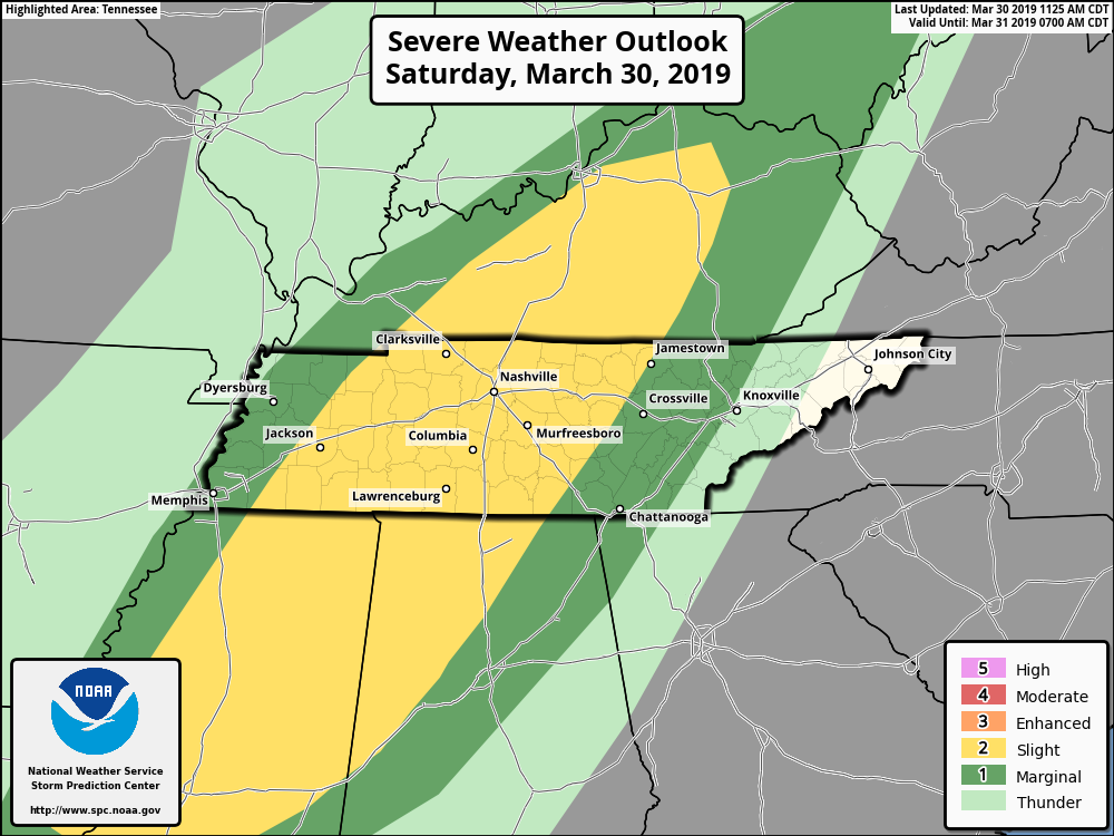
We’ve got a warm, south wind this morning bringing warm, moist air up and into the Nashville area. This is the energy storms will use later this afternoon. SPC has placed us within a Slight (2 out of 5) Area for Severe weather today.


You must be logged in to post a comment.