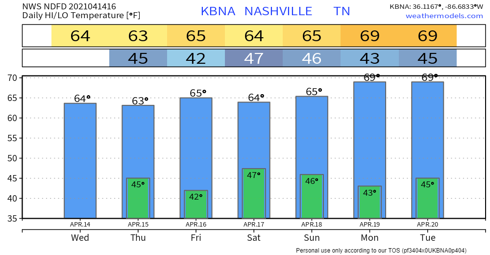
Sunny skies will continue until Friday when our next system arrives. Rain should hold off until Friday evening/overnight into Saturday, but don’t be surprised if a few sprinkles or showers pass through during the day Friday.

Sunny skies will continue until Friday when our next system arrives. Rain should hold off until Friday evening/overnight into Saturday, but don’t be surprised if a few sprinkles or showers pass through during the day Friday.
Satellite imagery from this morning shows clouds thinning out following the passage of the cold front last night.

As the day progresses, we should see more and more sunshine peeking through. Strong northwesterly winds will allow the chill in the air to persist though. Wind chill temperatures likely won’t surpass 50º.
Probably not the April gift y’all were looking for.
Yes, a snowflake may mix in with the rain and make it to the surface. After midnight ETA. It’ll splat melt.
No, you should not panic buy milk and bread (for milk samiches).
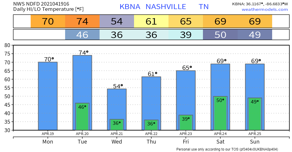
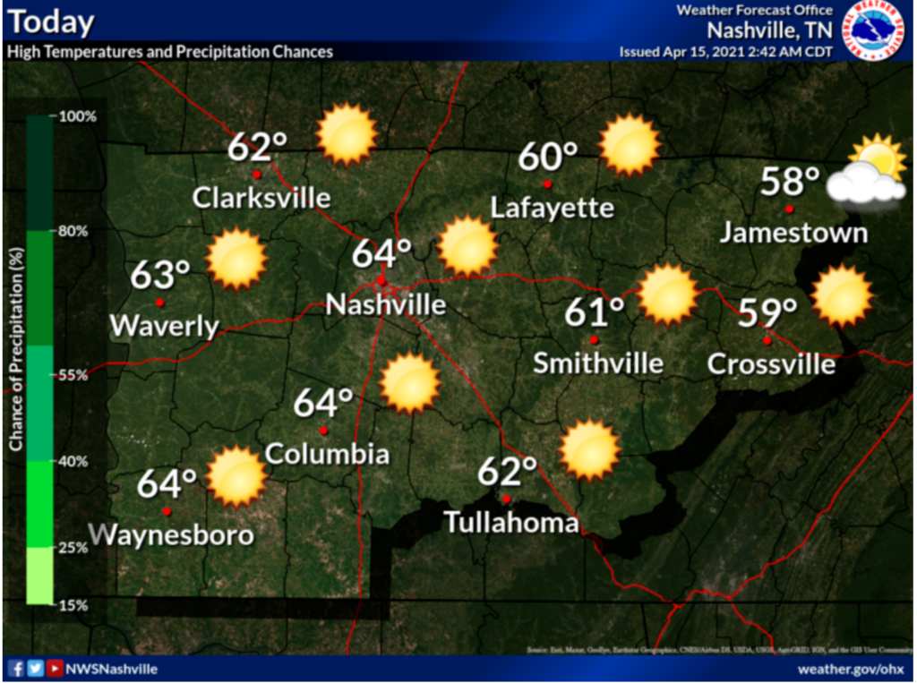
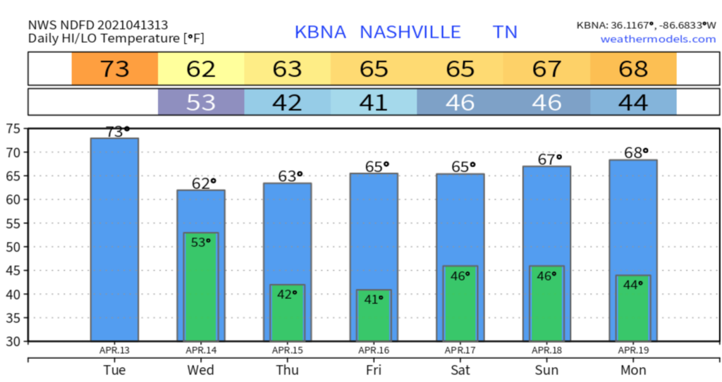
Not much to report on for today and Tuesday: mild temps and plenty of sunshine.

This is due to a cold front coming through the area.
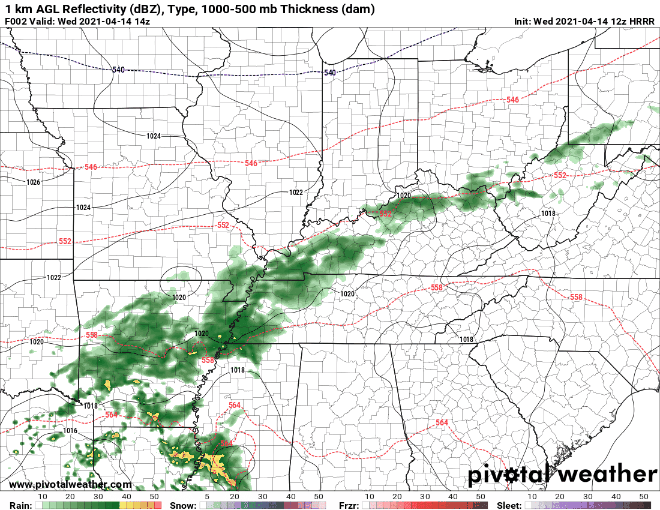
Models show showers beginning around midnight. Here’s the Euro:
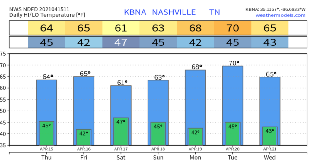
Happy Sunday! We have a beautiful day in store to finish out our weekend.
Although, we could possibly see some showers and thunderstorms develop as we head into the later afternoon hours, after 5pm.
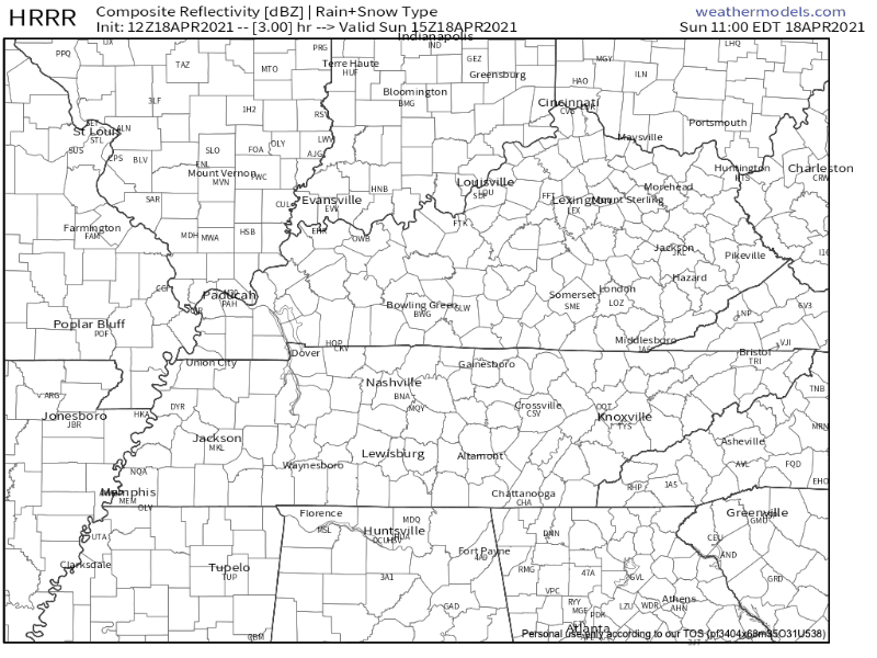
The HRRR has a few showers in the mix for our evening/overnight hours.
Skies will remain rather cloudy today but in terms of rain, however, very on and off pattern for the majority of the afternoon into the night.
You may see a stray shower in your backyard, you may not. We’re mainly eyeing a couple of passing sprinkles.
A layer of clouds sits over Middle Tennessee this morning. The cloud cover may thin at points today to allow sunshine to peek through.

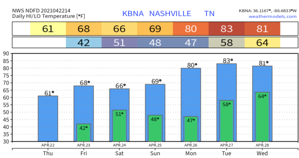
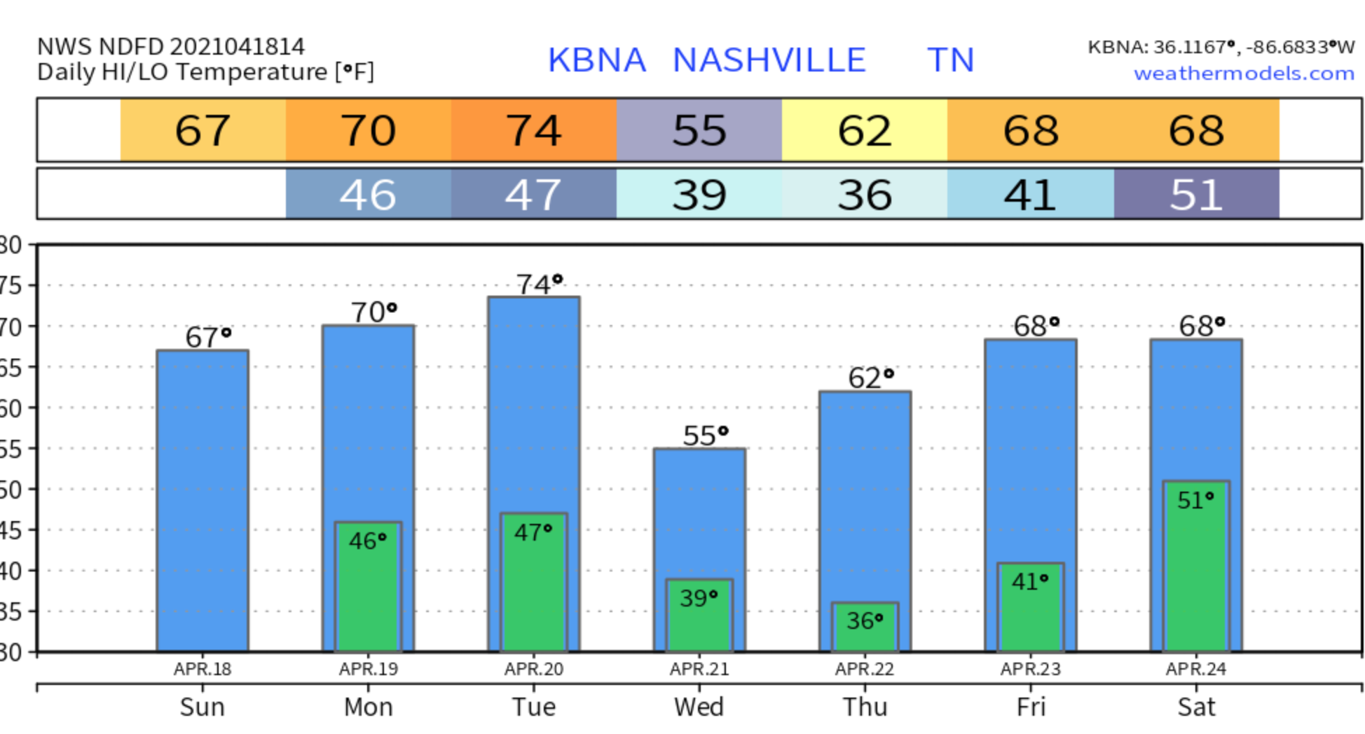
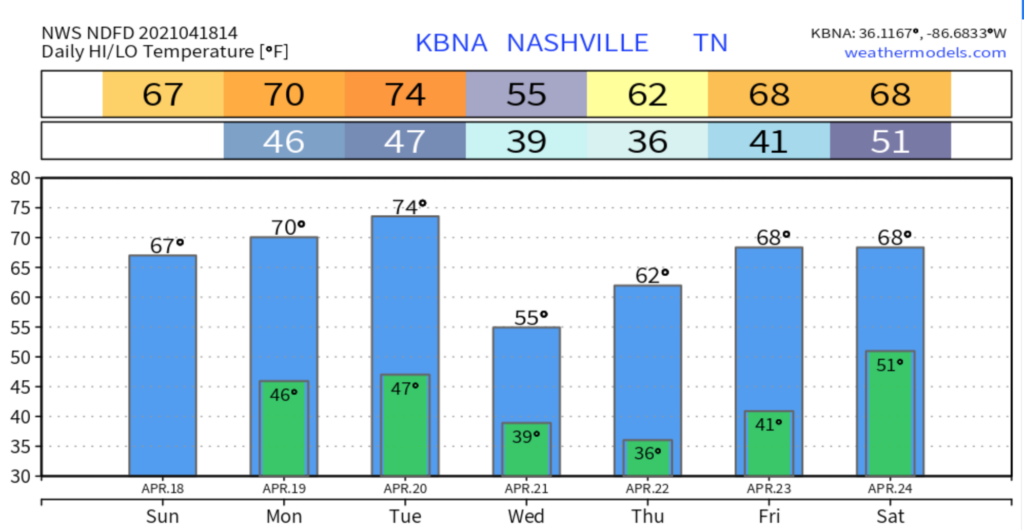
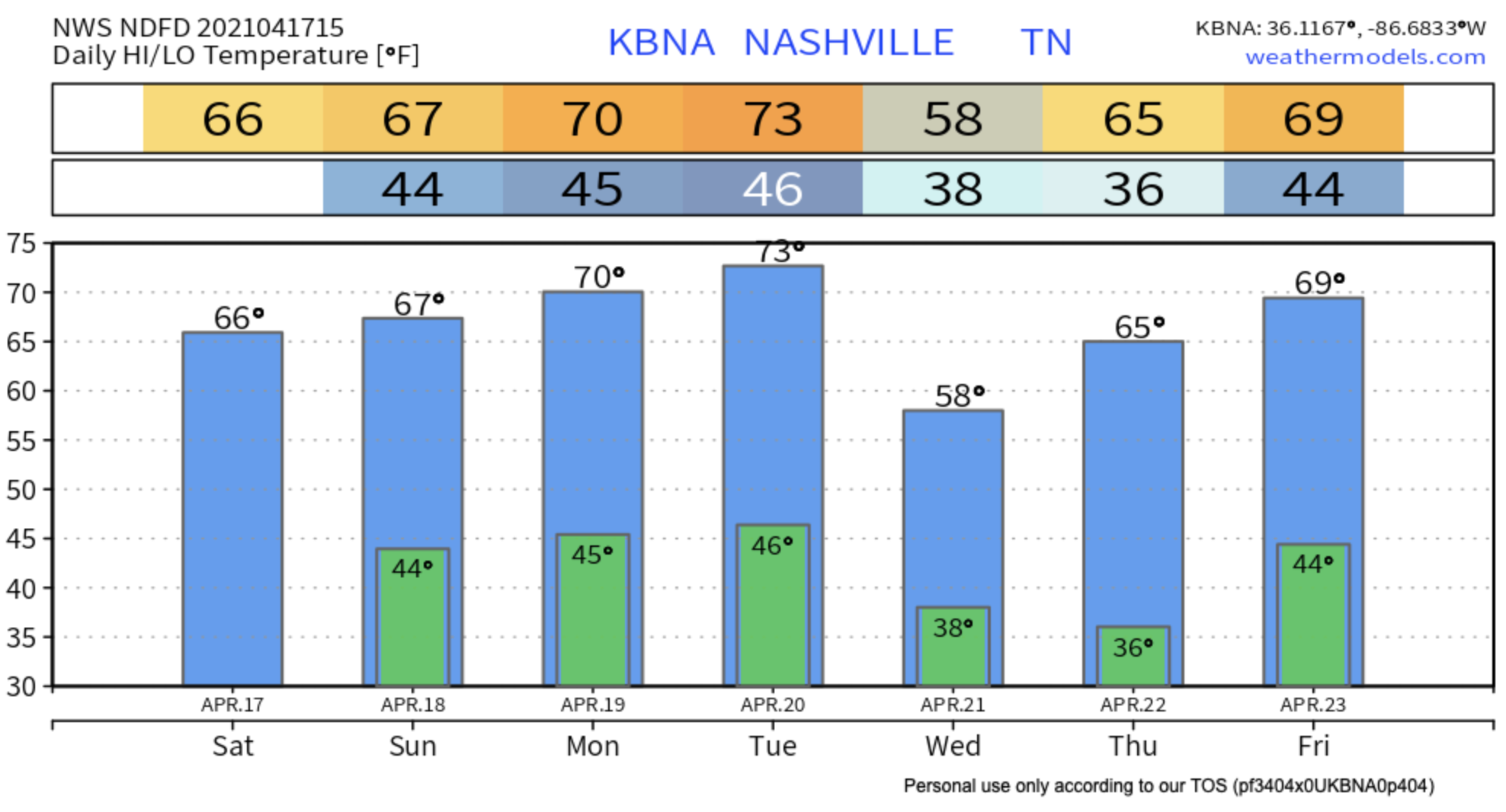
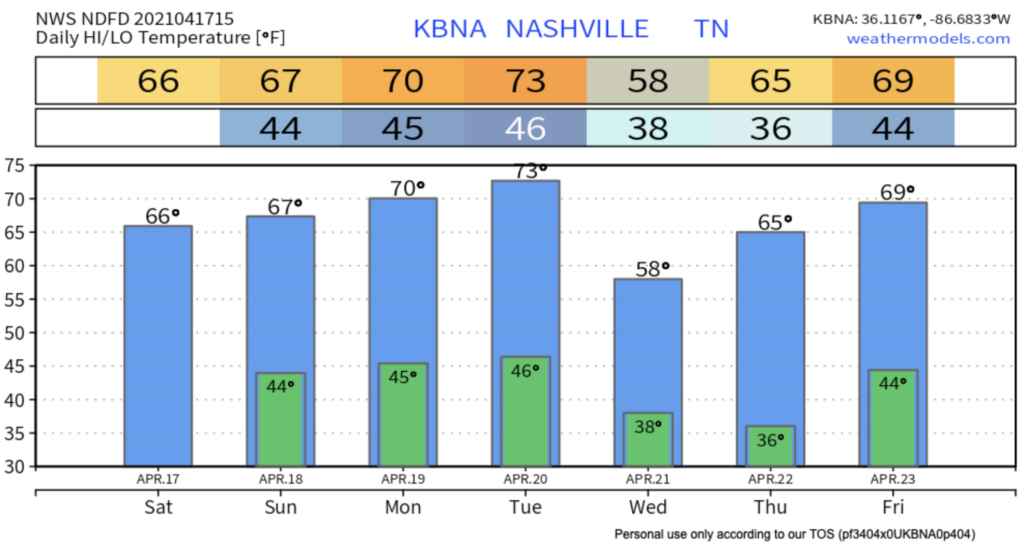
Temperatures Friday will remain on the cool-but-pleasant side of things. High temperatures should reach 66º.

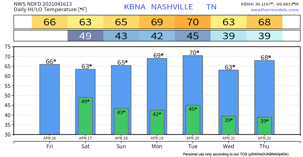
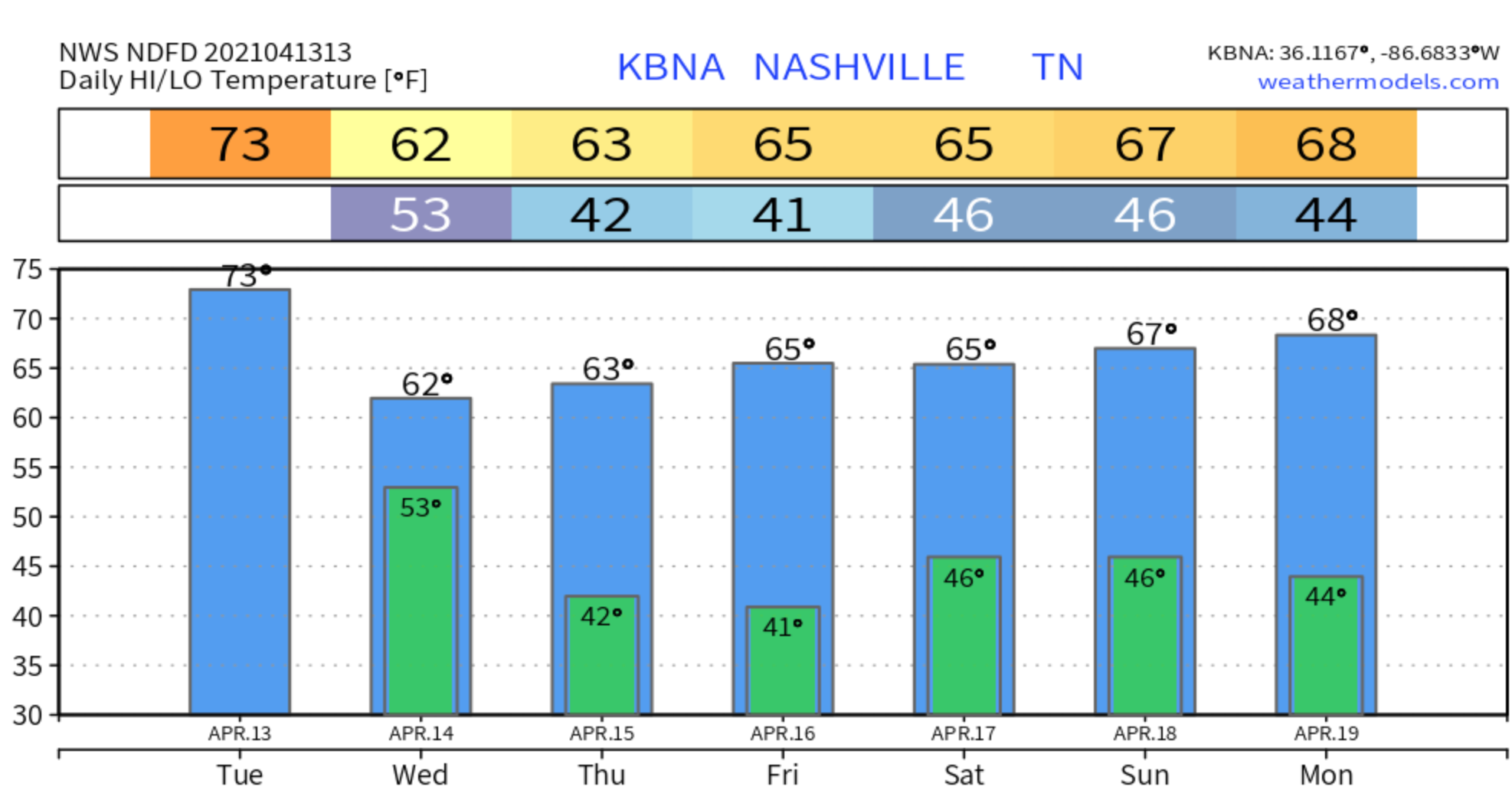
Nice and dry day on tap. Our temps are a bit cooler than usual due to the cold front that moved through yesterday.
Ridging influences will keep us dry once again on Friday, but with less sunshine in the mix as rain moves back in Friday night. Temps still fairly cooler.
Some areas may have already seen some rain this morning.
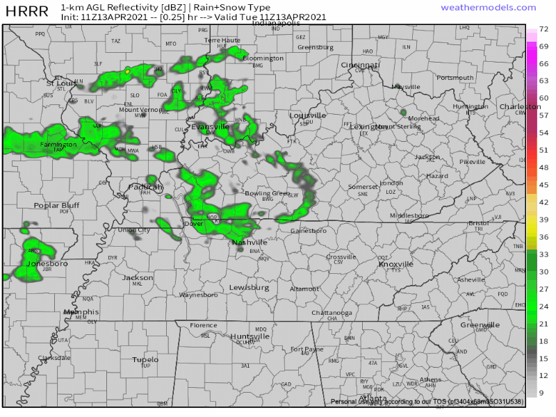
The HRRR shows showers entering the area by lunch.
Spotty showers will continue into the evening hours. This doesn’t look to be a washout, but:
A few light showers are possible in our area today, mainly before 3pm. A few more may sprinkle in tonight.
A weak cold front will move through the region today and tomorrow brining more scattered showers Wednesday. ETA mid-day, around lunchtime. Looks really light:
You must be logged in to post a comment.