
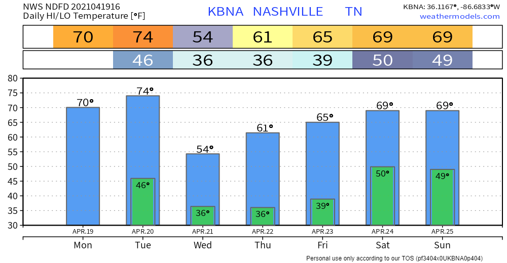
Not much to report on for today and Tuesday: mild temps and plenty of sunshine.

Showers Possible Tuesday Night
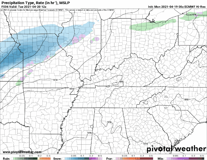
This is due to a cold front coming through the area.
Models show showers beginning around midnight. Here’s the Euro:
And the GFS:
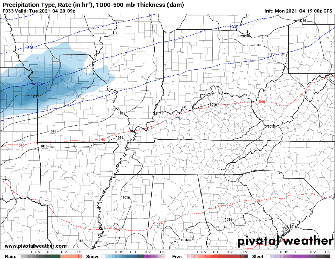
Although we should primarily see rain, a couple snowflakes can’t be ruled out. Less than a tenth of an inch of rain is expected. Any flakes that make it to earth will go splat:melt. No interruptions to your Wednesday morning.
Surface temps will crash into the upper 30°s just before dawn Wednesday. Frost is maybe possible, but wind, cloud cover, and precip should limit any impacts.
We’ll be clear by sunrise Wednesday, giving way to cooler temps and sunny skies.
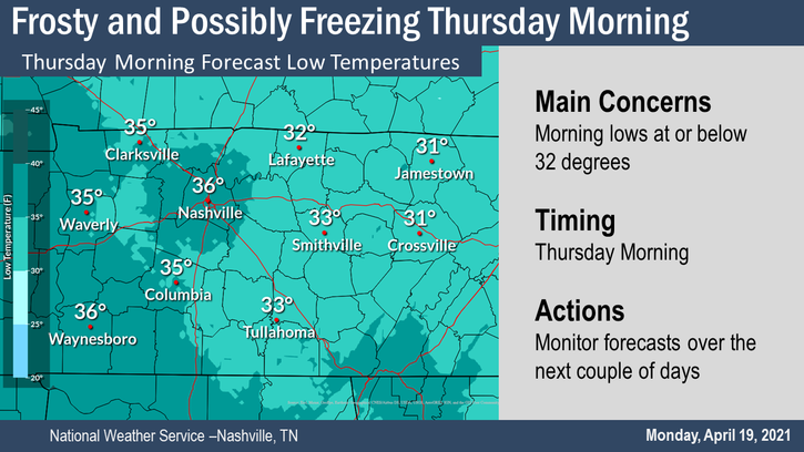
Frost Possible Thursday Morning
You may want to cover those plants before going to bed Wednesday night.
Temps overnight Wednesday will get into the mid 30s. Because of this, we could see frost across the region Thursday morning.
Temps will begin to warm into the lower 60s Thursday afternoon.
Frosty Friday morning is less likely.
Looking Ahead
Our next chance of rain comes this weekend.
Rain looks to hold off until Friday night as a broad trough approaches. The weekend rain looks like it will be more than just a tenth or two unlike our last few rain chances.
NWS Area Forecast Discussion
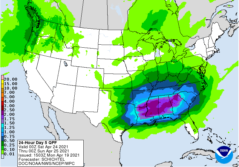
The Weather Prediction Center has around an inch of rain falling between 7 am Saturday and 7 am Sunday.
Data isn’t solid on timing but the 1 PM kickoff at Nissan Stadium looks wet. At least it does right now. That may change but really:
Categories: Forecast Blogs (Legacy)
You must be logged in to post a comment.