
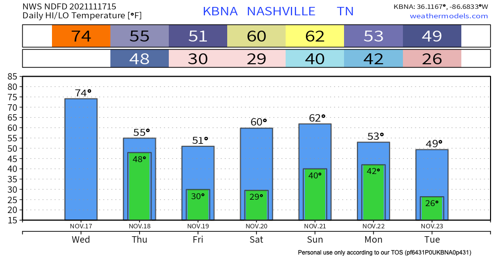
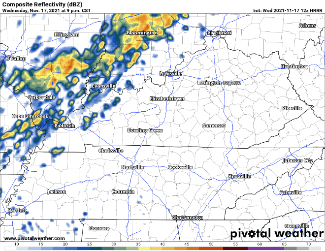
Warm today with temps creeping up to the mid 70’s and wind gusts up to 30 mph. A cold front passes through early tomorrow morning. HRRR has sprinkles in our counties starting around midnight with the bulk of the system starting around 2am. Heaviest rain is overnight. Leave a tad early tomorrow as the rain persists during the morning commute. Showers move out by 11am. No severe weather is tagging along.
Cold air spilling in behind the cold front will keep high temps in the mid 50’s for Thursday. After Thursday we stay dry and sunny for the start of the weekend! Below freezing overnight temps at 30 deg for Friday and Saturday mornings. Highs heat up to the low 60’s by Sunday. Sunday-Monday is looking yucky as another cold front comes through. Consensus: weekend outdoor plans are best Friday and Saturday.

Categories: Forecast Blogs (Legacy)
You must be logged in to post a comment.