
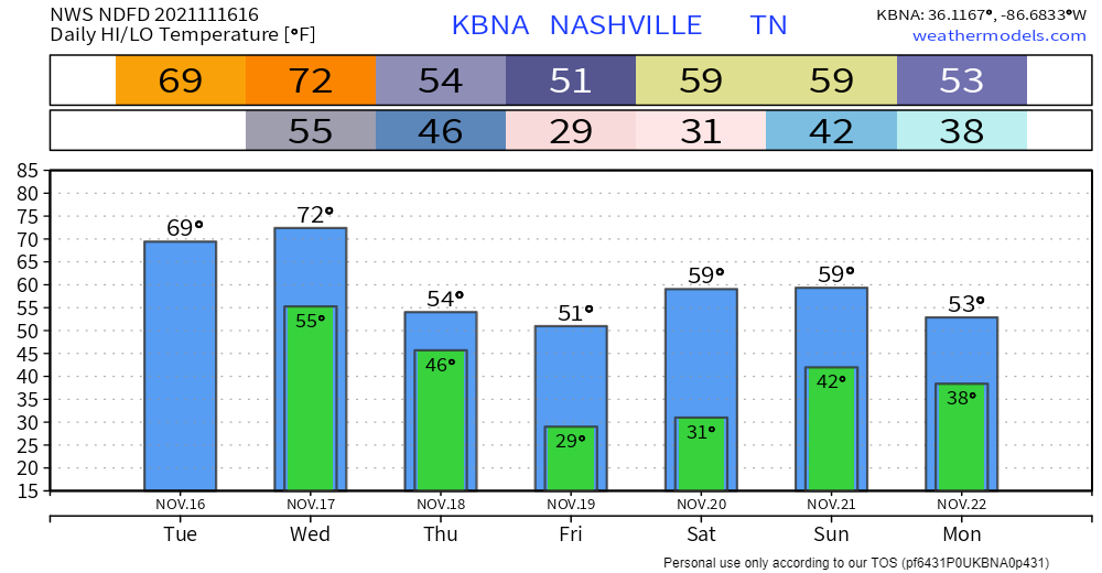
A warm front that passed through this morning. Result: overcast and warmer. Highs today hover around 70. There’s a chance of a light sprinkler here and there, but the real rain comes late Wednesday night, probably Thursday.
Highs creep up into the 70s Wednesday, with sun. But November gonna November with rain and cold-down. Rain ETA after midnight Wednesday night continuing off and on through the commute toward lunch Thursday. Less than half an inch of rainfall is expected. The HRRR illustrates:
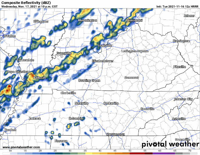
After the Rain, the Cold Front
Mornings near freezing Friday and Saturday. Highs both day barely break into the 50s. But then the weekend comes and we warm up a bit, until another weather maker shows up late weekend/early next week. Looks like a weak, meh rainer Sunday/Monday, then after that another shot of cold air. Could be the fall’s coldest air, but models have different solutions, so maybe not.
Editor’s fave temps up/down gif seems about right:

Categories: Forecast Blogs (Legacy)
You must be logged in to post a comment.