
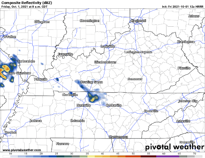
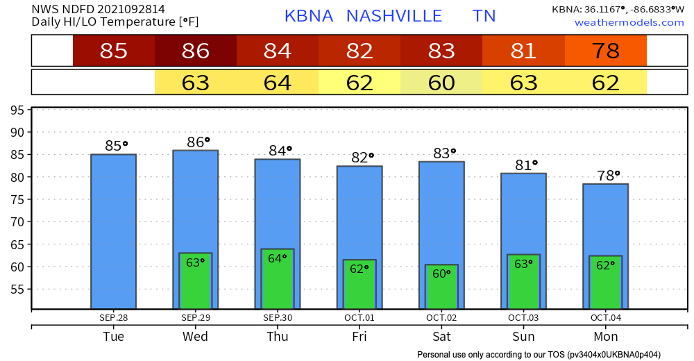
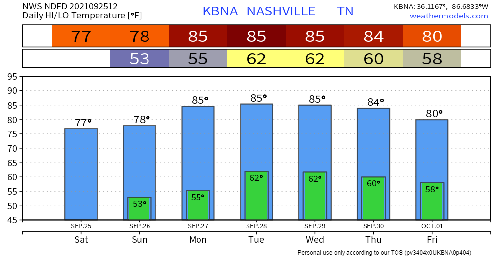
Those scattered showers from this morning might cause sprinkles for some of us until the early afternoon. For the rest of the day HRRR has the rain breaking up to avoid our counties.
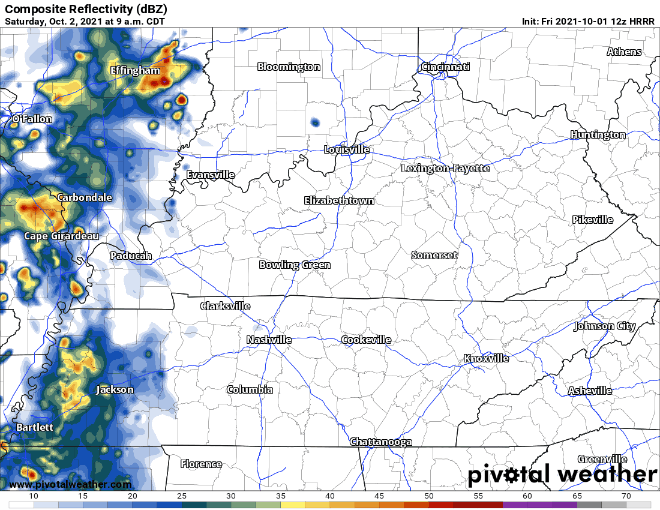
This weekend is where we will see more of this rain. Saturday looks to have some scattered showers arriving around early afternoon. These won’t be too intense but will ease us into Sunday’s batch of rain starting Saturday night.

You must be logged in to post a comment.