
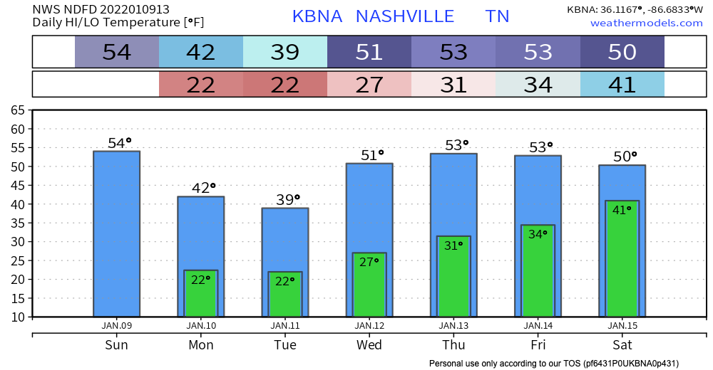
HEAVY RAIN
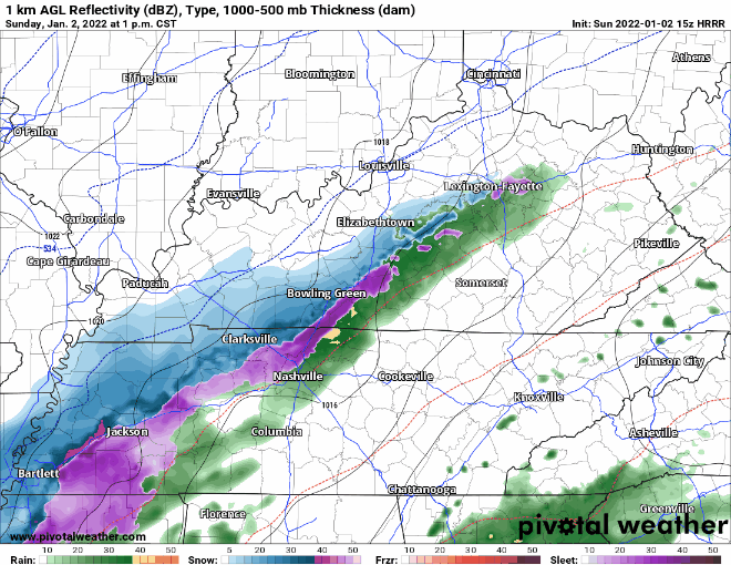
We’re starting off our Sunday with some rain. HRRR model:
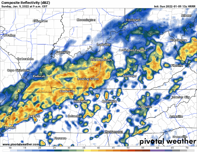
We are not expecting anything severe, but you might see some heavier rain or hear some rumbles of thunder as this cold front moves in. The biggest threat? Localized flooding, but this is a low probability hazard.


You must be logged in to post a comment.