
PSA:
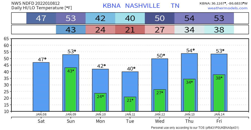
Temperatures will climb above 32 degrees at around 10 or 11 AM for the first time in a few days, allowing for some serious melting to begin, aided by the sun. It will take a while for all the ice and snow to melt. Melting occurs at different rates so there may still be slick spots, but today will be a dramatic improvement.
Temps will get to the upper 40’s this afternoon and will only fall to the low 40’s tonight thanks to cloud cover, so there will be no refreezing of the roads.
Rain Tonight Into Sunday
Models think we could get some showers this afternoon, if these do occur they would be light and brief. Most of the rain will come around midnight or shortly after.
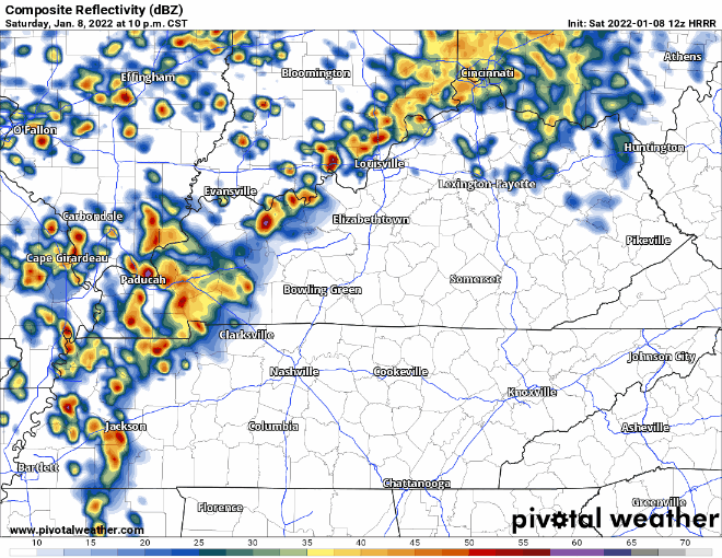
The rain could be heavy at times, and you might hear a rumble of thunder or two, but no severe weather is expected. There is some threat for isolated flooding. The Weather Prediction Center has us outlooked for a 5-10% chance of flash flooding within 25 miles of us.
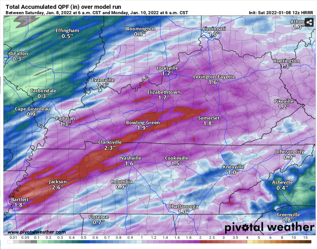
The HRRR thinks we get around 1-2″. This amount of rainfall most areas could handle. However, somewhere models think there will be a band of heavier rain, with amounts around 2.5 – 3″. This, along with the snow melt, could cause some flooding issues. Right now the current thinking is this heavier, floodier rain band will stretch from Memphis to Clarksville. This will likely change throughout the day, keep checking back for updates on this.
The rain should end sometime Sunday afternoon, models’ best guess right now is around 2 PM or 3 PM. A cold front will be pushing this rain out, so temps will fall behind it and we are expected to dip back below freezing Sunday. This might lead to some icy roads Monday morning, but water runoff, steady winds, and this nice warmup may make ice accumulation difficult.
Finally…Clear Weather
We dry out Monday and we finally all get to take a break from this crazy weather. Temps will be around average for this time of the year and we’ll take a break from precipitation until at least Thursday.
Quick References:
Weather changes constantly.
Follow @NashSevereWx on Twitter for any changes to this forecast.
Live coverage during tornado and severe thunderstorm warnings:
Look good.
Support the mission.
We are 100% community supported. No ads. No subscription fees. Keep it free for everyone.
Categories: Forecast Blogs (Legacy)
You must be logged in to post a comment.