Rain possible every day this week beginning Monday.
HRRR has rain Monday night.
It may miss us to the south.
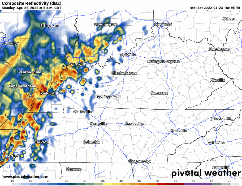
More rain may sneak in Tuesday morning, here’s the HRRR before it hits the end of its range at 7 AM. Looks like a mid/ late morning ETA.

Rain possible every day this week beginning Monday.
HRRR has rain Monday night.
It may miss us to the south.
More rain may sneak in Tuesday morning, here’s the HRRR before it hits the end of its range at 7 AM. Looks like a mid/ late morning ETA.
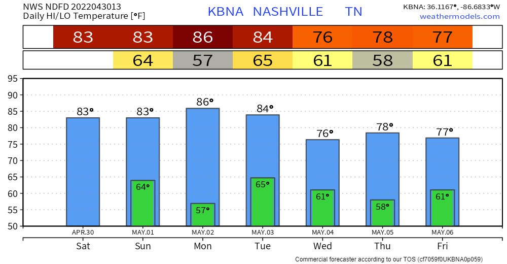

Last day of April brings us a bit above average temperatures. Nothin’ crazy. Noticeable breeze from the south and clouds will aid in keeping you a lil cooler.
Tonight
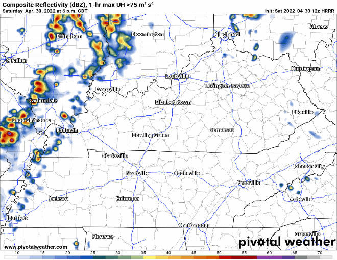
The HRRR model (above) shows some storms popping off and moving into our area around 7-9p. These storms should move out fairly quick. However, they may carry some lightning, so if you have outdoor plans, have a way to seek shelter inside. If thunder roars, go indoors. No severe weather is expected at this time, but stay connected.
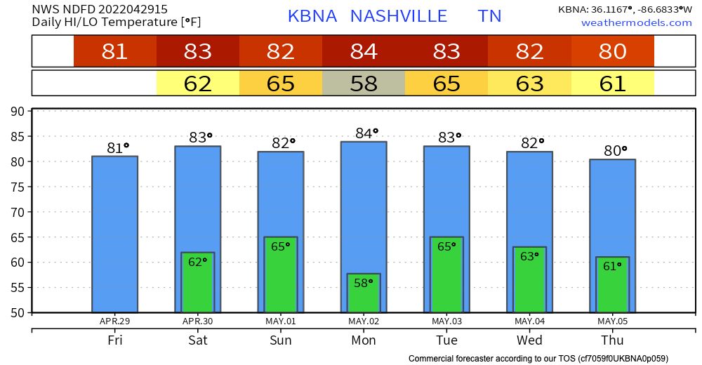
Friday and Saturday – enjoy these warm temps and rain-free skies. Highs are in the 80’s and lows in the 60’s AKA capital S Spring weather.
The next weather event we’re watching is Saturday overnight into Sunday. HRRR shows some spotty storms arriving around midnight and clearing out by 7am. This means your Saturday evening plans should be good to go, as well as your Sunday plans!
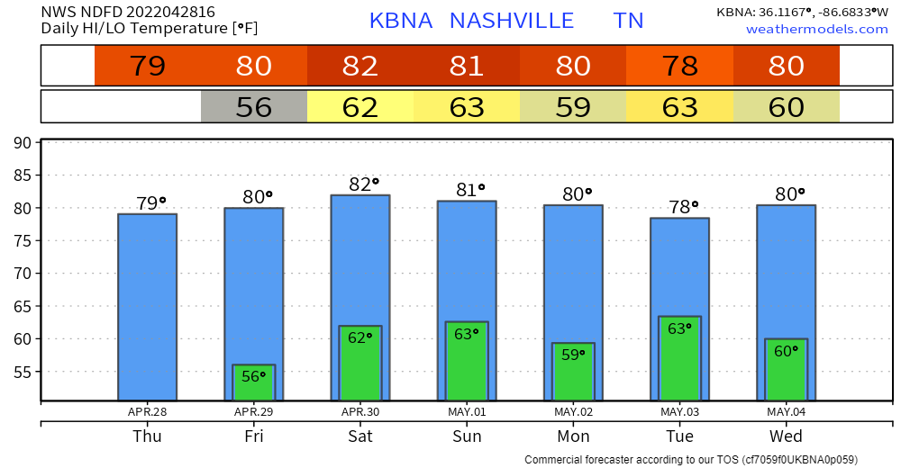
High pressure has set in… last day of zero rain chances. Relatively comfortable highs around 80 thanks to low dewps. Great day for your outdoor plans.
Rain chances start to go up tomorrow through the weekend. They’re low until Sunday. This is the time frame we’re watching for showers.
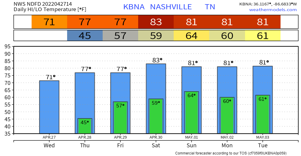
A cool morning turning into a pleasantly warm day. Super dry atmosphere = clear skies and lots of sunshine.

A surface ridge will bring us progressively warmer temps in the coming days. Highs in the 80s by the weekend. Well above average this time of year. Extra moisture will come with it. A little more cloud coverage and rain chances start to creep in over the weekend.
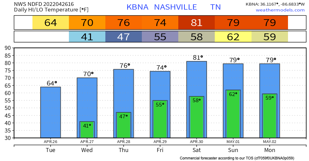
The cold front has moved past us, leaving us with much cooler temperatures this afternoon and evening. Temps drop into the lower 40s tonight. Maybe upper 30s in the outlying areas. Chilly air is back for a bit, but no freezing temperatures are in the forecast.
A strong cold front has been causing us some rain and thunderstorms today.
0.33″ fell late thig morning into the lunch hours at the official observation site at BNA.
More rain is coming, for most of us anyway.

Sunshine remains in the forecast today. No rain. Enjoy!
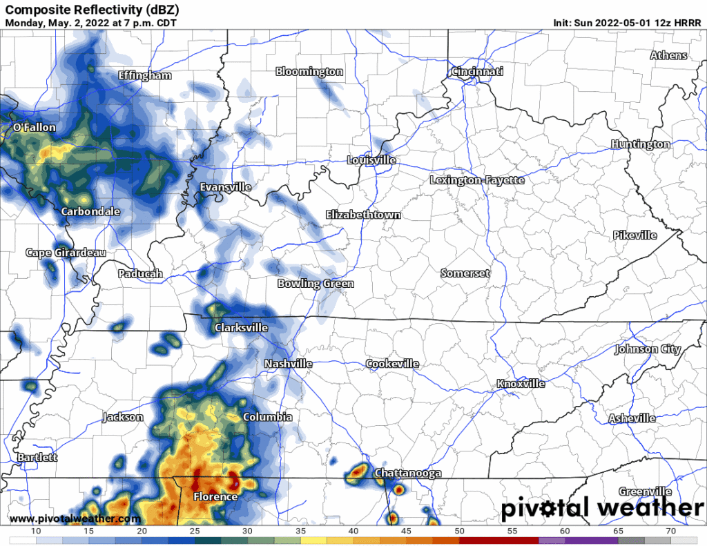
Rain returns on Monday. It won’t be much, but it will be here. HRRR thinks wet stuff arrives late morning / just before lunch. Some of the showers could bring brief heavy downpours, but nothing severe is expected, and they won’t last all day. A second round of rain could develop in the evening Monday. See gif below:
No rain in the forecast at all this weekend. Just pure sunshine!!
Rain should approach our area around lunchtime. The HRRR doesn’t think it’ll be much:
Rain is most likely during the afternoon and evening Monday. It’ll be off and on, ending some time late Monday night or early Tuesday morning. About 0.25″ to 0.35″ expected on average. A few storms may mix in Monday afternoon but that appears unlikely. Nothing severe, and no flooding concerns.
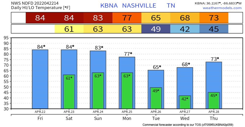
We have an upper high hanging out that’s keeping us warm and dry this weekend! Temps will hit the lower 80s! Everybody say thank you upper high!

Looking ahead to our next weather event Monday, we’ll have a cold front making its way through our area bringing cooler temps and some rain. The GFS shows us having a wet Monday. Keep in mind we’re a little far out to completely rely on the model’s timing/severity.
You must be logged in to post a comment.