
Rain possible every day this week beginning Monday.
HRRR has rain Monday night.
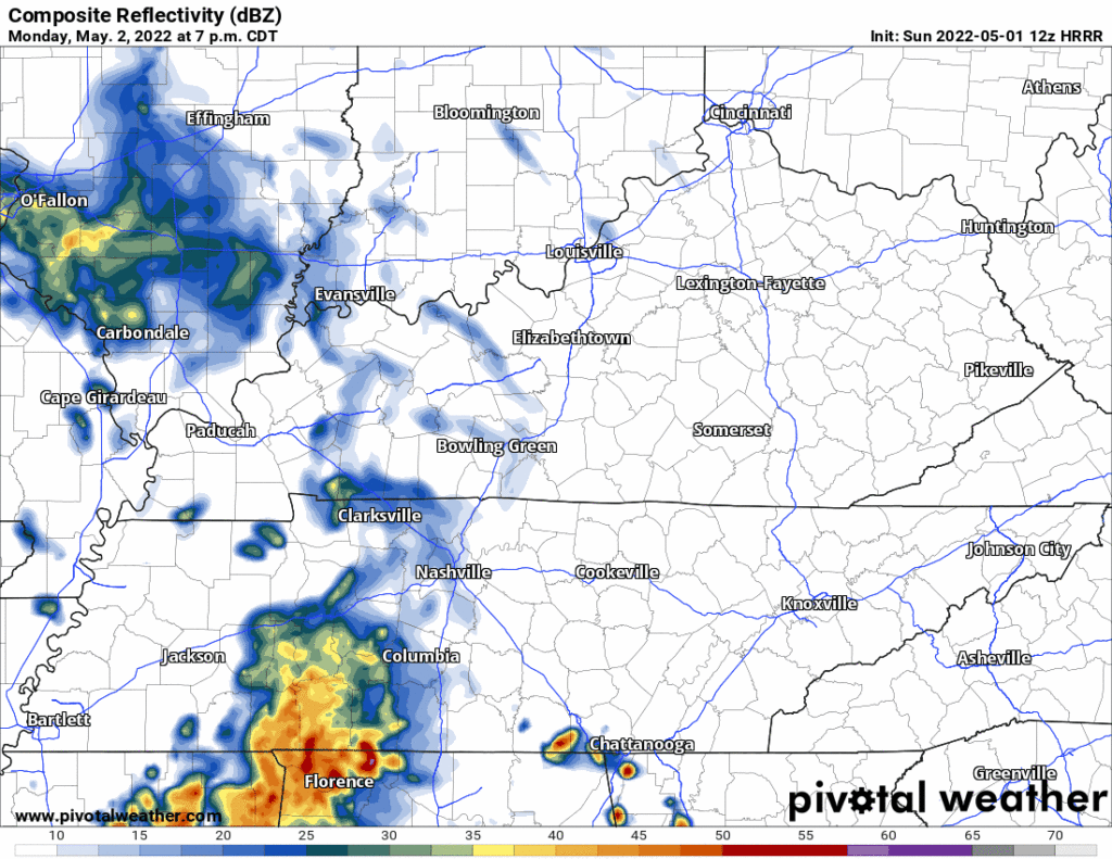
It may miss us to the south.
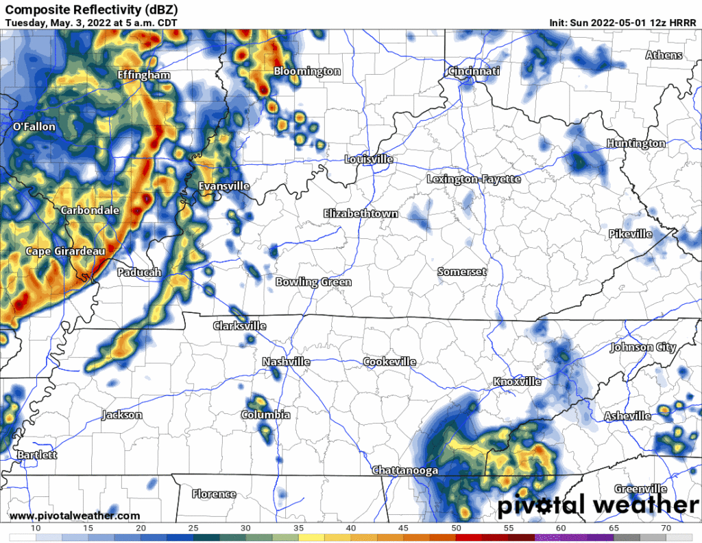
More rain may sneak in Tuesday morning, here’s the HRRR before it hits the end of its range at 7 AM. Looks like a mid/ late morning ETA.
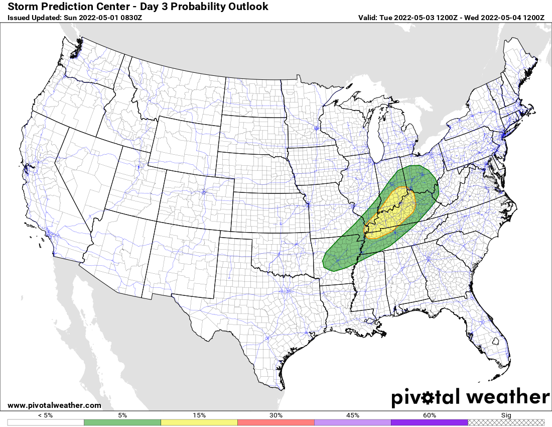
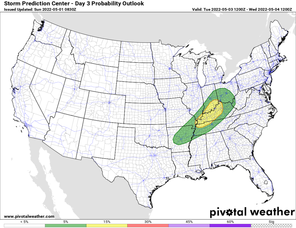
We Are Outlooked for a Low Probability Severe Weather Event Tuesday afternoon/evening
Wut. Lightning storms. Damaging straight line winds. Maybe hail. Tornado ehh/shrug, kinda too soon to tell.
When. Severe weather opportunity window is late in the afternoon or evening. Probably evening. No high resolution timing models are in range yet.
Where. More likely to our NW, but storms may last and get into Nashville and/or Will Co.
Why. Consult a local theologian.
SPC discussion below, with translation to follow:
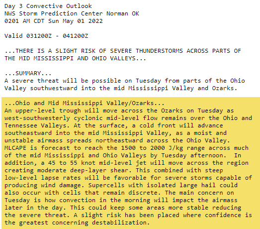
This means severe storm ingredients will exist. But will they come together to make severe weather? Maybe not, especially if the morning rain/storms reduce CAPE/instability.
SPC says 5% probability of any severe weather event within 25 miles of us Tuesday evening.
Anxiety Level Expressed By GIF:

More rain will be possible Wednesday through at least Saturday as warm and cold fronts trade places in Middle Tennessee while shortwave energy sets off rain/thunderstorms at impossible to determine ETAs. Best bet for more rain/storms is Friday if the models have the cold front passage timed out right.
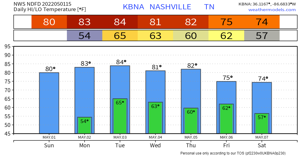
To sum up, expect scattered to numerous showers with isolated to scattered thunderstorms at times Tuesday through Saturday. Total rainfall amount through next Saturday should range from just over one inch south to around two inches north.
NWS-Nashville Forecast Discussion
Quick References:
Weather changes constantly.
Follow @NashSevereWx on Twitter for any changes to this forecast.
Live coverage during tornado and severe thunderstorm warnings:
Look good.
Support the mission.
We are 100% community supported. No ads. No subscription fees. Keep it free for everyone.
Categories: Forecast Blogs (Legacy)
You must be logged in to post a comment.