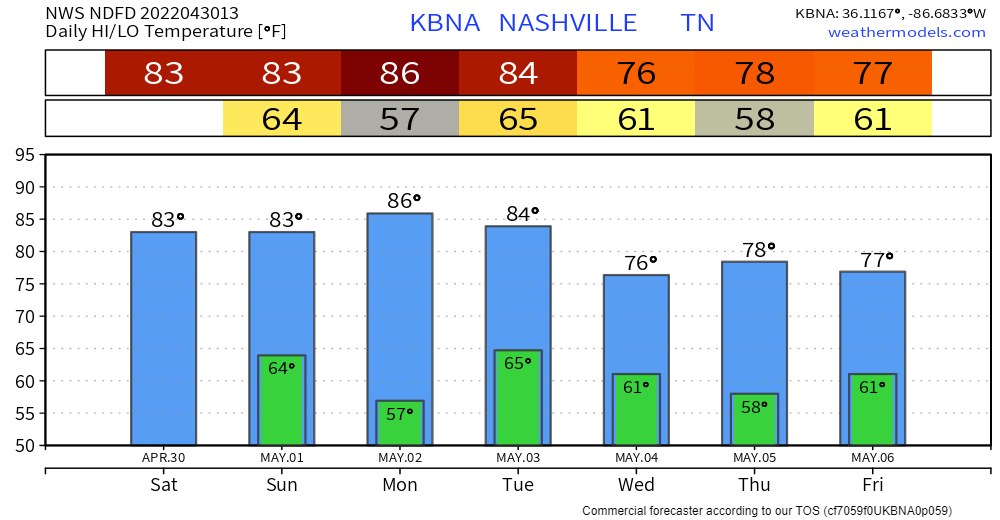
Last day of April brings us a bit above average temperatures. Nothin’ crazy. Noticeable breeze from the south and clouds will aid in keeping you a lil cooler.
Tonight

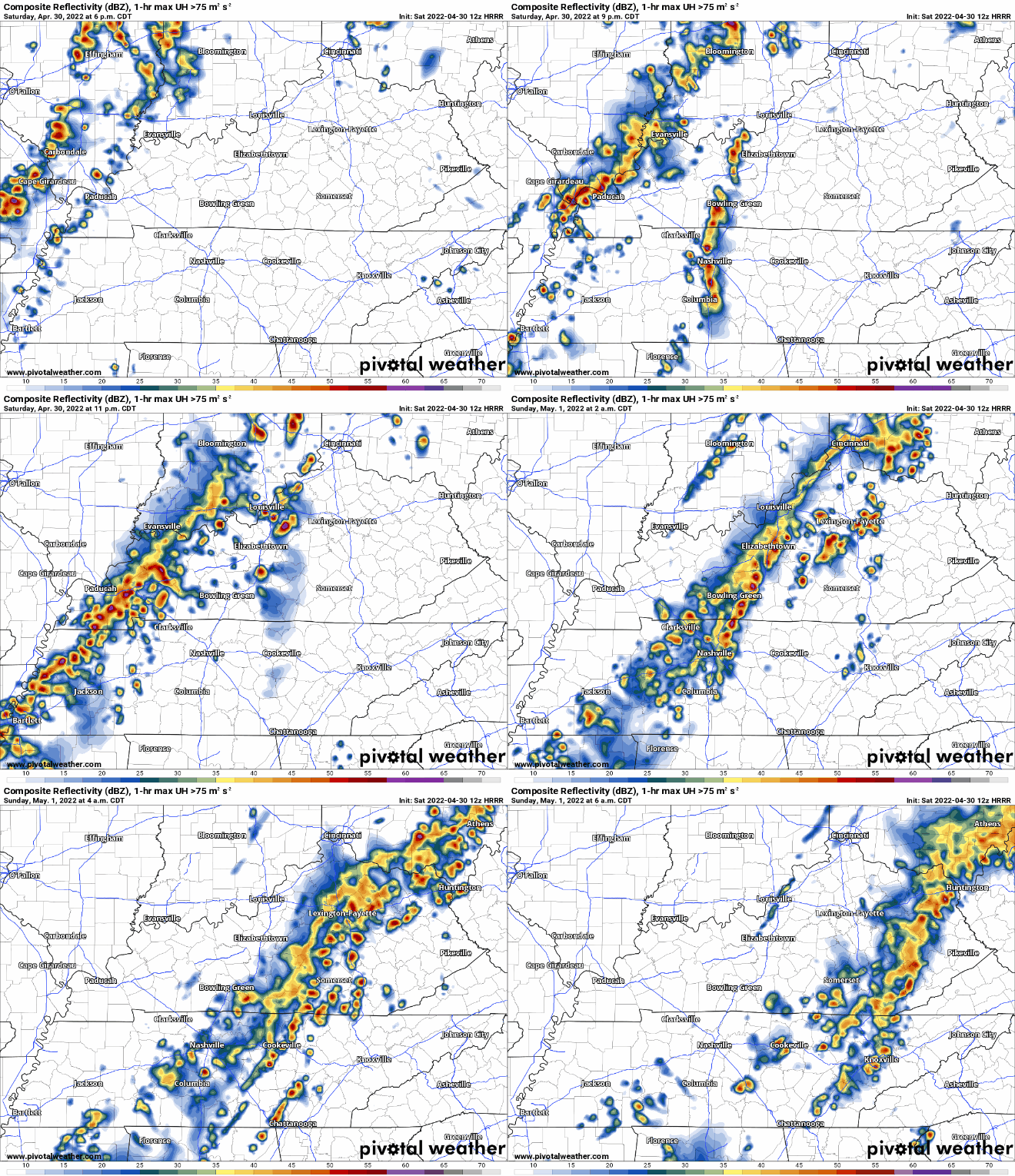
The HRRR model (above) shows some storms popping off and moving into our area around 7-9p. These storms should move out fairly quick. However, they may carry some lightning, so if you have outdoor plans, have a way to seek shelter inside. If thunder roars, go indoors. No severe weather is expected at this time, but stay connected.
After Midnight – Early Sunday Morning
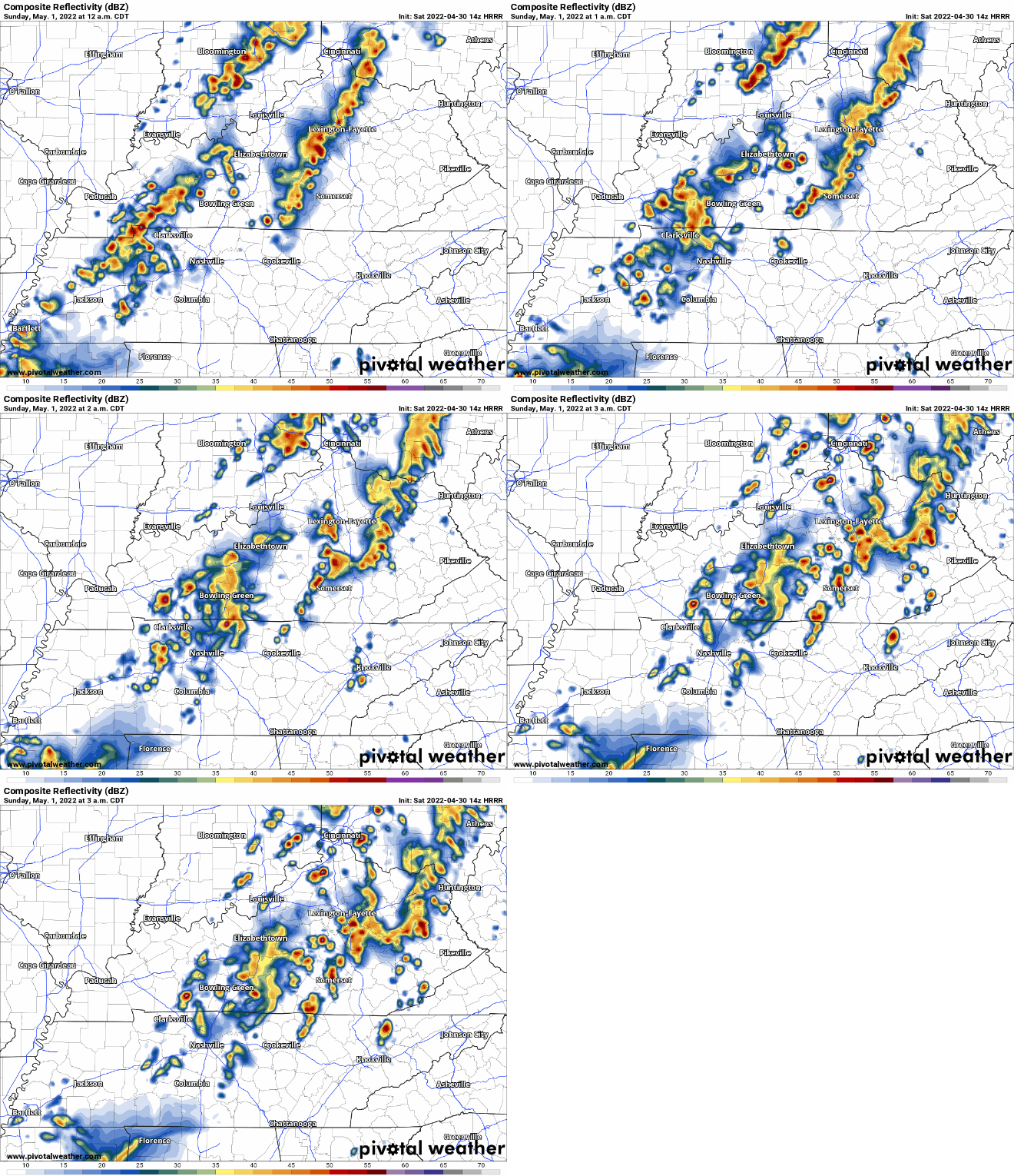
After that, another line of showers/storms looks to make it to Davidson and Will. Co around 2 or 3am, moving out before your Sunday morning activities. This looks like it’ll break up, but you may hear thunder:

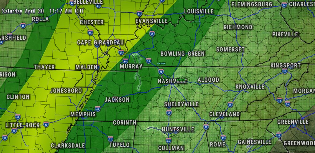
This line may be strong/severe to our northwest. It should weaken as it moves closer to us. Notice the SPC convective outlook has the severe ingredients (in yellow) pretty far northwest of us:

Not worried about this tonight.
Sunday
By late morning, it looks splendid. Sun and low 80’s. A great day for a home opener and a W.

Rainy Week Ahead
Next week looks damp, with rain chances just about every day. First chance looks to be Tuesday. Currently not outlooked for any severe weather or flooding. Rain chances will ride a series of shortwaves that often don’t go severe.

Quick References:
Weather changes constantly.
Follow @NashSevereWx on Twitter for any changes to this forecast.
Live coverage during tornado and severe thunderstorm warnings:
Look good.
Support the mission.
We are 100% community supported. No ads. No subscription fees. Keep it free for everyone.
Categories: Forecast Blogs (Legacy)


You must be logged in to post a comment.