
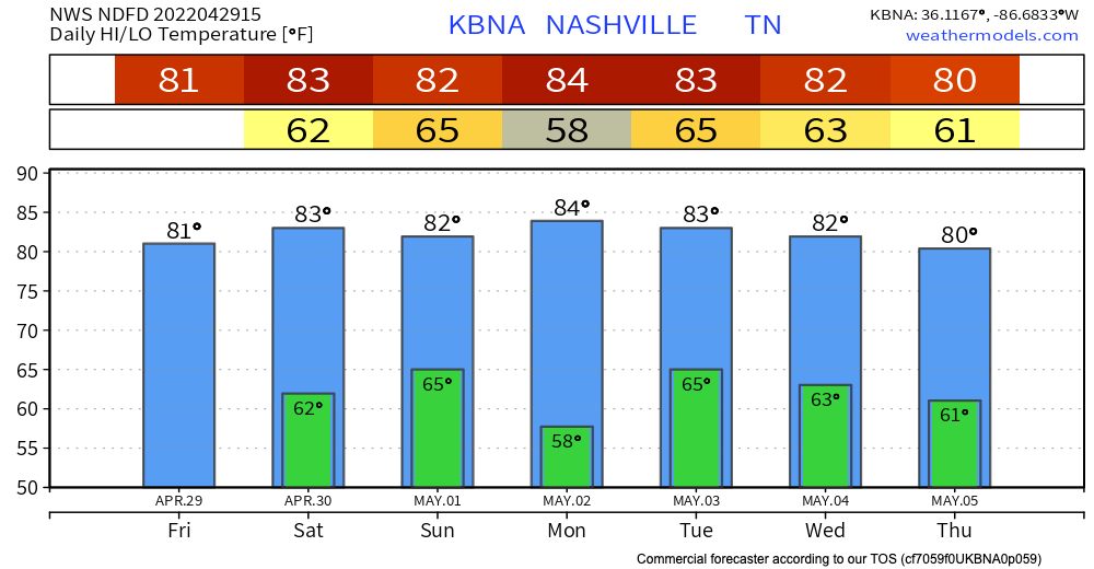
Friday and Saturday – enjoy these warm temps and rain-free skies. Highs are in the 80’s and lows in the 60’s AKA capital S Spring weather.
The next weather event we’re watching is Saturday overnight into Sunday. HRRR shows some spotty storms arriving around midnight and clearing out by 7am. This means your Saturday evening plans should be good to go, as well as your Sunday plans!

See the HRRR below for a glimpse at possible timing. Some of these showers/storms can be heavy at times. For those concerned about severe weather, a few severe weather ingredients might be present, but we aren’t expecting anything widespread at this time.
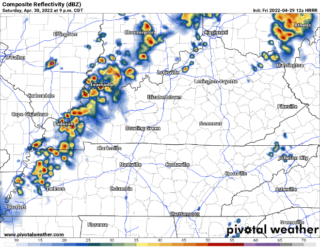
There is a lot of uncertainty about this event, and it is still a bit early to fully rely on models for timing. As always, we will keep you updated!
Next week, we have several more chances or rain, and a cool down to more early spring-like temperatures.
Writer’s Note: This is my last blog for Nashville Severe, and I am so so so thankful for the opportunity to write for this past year. I appreciate every one of you who read and shared my blogs! Nashville will always have a special place in my heart. Special shoutout to David, Andrew and Will for sharing their knowledge with me and the rest of the interns! This year has been a blast and I have grown so much as a meteorologist and a writer. You can keep up with my journey by following me on Twitter @MerzEmily

Quick References:
Weather changes constantly.
Follow @NashSevereWx on Twitter for any changes to this forecast.
Live coverage during tornado and severe thunderstorm warnings:
Look good.
Support the mission.
We are 100% community supported. No ads. No subscription fees. Keep it free for everyone.
Categories: Forecast Blogs (Legacy)
You must be logged in to post a comment.