
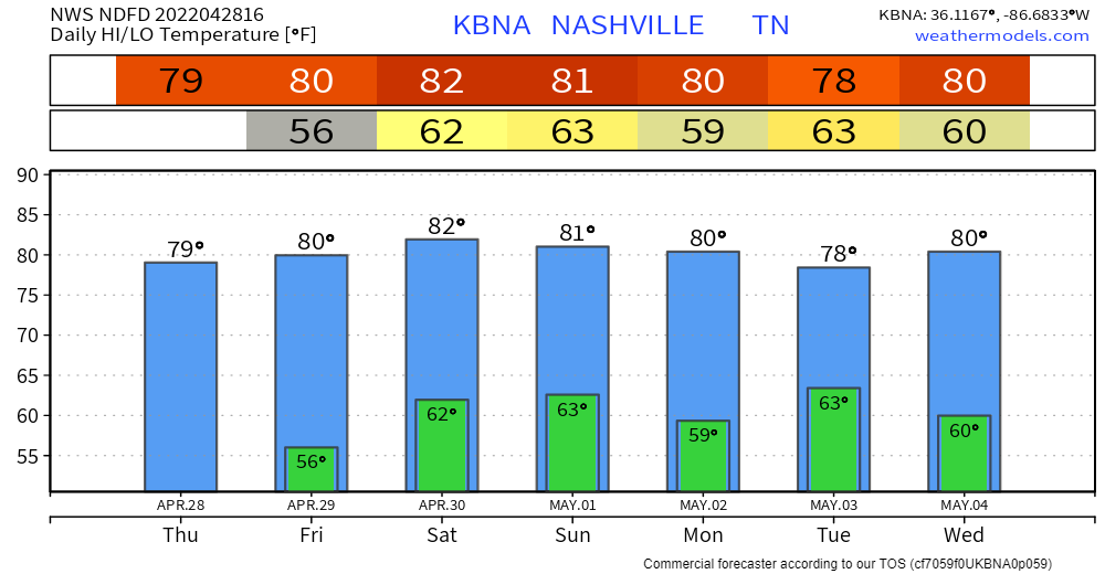
High pressure has set in… last day of zero rain chances. Relatively comfortable highs around 80 thanks to low dewps. Great day for your outdoor plans.
Rain chances start to go up tomorrow through the weekend. They’re low until Sunday. This is the time frame we’re watching for showers.
Weekend plans? Let’s dive in…
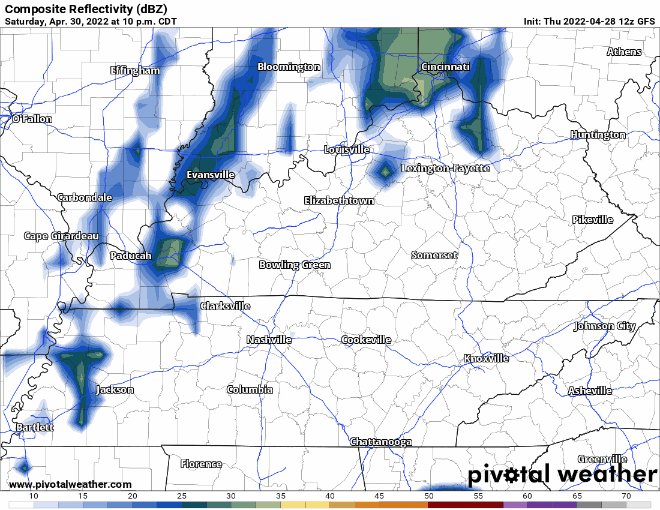
Between Saturday night and Sunday noon is the current ETA. We have low confidence in this right now. Models don’t like what they’re seeing. GFS currently has only a little action for us:
David laid out some of our concerns with timing in a few tweets this morning.
Take home point is whatever materializes likely won’t be rainout material. We’ll know more once the HRRR starts to pick up on it. Severe weather is not a concern.
Above-average temps hold well into next week despite the rain. Active weather pattern starting next week. Next severe threat may come mid-week. We’ll keep you posted!
Quick References:
Weather changes constantly.
Follow @NashSevereWx on Twitter for any changes to this forecast.
Live coverage during tornado and severe thunderstorm warnings:
Look good.
Support the mission.
We are 100% community supported. No ads. No subscription fees. Keep it free for everyone.
Categories: Forecast Blogs (Legacy)
You must be logged in to post a comment.