
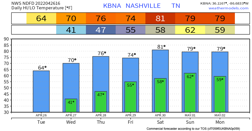
The cold front has moved past us, leaving us with much cooler temperatures this afternoon and evening. Temps drop into the lower 40s tonight. Maybe upper 30s in the outlying areas. Chilly air is back for a bit, but no freezing temperatures are in the forecast.
A surface ridge will be moving in Thursday, meaning warmer temps once again! However, following behind this warm weather is our next rain chance.
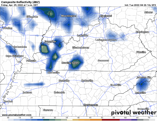
We’re looking at Friday for timing, and lasting through the weekend. At this time, there is no severe risk, but we are very far out. For now, plan on scattered rain chances from Friday morning through a good part of next week. Not 24/7 rain. Just an unsettled weather pattern with waves of rain/storms. Just as a general idea of the pattern, GFS illustrates (Friday 1:00 am – Wednesday 4:00 am). Make no assumptions on exact timing with this model.

Quick References:
Weather changes constantly.
Follow @NashSevereWx on Twitter for any changes to this forecast.
Live coverage during tornado and severe thunderstorm warnings:
Look good.
Support the mission.
We are 100% community supported. No ads. No subscription fees. Keep it free for everyone.
Categories: Forecast Blogs (Legacy)
You must be logged in to post a comment.