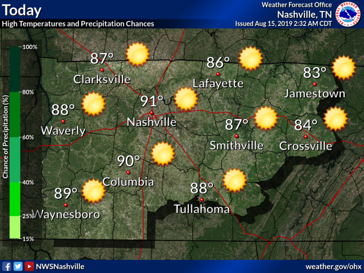
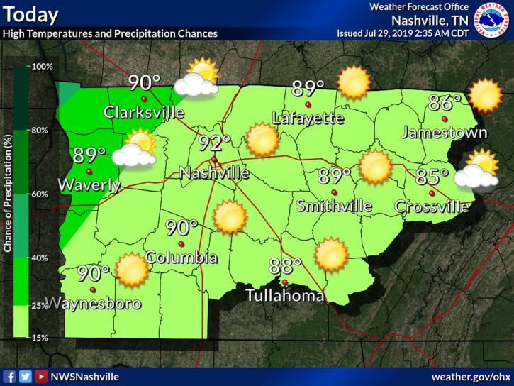
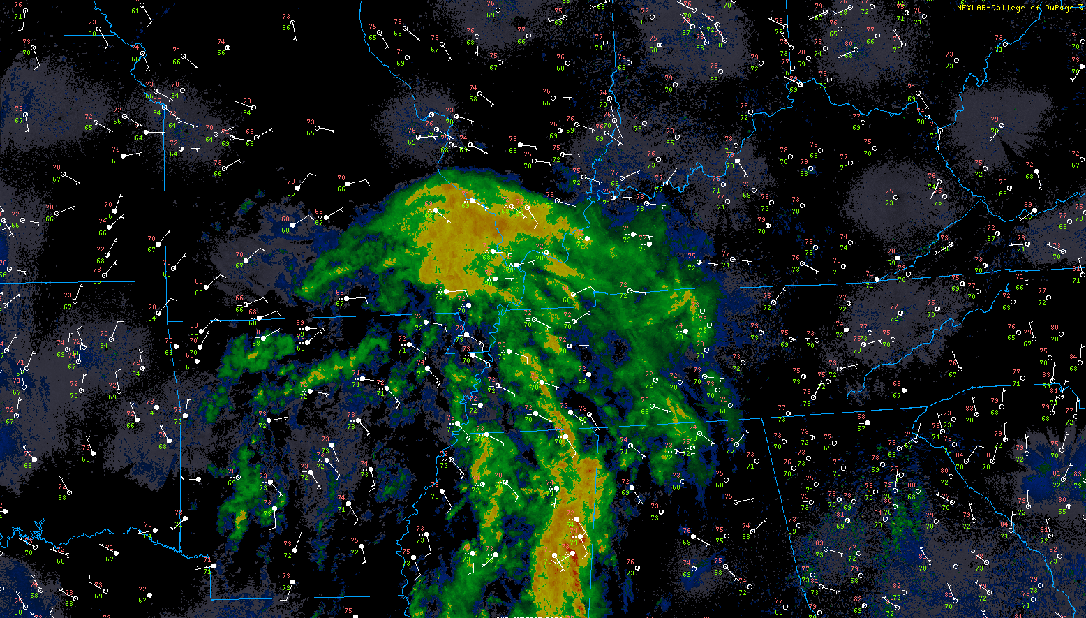
Clear for the Rest of the Week; Rain Chances again by the Weekend

Thursday

We will see temperatures in the lower 90°s and dew points in the mid 60°s.

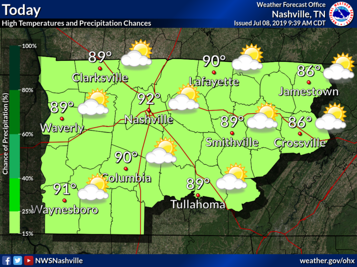
It will continue to be hot, with temperatures at or above 90°F for the next 7 days.

Live on the Green

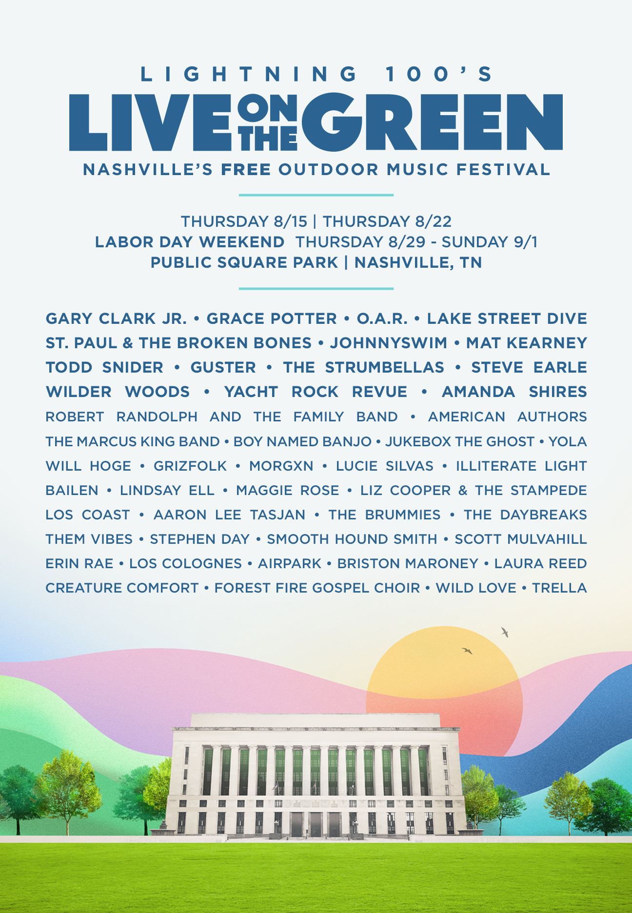
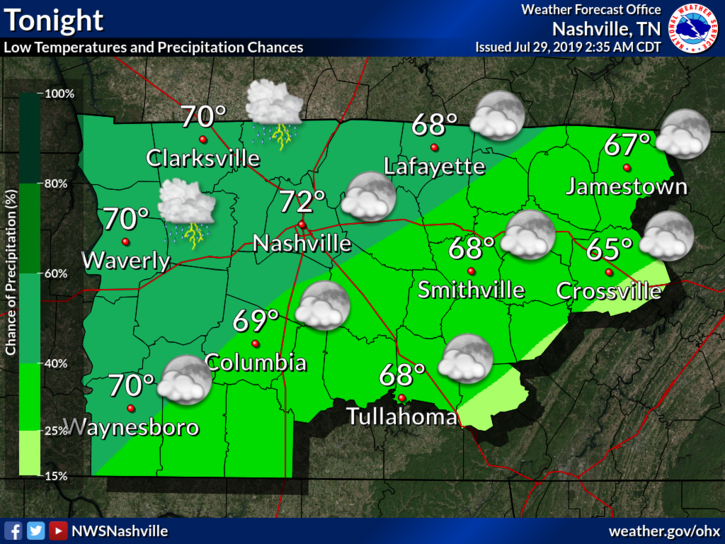
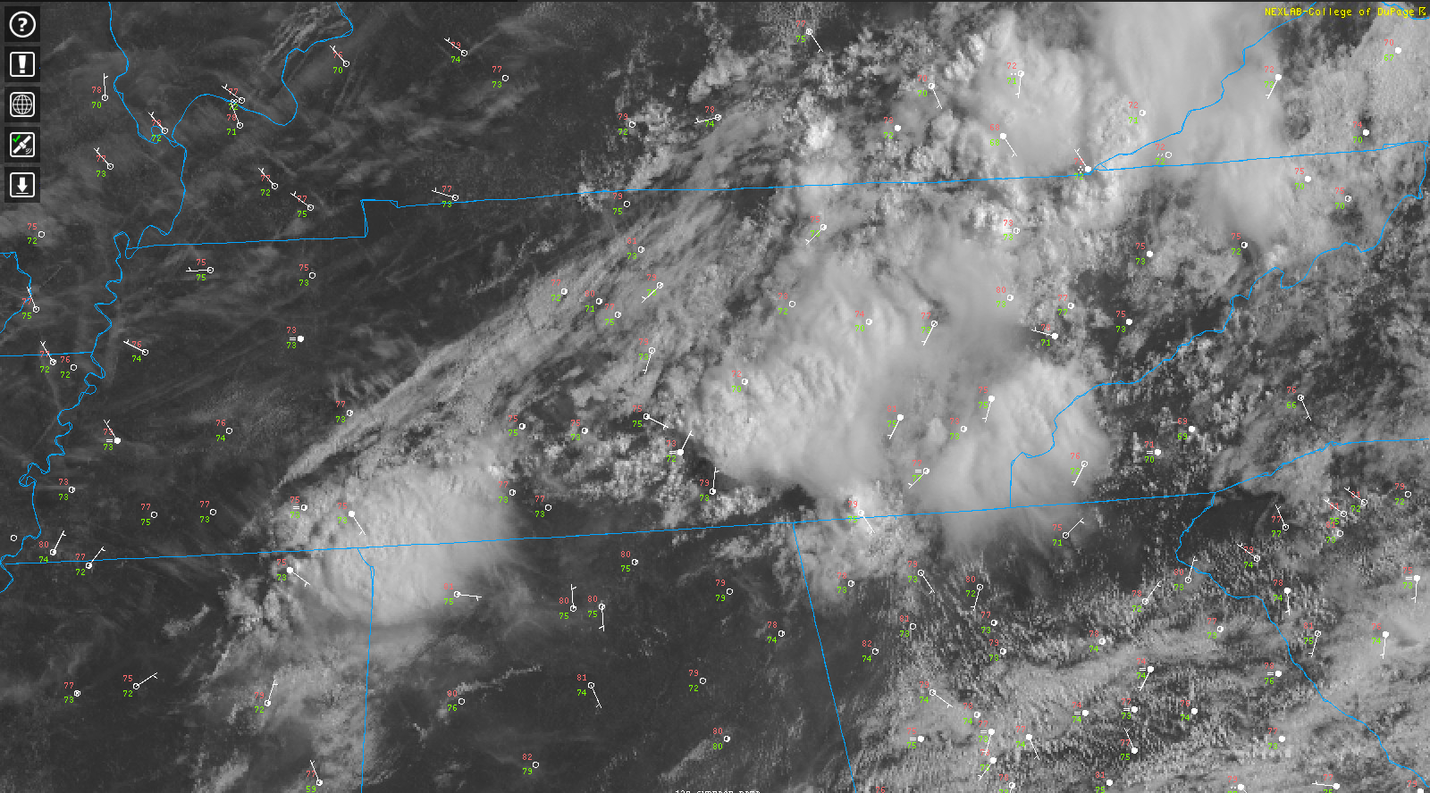
They’ll be starting with the first performance tonight at 6 PM, going through until 11 PM. Should be clear tonight with lowered dew points and the temperature should drop quite nicely.  read more

Typical Mid-August Weekend; Very Hot & Humid Monday-Tuesday.

Saturday

Hot! High in the low 90°s.

Now that doesn’t sound too bad initially… but wait there is more.

Our dew points will be lingering in the low 70°s.

Here is what NWS-Nashville has to say: read more

Friday Night Lights Forecast; Rain Chances Increase on Friday

Thursday

We start off with a foggy morning. Much of this fog should have finished mixing out by now.

As the fog mixes out, our temperatures should start to rise. The high could reach into the low 90°s today.

read more

Cloudy & Humid Monday, Rain Likely Tuesday, Clearing Wednesday

Monday

Typical late July.

Low 90°s high, with clouds building into the night.

A few late night showers may be included in the clouds moving in.

Why? A weak cold front is heading our way.

Rain chances will increase as we move into Tuesday. read more

Flash Flood Watch Details: ETAs, Most Vulnerable Areas/Activities, etc. Then A Pretty Great Tuesday (& Beyond).

Monday

As of 8:41 AM CDT, the temp is 79°F with a dew point of 73°F. Tropical moisture is here, ready for a cold front to tap into it.

This afternoon, cloud cover.

Late this afternoon, the rain begins.

FLASH FLOOD WATCH read more

Potential Heat Advisory for Today; Rain Chances this Afternoon

Today

A Heat Advisory will be in effect from 12 PM CDT to 7 PM CDT.

This means dangerously hot and humid conditions are possible in and around our area. Head indices could reach 105°F.

I use the word could because of uncertainty with where the heat index goes. read more

Rainy Start to the Week from Barry Remnants; Clearing Out by Thursday

Monday

Our high today will reach into the mid 80°s. This is due to all of the cloud cover Tropical Depression (TD) Barry is bringing our area.

Rain will be the main story as the remnants of Barry moves further north. read more

Chance of Showers and Storms this Evening; Continued Weekend Uncertainty

Hot and humid weather continues. A weak frontal boundary will be moving through today, increasing our rain chances. The biggest forecasting challenge is through this weekend, associated with the next Atlantic tropical system. read more

Typical July; Hot & Humid, With Afternoon Pop-Up Storm Chances Decreasing

As we move into the second week of July, we continue with our average summertime weather. Hot, humid, somewhat miserable outside, with a chance of pop-up storms during the afternoon.

Monday

Our high should top out at around 92°F today, with dew points in the upper 60°s. Heat index in the upper 90°s, perhaps scratching triple digit territory. read more

Hot and Humid with a Chance of Showers and Storms Each Day

It looks like summer continues this week. The main story is going to be this heat and humidity.

Monday

As of 8:14 AM, it is 73°F with a dew point of 68°F. Ugh.

It isn’t getting much better than this.

The high today is going to reach 94°F. Dew points hanging out in the low 70°s. Heat index values could approach the low 100°s today. Take extra precautions if you are going to be out for an extended period of time today. Keep water close, and shade even closer – if possible. read more