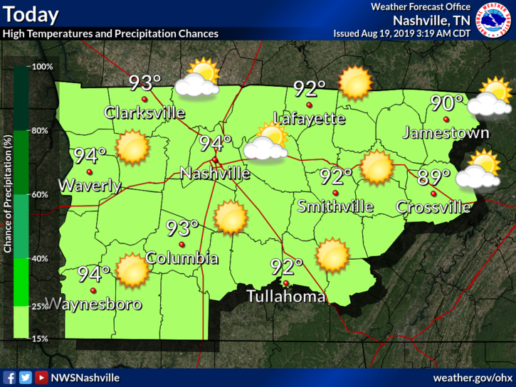
Okay, this is unnecessary. The heat is STILL going strong.
Expect to hit into the upper 90°s for our high today. Dew points in the low to mid 60°s.
No rain chances until late weekend.
NWS-Nashville has more info:

Okay, this is unnecessary. The heat is STILL going strong.
Expect to hit into the upper 90°s for our high today. Dew points in the low to mid 60°s.
No rain chances until late weekend.
NWS-Nashville has more info:

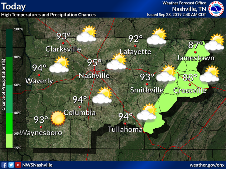
You know how it’s the last weekend of September? Well, it feels like the second weekend of July.
Editor’s Note:
Highs today will approach the mid 90°s with dewpoints in the mid 60°s.
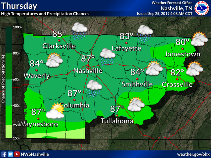
Tonight's rain fizzling, Thursday morning rain amounts vary dramatically by weather model, after that hot the rest of the month. Deeets ⏬ https://t.co/lfehyETKnH
— NashSevereWx (@NashSevereWx) September 25, 2019
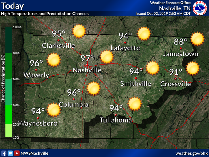
Hot, unfortunately. The heat continues into the middle of the month.
High today expected to be in the upper 90°s. Dewpoints in the mid 60°s. Bleh.
Any relief coming?
NWS-Nashville:
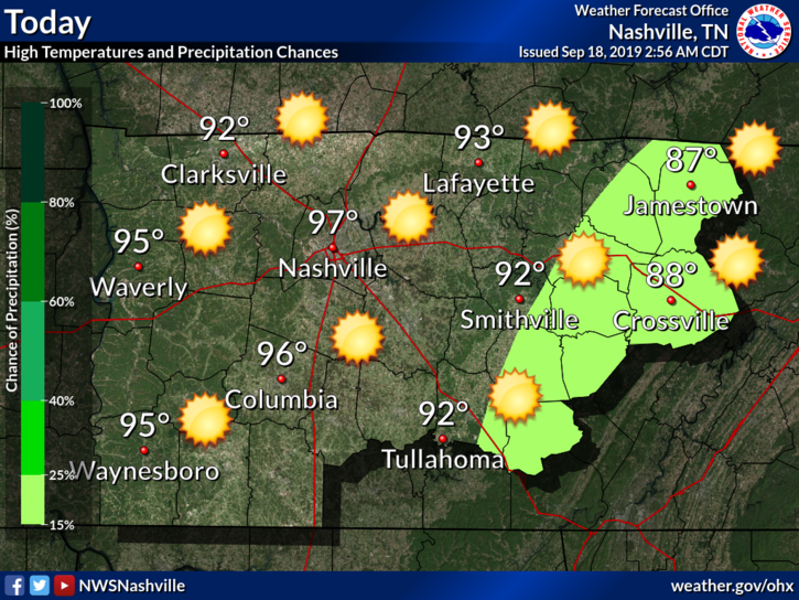
Surface observations this morning show it`s (surprise) another warm and humid one with current readings in the 60s and 70s. Some patchy fog is noted mainly over eastern counties, and cannot rule out a few dense spots. Otherwise, another unusually hot mid September day is on tap, although at least highs look to be a degree or two below yesterday`s levels. Models continue to show a surge of slightly cooler and significantly drier air coming down the east side of the Appalachians then spreading westward into our area later today.
Just barely. We might be dealing with some dry heat instead of our typical muggy heat. Let’s check the dewpoints on the models!
The story has not changed much at all. The only ‘major’ change is in the dewpoints, which are in the low 60°s.
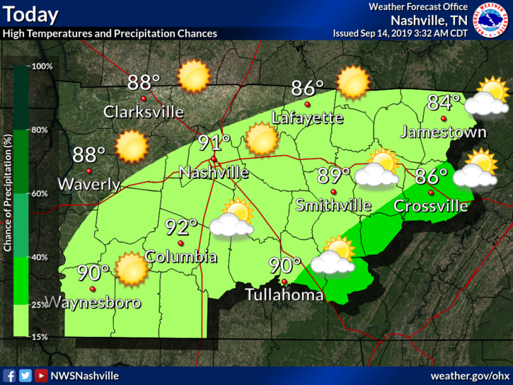
Our high today should be in the low 90°s, with a small chance of some pop-ups this afternoon. This is due to a weak frontal boundary moving through.

For the second week of September, it is going to be quite hot – so bear with me. Summer will eventually end, just not this week.
EDITOR’S NOTE:
We will be reaching into the mid 90°s for our high today. Bleh. Thankfully dewpoints are in the low 60°s.
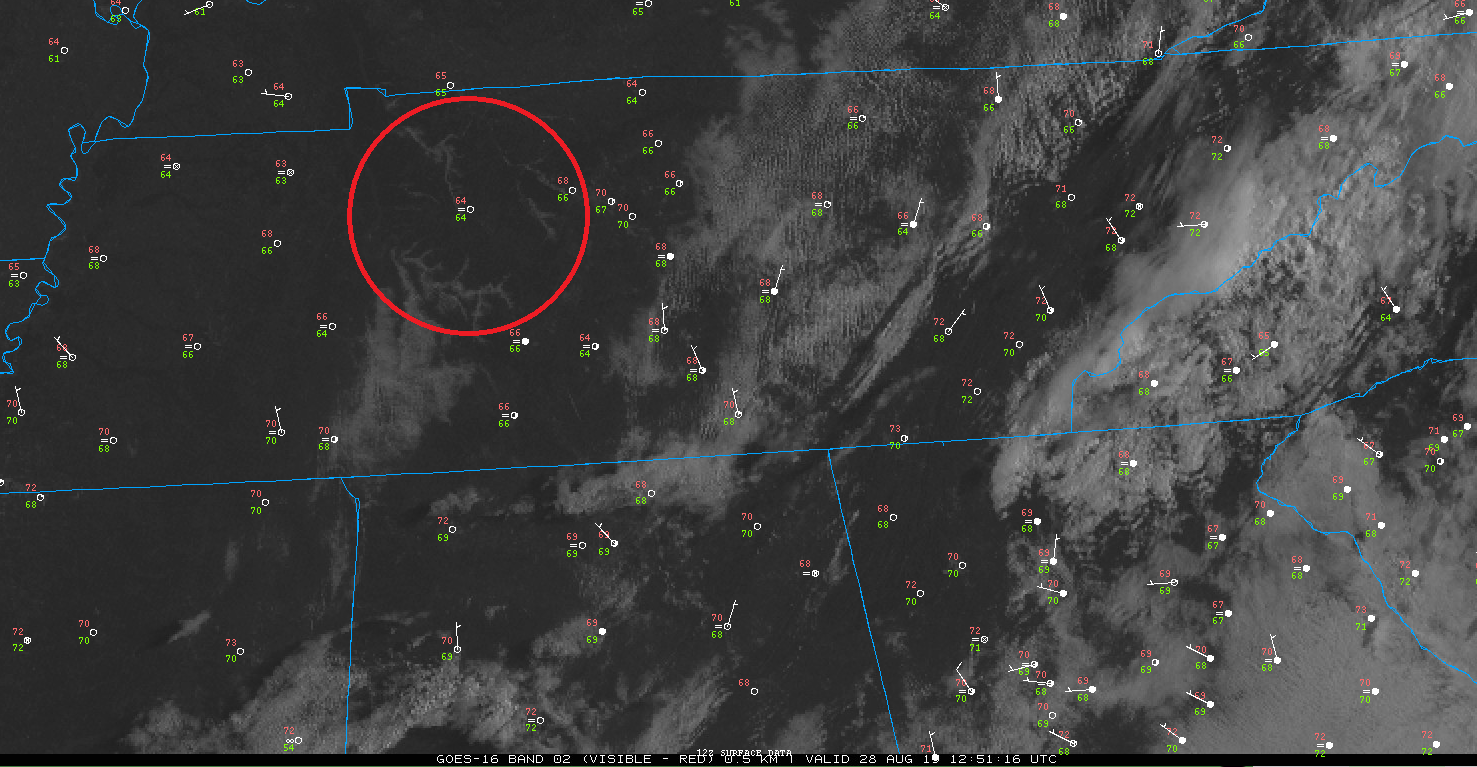
As of 8:12 AM, you can see some valley fog! It is very apparent to our east along the Appalachians. You can also see temperatures (in red) and dew points (in green.)
Any fog should mix out as the sun heats up the surface and convection begins for the day.
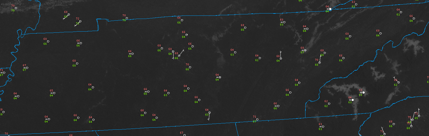
As of 8:00 AM CST, it may feel a little chilly thanks to a cold front that moved through earlier this morning.
Above you can see our current temperature (number in red) is 70°F with a dewpoint around 67°F (number in green.)
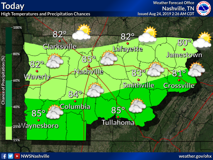
The heat is going to be a little bit more tolerable with the high around 85°F.
Models are quiet. Not expecting rain but can’t rule out a small shower. Clouds shaded the sun this morning but I think it’ll peek out this afternoon. Humidity is tolerable.
Hot and muggy, with a small chance of a pop-up storm this afternoon.
High could reach the mid-90°s today with dewpoints settling around the low-70°s.
Most of the rain today, if any, will be due to (1) day-time heating, typical summer, and/or (2) weak shortwave moving through. This could encourage storm development, but not by much.
You must be logged in to post a comment.