Sunny today. We warm up into the low 80°s with light south winds.
Clear skies means a temp drop into the 60ºs tonight, mid 50°s Tuesday morning.
Tuesday
More clouds as a mid/late week rainmaker creeps closer. No real temperature change.

Sunny today. We warm up into the low 80°s with light south winds.
Clear skies means a temp drop into the 60ºs tonight, mid 50°s Tuesday morning.
More clouds as a mid/late week rainmaker creeps closer. No real temperature change.
Right now it is 43° and mostly cloudy around our area. You can thank the recent cold front for the unseasonably cool weather. There is a chance of rain and showers this morning and into this evening, though this rain will be light and precipitation amounts will be meager (less than a tenth of an inch).

We were off to a cool and dry start this morning due to a cold front that moved through this weekend. Winter decided to show itself very briefly, reminding us that it is still April. However, this did not last long as temperatures should rebound quite nicely as we move into the afternoon hours.
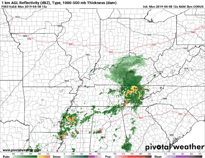
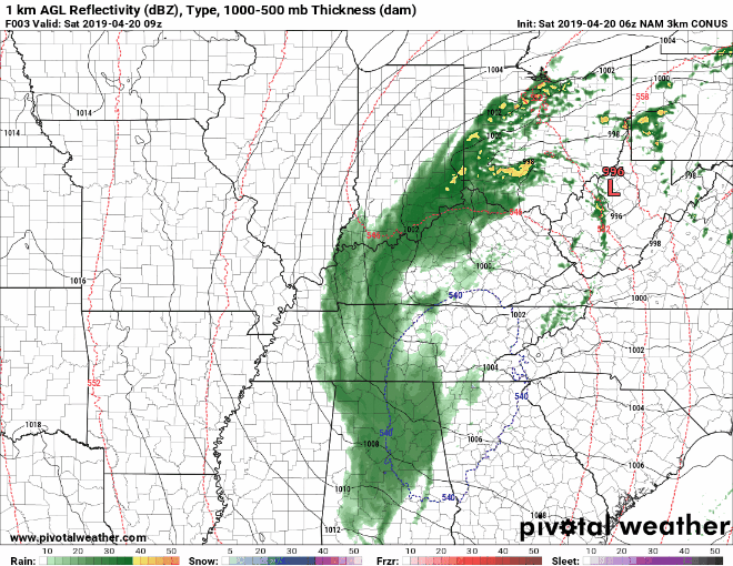
If you were woken up by some rumbles of thunder earlier this morning, you weren’t alone. Our greatest chance of rain has already moved through the area as we were all getting up for the start to our day.
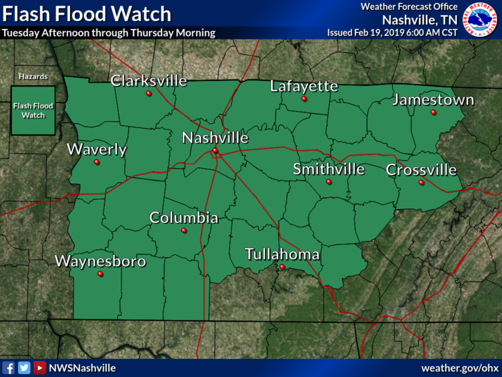
Forecast totals from NWS-Nashville:
A Flash Flood Watch goes into effect this afternoon and lasts until Thursday morning for Nashville, Williamson County, and most of Middle Tennessee.
Rain will start this afternoon, so be sure to have that umbrella handy. Rain will intensify during the evening commute, becoming more widespread by 4:00 PM – 5:00 PM, and continuing into the evening.
Not much in the way of sunshine is expected as we are looking at the potential for cloud cover throughout today. Rain chances will be associated with this cloud cover; isolated showers and perhaps a few rumbles of thunder will be possible, with a greater chance of rain during the overnight hours. High temperatures could reach into the 70s today across most of our area, along with dewpoints hanging out in the 50s to lower 60s.
You must be logged in to post a comment.