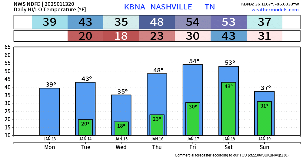
Tonight, Tuesday night, and Wednesday night – low temps will all bottom out around 20°. Prepare to bundle up for the bus stop, commute to work/school.

Temps will slowly warm up throughout the week, getting back into the 50s by Friday and Saturday.

Tonight, Tuesday night, and Wednesday night – low temps will all bottom out around 20°. Prepare to bundle up for the bus stop, commute to work/school.
Temps will slowly warm up throughout the week, getting back into the 50s by Friday and Saturday.

Temperatures have climbed all the way into the low to mid 40s, which has done a number on snowmen.
Some shady areas are stubborn and there could still be some slick spots on roads. Temperatures will dip below freezing again tonight, and while most roads are bone-dry, a few spots of black ice are possible Monday AM.

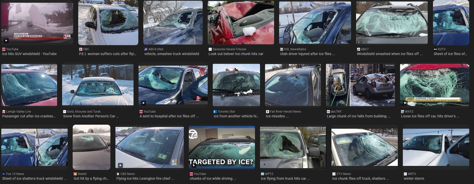
If you are going outand about, please clear the snow off the top of your vehicle.
Please don’t let this be you or someone else.
With temperatures above freezing and the sun out, some melting is ongoing today. Good news for the roads, bad news for local snowmen.


Well, it’s snowing.
Our Winter Storm Warning is set to expire at 9p tonight.
“Additional snow and sleet accumulations between 1 and 3 inches, as well as a light glaze from ice south of I-40…”

There’s been a few tweaks in the details for our upcoming snow tomorrow, but the overall forecast remains on track.
Headlines:
Data can still change! Stay tuned for the latest updates on all of our socials. We’ll also be hosting a YouTube Live at 8p tonight to answer all your questions, and to hopefully make some decent jokes.

As we continue to get closer to the event, some details are being finetuned, but overall, the forecast is on track.
Headlines:
Details still could change, stay connected for updates!

Overall, the timing remains the same.

Headlines:
Let’s dive into the details. Forecast could change! Stay connected for updates.
ETA of snow is expected sometime between 4a and 10a Friday, most likely around 7a Friday.
Snow will likely stick around for the majority of the day Friday. Snow should stop sometime Friday night; best guess right now would be 7-10p.

Although I am always hesitant with snowfall potential in our area, model guidance continues to point to us getting at least some snow on Friday. However, there’s still a good bit that still has to work itself out.

You may see a few flakes flying around over the next couple of days, but no accumulation is expected. There could be some slick spots on the roads tho – especially bridges and overpasses.
Before we talk about any of the winter weather stuff – it’s going to be downright cold this week.

Rain, heavy at times, will continue throughout the evening. No severe storm worries. You can check the radar anytime on our website here: Radar | Nashville Severe Weather Rain will end overnight as we catch some z’s.
You must be logged in to post a comment.