Now thru Friday, we j chillin.
We could see a few light showers Thursday, but those look to be few and far between.
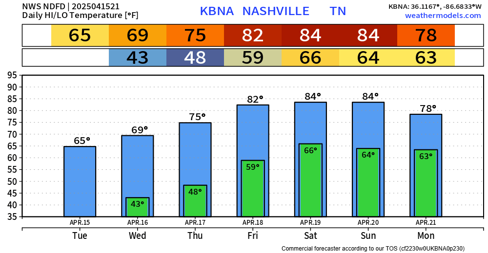
Temps slowly increasing throughout the week, getting to borderline hot by Friday and staying there for the weekend.

Now thru Friday, we j chillin.
We could see a few light showers Thursday, but those look to be few and far between.
Temps slowly increasing throughout the week, getting to borderline hot by Friday and staying there for the weekend.
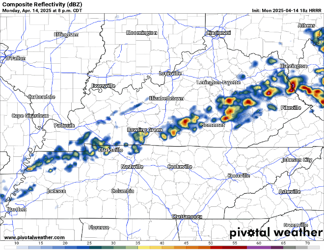
ETA of our expected showers continues to get pushed back little by little.
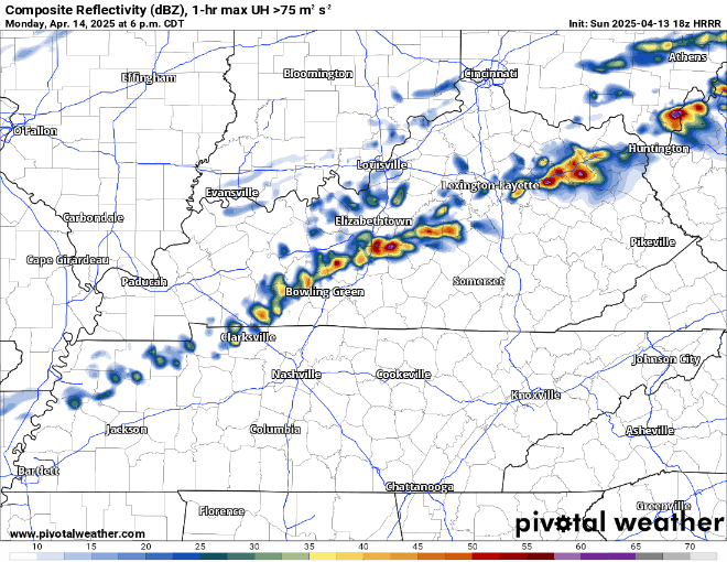
Still not expecting any severe storms but still can’t totally rule out a strong storm or two. Gusty winds, lightning, pea size hail the possibility in the strongest of storms – most of us won’t see that though.
Winds could be a little gusty Monday afternoon, up to 25 mph.
Also, some showers and storms look possible Monday PM, probably closer towards the evening/night. Ball practices may be OK.
Currently not expecting any severe weather, but some rumbles of thunder not out of the question.
Some scattered showers will continue to move thru over the next couple of hours before we dry out.
Fairly confident that all of our dinner/evening plans will be dry.
Rest of the weekend will consist of cool mornings, warm afternoons, and dry days.

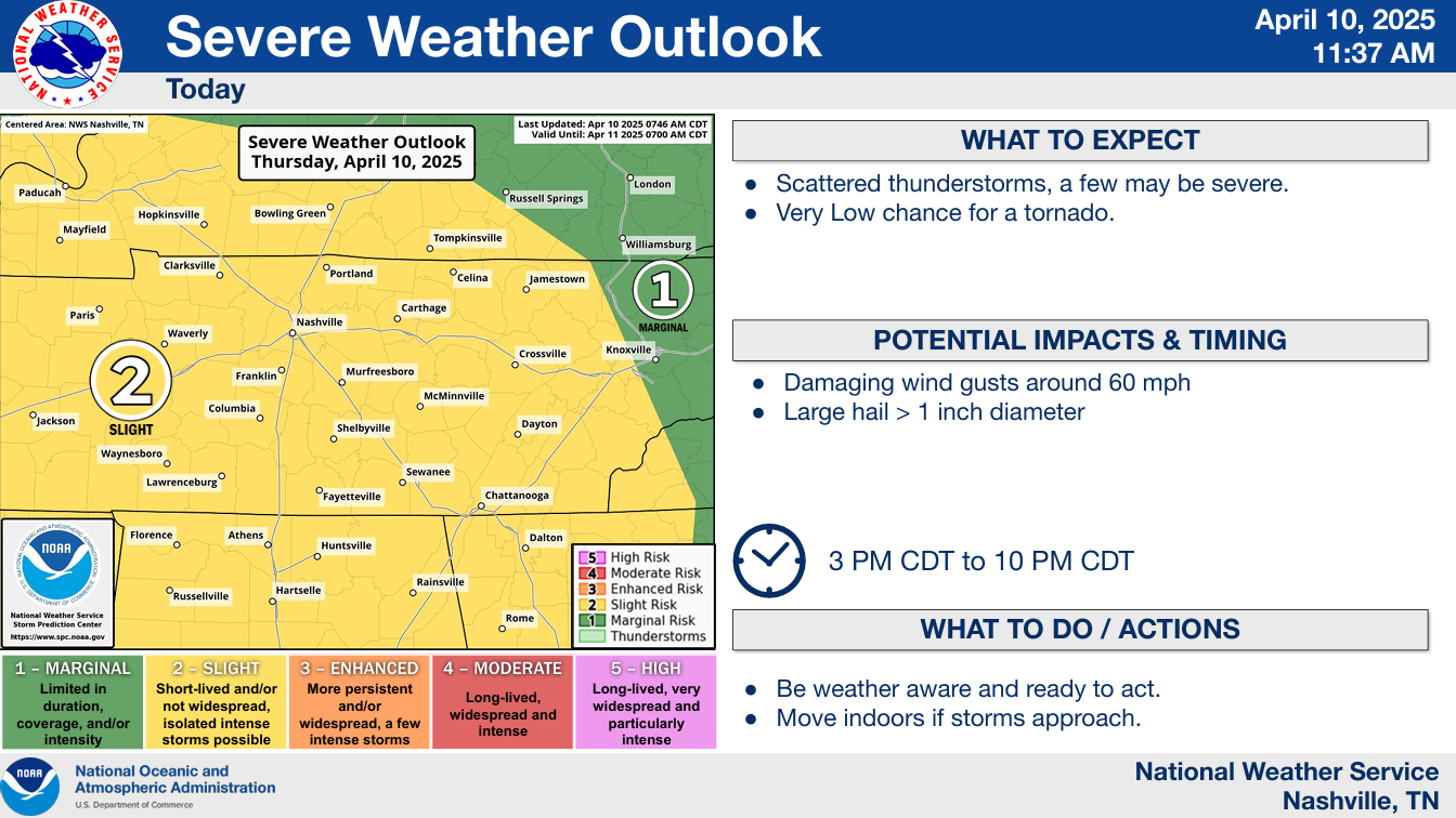
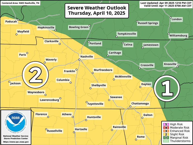
The Storm Prediction Center continues to have both of our counties outlooked with a 15% chance of hail (up to 1.5″) and/or damaging straight-line winds within 25 miles.
We have been removed from any tornado probabilities. The ingredients just aren’t there.
This looks absolutely nothing like what we dealt with last week. However, it still is worth keeping an eye on.
The Storm Prediction Center has slightly upped our chances for severe weather on Thursday, particularly for the afternoon and evening.
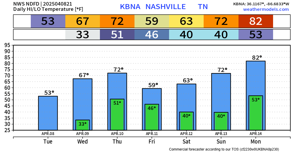
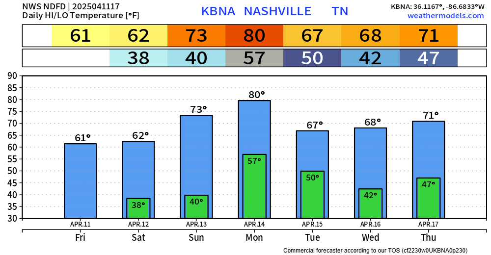
Lows tonight will yet again get down close to, if not below freezing. Cover up/bring in any loved plants!
Downtown Nash gets roughly a 50/50 shot of reaching 32°, with areas further away from the Urban Heat Island having much higher odds.
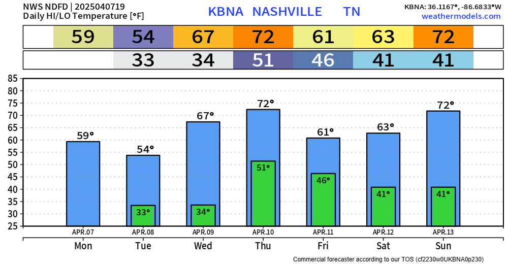
From 80s just a couple of days ago, we are looking at two straight nights of temperatures getting close to, if not below freezing…
Official lows for Nashville for tonight and Tuesday night are 33° and 34°, respectively. Although downtown is usually a few degrees warmer than everywhere else, so most of us likely will see a freeze. Cover up/bring in any plants.

There are currently no severe weather concerns for at least the next week.
Some rivers are still running high, it’ll take a little for the “big” ones to come down. Avoid flooded roadways – turn around, don’t drown.

Update as of 3p: The SPC did decide to include us on the very edge of a Tornado Watch until 10p. The forecast holds true. The highest severe threat is well to our west and any threat of severe weather/tornado is quite low – but not impossible. Stay weather aware!
You must be logged in to post a comment.