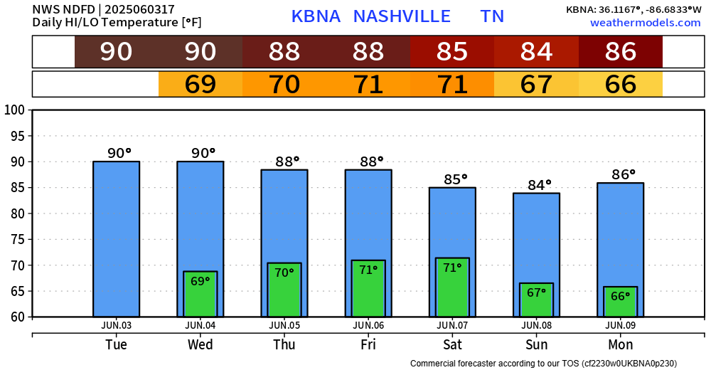
We are currently on our way towards 90°, we’ll likely get there but could end up just short. If we do get there, it’ll be the first time since October 6th of last year.
And if we don’t get there today, we have another go at it Wednesday.

We are currently on our way towards 90°, we’ll likely get there but could end up just short. If we do get there, it’ll be the first time since October 6th of last year.
And if we don’t get there today, we have another go at it Wednesday.
Tuesday and Wednesday will be pretty much a repeat of today’s weather, just a couple degrees warmer.
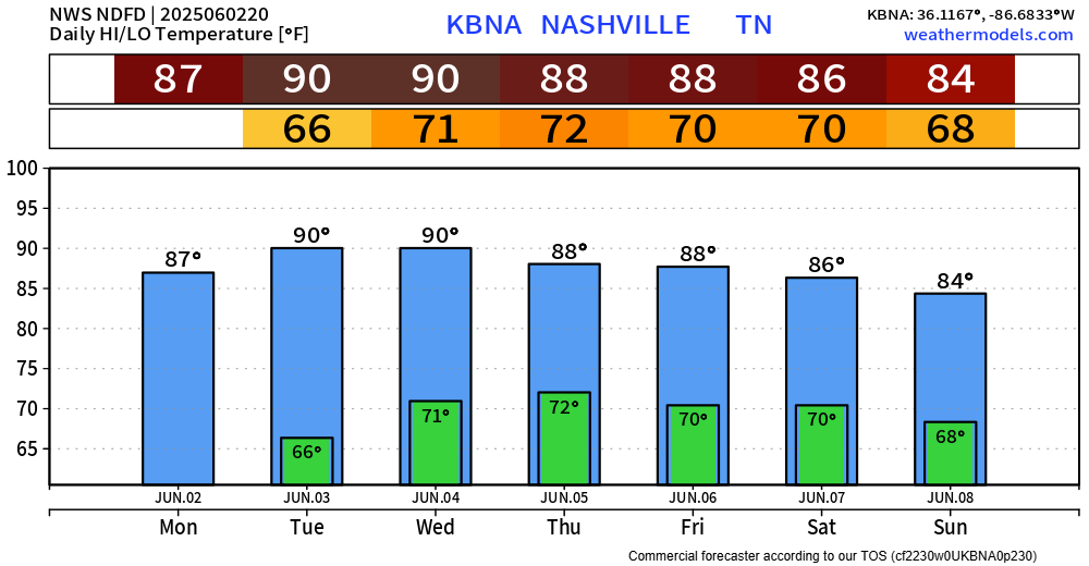
BNA touched 89° today, just short of breaking our streak of sub 90° temps. We haven’t hit 90° since October 6 of last year, per NWS Nashville. Quite the stretch, but hey, we’ll take it.
As of the time that I am writing this (7:45p), there are a few cells to our north that are slowly drifting south. With the loss of daytime heating, not too confident in those making it here. If they do, it would just be a quick shower, maybe a rumble of thunder. As always, you can check the radar anytime on our website: Radar | Nashville Severe Weather
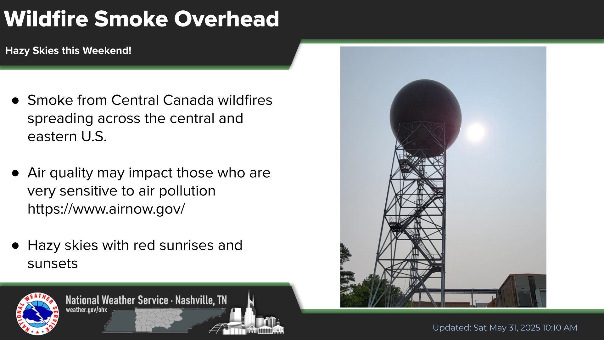
Wildfire smoke from Canada has made its way down south and will hang around for at least a couple of days. While the general population won’t be affected, those with respiratory issues may want to limit time outdoors. It will make for some cool looking sunsets/sunrises.
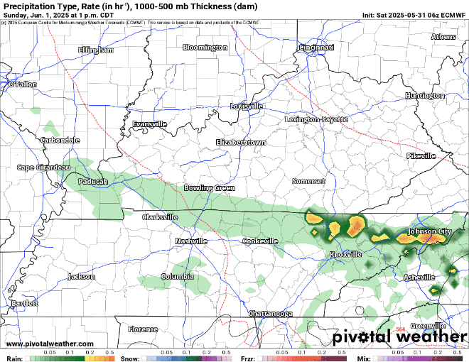
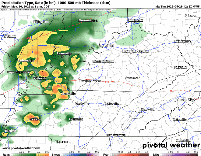
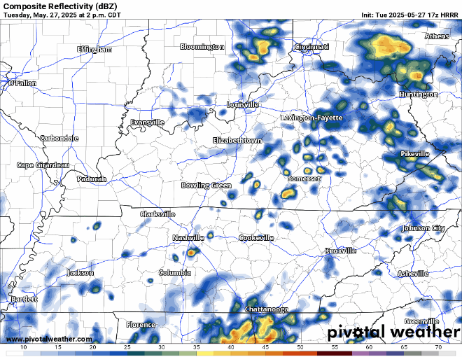
We could see a few spotty showers, maybe a thunderstorm this afternoon, but models – along with the latest observations think most of the activity goes to our E.
HRRR gives a guess below:
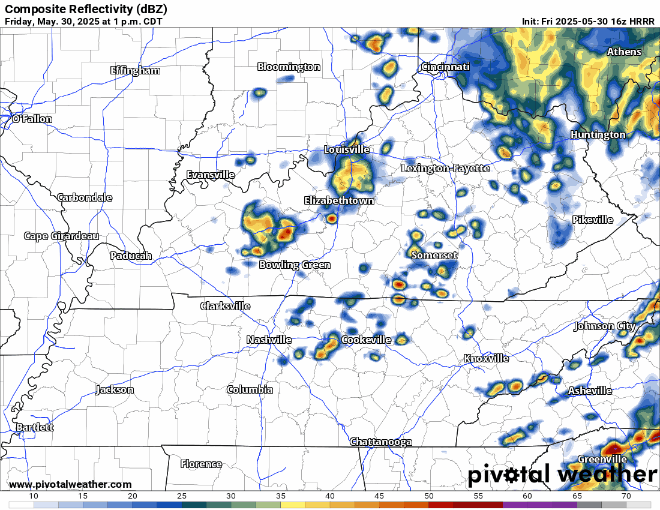
You can also check the radar anytime on our website here: Radar | Nashville Severe Weather
Scattered showers/storms possible this afternoon and evening. Wattery style, so no way to pin down any exact ETAs. Although the chance is low, a storm or two could contain some gusty winds and small hail.
It will stop – eventually. Which is great news, because we’ve received plenty.
One or two of us may see a stray shower this evening but think most of us stay dry.
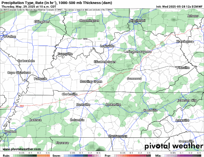
Few showers possible Thursday AM, but bulk of rain chances hold off until Thursday PM continuing thru Friday midday.
If you feel like May has been wetter than normal – you’d be correct.
The wettest May in 15 years, and we’ll add some to that total as we wrap up the month.
Rain chances will continue this afternoon and evening. Scattered showers/thunderstorms possible, not a total washout – but heavy rain possible underneath a storm.

Jason was born in Nashville. He graduated from Franklin High School. He met Ashley at ETSU. Then he joined the Army.
Jason and Ashley married and moved to Ft. Bliss. Jason had a boxer, Charlie. He rode motorcycles, played tennis. Jason and Ashley planned a formal wedding after he returned from Afghanistan.
We could see a few light showers later this evening, but not totally sure if they make it here. Models aren’t handling things very well today. You can check the radar anytime on our website here: Radar | Nashville Severe Weather
You must be logged in to post a comment.