
Wet Week Ahead
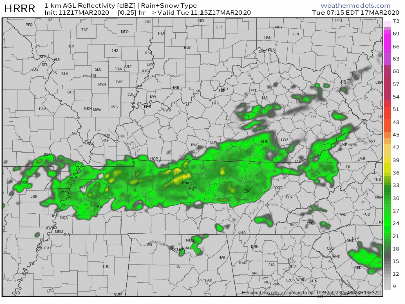
Scattered to widespread showers hang around Middle Tennessee all morning. We expect to begin to dry out between 5PM-7PM, so today isn’t a complete washout, but if you’re heading out before then, take the umbrella. Here’s what the HRRR model thinks might happen:
57° for the high.
Wednesday And Thursday
Yes more rain, but not a complete washout.
Wednesday does bring with it another rain chance, but it’s not going to be an all day, or really even widespread. The NAM thinks most of the showers will stick off to our north and we’ll see a few “splash and dash” rain chances through the afternoon:
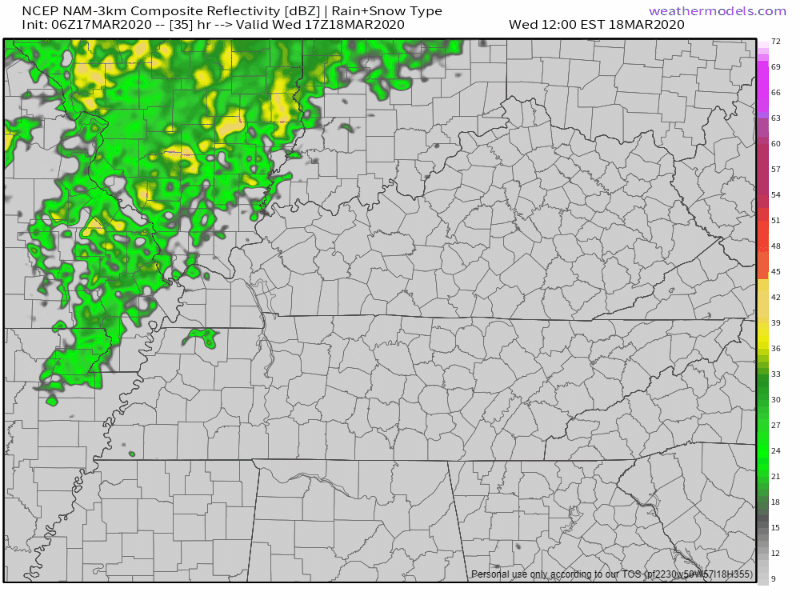
It’ll be warmer, 74° for the high.
Thursday brings much of the same, but more widespread rain than Wednesday, warm again at 77°.
Storm Potential Late Thursday And Friday
A cold front pushing its way through Middle Tennessee will come through late on Thursday and into early Friday. Most of the moisture ahead of the cold front will be where we get most of our impacts of this system from.
The NWS-Nashville goes further in depth to explain what is going into this system:
“Overall, shear ramps up from time to time but instability remains very low end. While the main front passes largely Fri afternoon, there is a window overnight Thu into early Fri were instability does become a little more favorable, while shear elevates as well. At this point however, it is still wait and see if models trend instability higher for severe potential because even a bit more favorable it is still quite low.”
NWS-Nashville Forecast Discussion 3/17
The severe potential is there, but still too far out to be certain of anything. If a decent amount of instability and shear are available overnight, we could get stronger storms out of this system. The storm prediction center has our two counties highlighted in its general thunderstorm risk area.

This being said, we’re still uncertain on exactly how much energy these storms will have to work with. Regardless, plan now and have a plan in case severe storms do make their way into Middle Tennessee Thursday night into Friday morning. Stay connected. Don’t let this be the last time you check on the forecast for this system.
Weekend
Behind our cold front passing through on Friday, we will begin to see a much needed and wanted drying trend that will last through most of the weekend, as a few showers may return again later on Sunday. The cool front will certainly bring cooler weather. Mid 50s for the highs over the weekend, but the sun makes its glorious return for us.
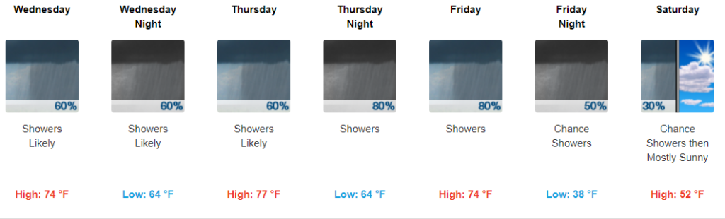
Have that umbrella handy this week and happy St. Patricks Day!


Categories: Forecast Blogs (Legacy)
You must be logged in to post a comment.