
First Saturday of the month. Tornado siren tests are today. Davidson Co at noon. Williamson at 1:00 pm.
Frost Advisory Tonight, Unsettled Pattern Begins Sunday.
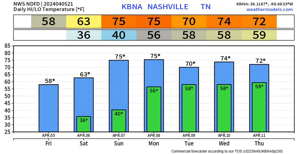
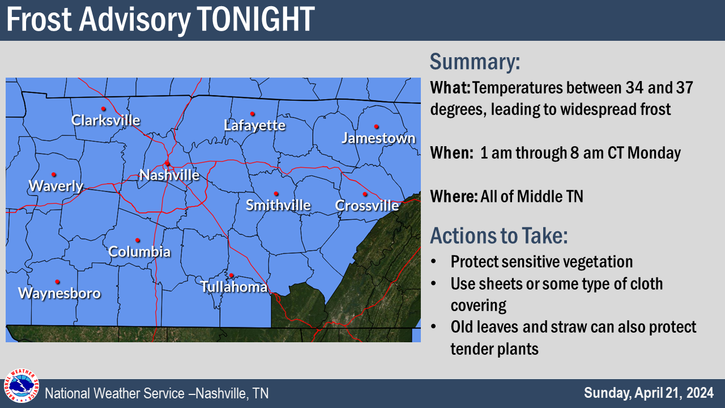
Good idea to cover up plants tonight, a Frost Advisory will be in effect from 4am thru 9am Saturday morning.
Lows are expected to get down into the low 30s, thankfully temps will quickly recover Saturday afternoon and make it into the low 60s.
Frost/Freeze Possible Tonight and Friday Night, Rain Chances Return Sunday.
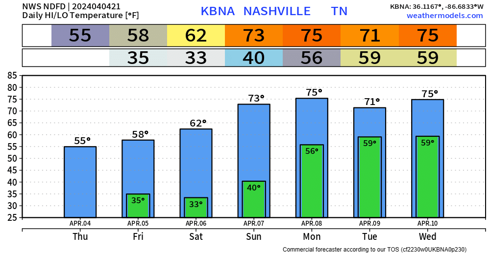
Temperatures will dip into the mid 30s tonight, which may bring some frost to the area. A few backyards may dip below the freezing mark.
Friday high temps will reach the upper 50s, but Friday night will have our coldest temperatures of the forecast, with temps in the low 30s. A few places may get down into the upper 20s. Good idea to cover up any loved plants.
Frost/Freeze Possible Thurs/Fri Night, Looking at Eclipse Cloud Coverage.
Pockets of on/off rain continue to move thru the area, coverage will decrease as we head into tonight. Still can’t rule out some more brief graupel/small hail aka Sonic ice in some of the showers.
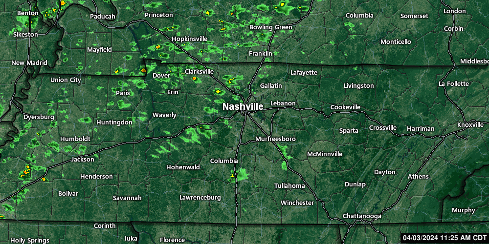
Temps aloft below freezing. Graupel/frozen precip like Sonic Ice may fall out of these showers this afternoon.
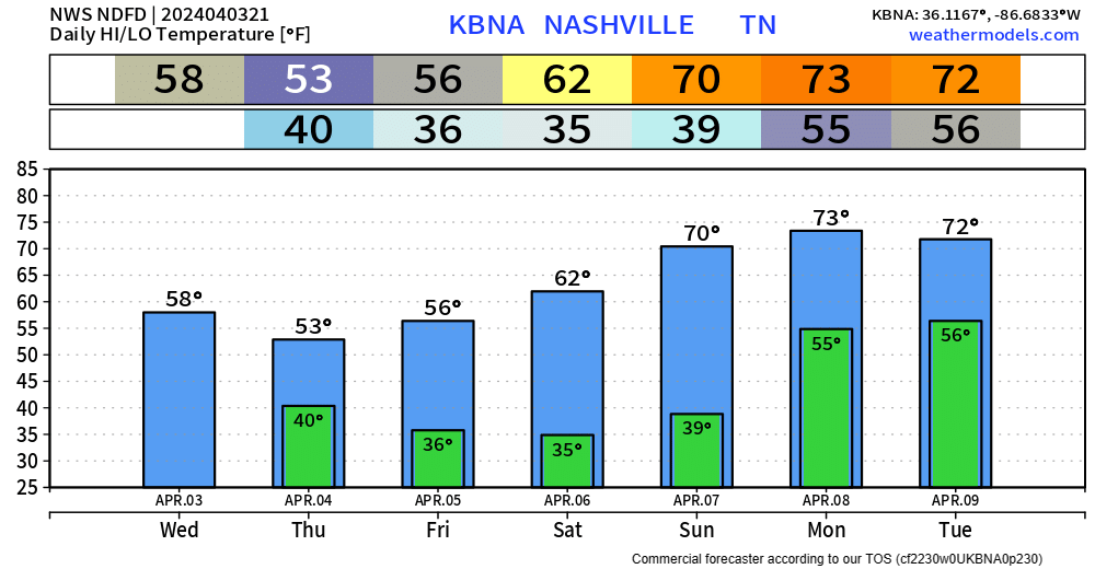
All Clear. Cool Rain Possible Wednesday + Thursday.
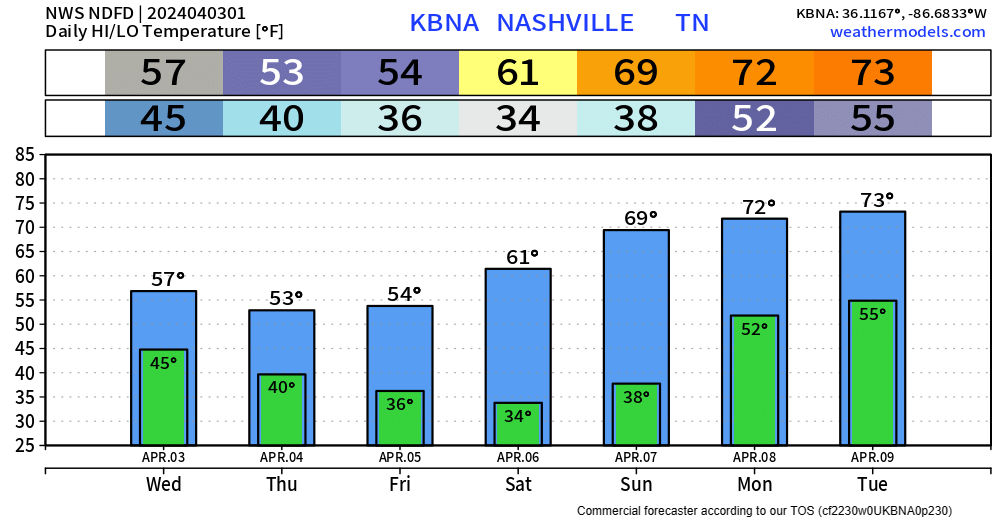
The cold front has passed through, bringing in cooler air and signaling the end of our severe weather threat.
High temperatures Wednesday – Friday will be about 20° cooler than we experienced today. Gross.
Severe Weather Possible Today; Stay Connected
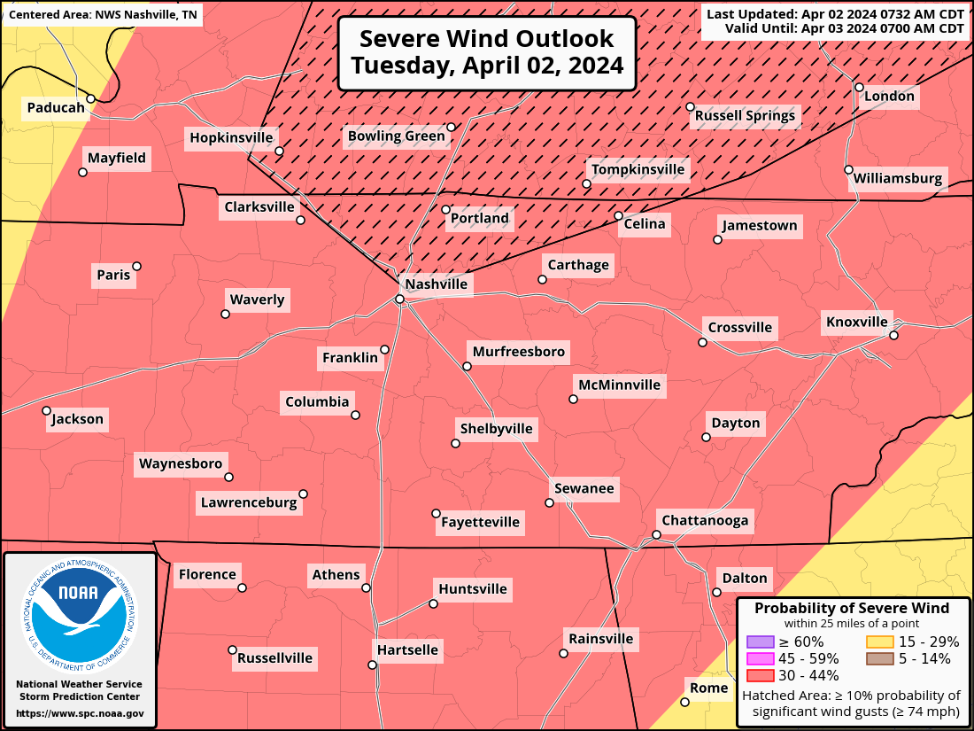
Our probabilities from the SPC remain unchanged for now. Within 25 miles of you, there is a 30% chance of damaging straight-line winds, a 30% chance of large hail and a 10% chance of a tornado, which could be strong (EF2+).
A favor? Y’all click this link real quick so we can test capacity? nashvillesevereweather.com Try and break it. Testing some website stuff.
New Info on Timing, Hazards for Tuesday’s Severe Weather Threat

The Storm Prediction Center came out with their midday update for Tuesday and have upped our probabilities for severe weather tomorrow.

Both counties are outlooked with a:
- 10% chance of a tornado within 25 miles (some of which could be strong, EF2+)
- 30% chance of damaging straight-line winds within 25 miles (some gusts could be hurricane force, 74mph+)
- 30% chance of severe hail within 25 miles
These probabilities are subject to change.
Except for blog posts, all updates from now until the storms move out on Tuesday night will be over on X (@NashSevereWx). We’ll see ya there. Latest blog post below.
You must be logged in to post a comment.