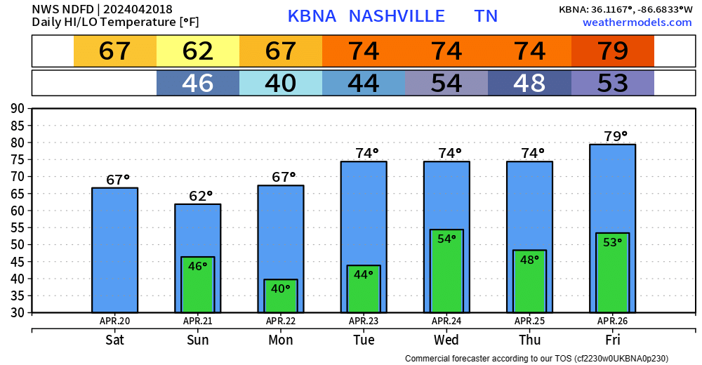
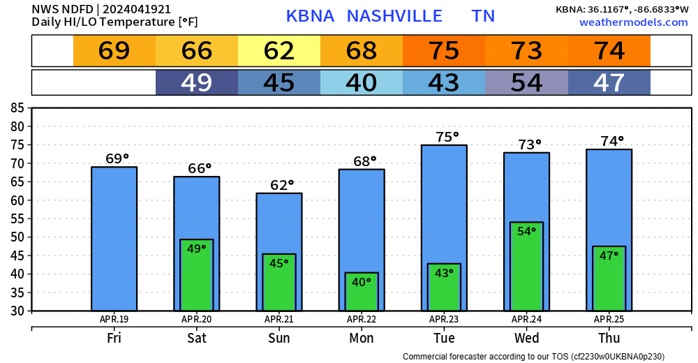
Temps will dip down into the mid 30s tonight, so NWS Nashville went ahead and issued a Frost Advisory from 1am ’til 8am Monday. Protect any loved plants.
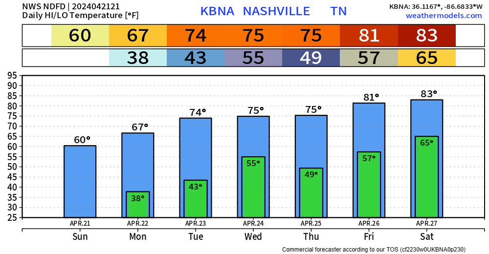
Thankfully, we’ll warm up throughout the weekend, with a return to the 80s by the end of the week. read more
Maybe a few sprinkles this evening, but nothing more. A little chill as the sun goes down as temps will make it down to around 50° tonight.
Maybe a stray shower or two Saturday morning, but that’ll be it as we are left with a dry rest of the day. Highs only making it to the mid 60s.
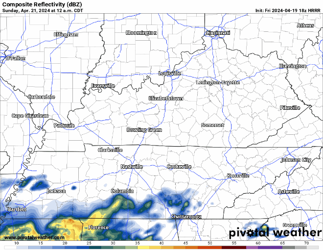
Sunday is the coolest day of the upcoming forecast, with some light rain possible in the morning. Doesn’t look like a rainout tho.
HRRR model (above) shows some light, NBD showers quickly moving in and out early Sunday morning.
Monday will be a nice sunny start to the week with highs in the upper 60s.
"A weak front will bring a small chance for showers late Tuesday and Tuesday night. The next significant rain chance will come late in the week. It looks like an active, stormy pattern may form for next weekend." - NWS Nashville AFDread more
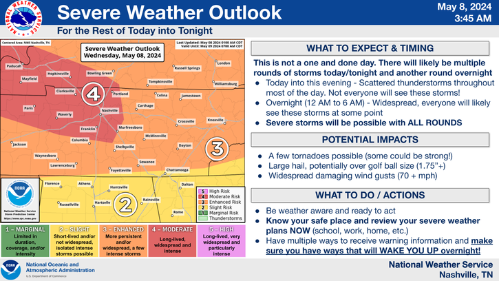
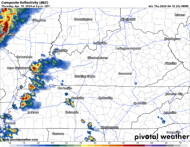
I’m encouraged by the latest HRRR model run, which keeps storms pretty isolated/scattered through the night rather than a big line of angry storms. I’m not betting the house on this, but my anxiety level is pretty low. Loop through noon Friday.read more
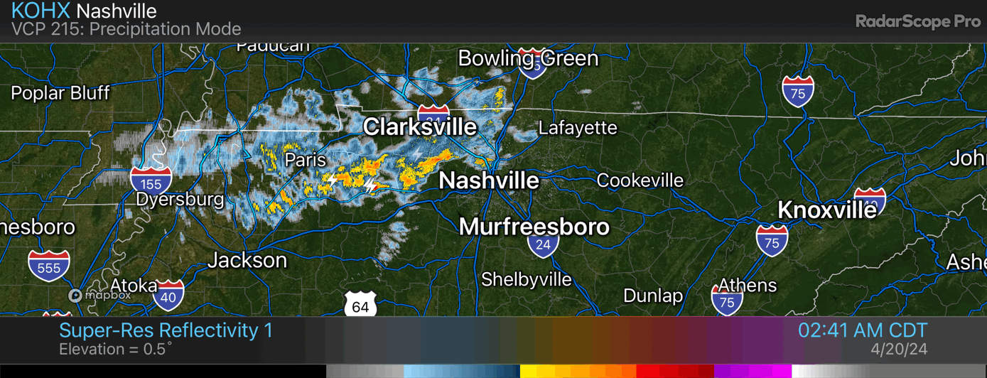
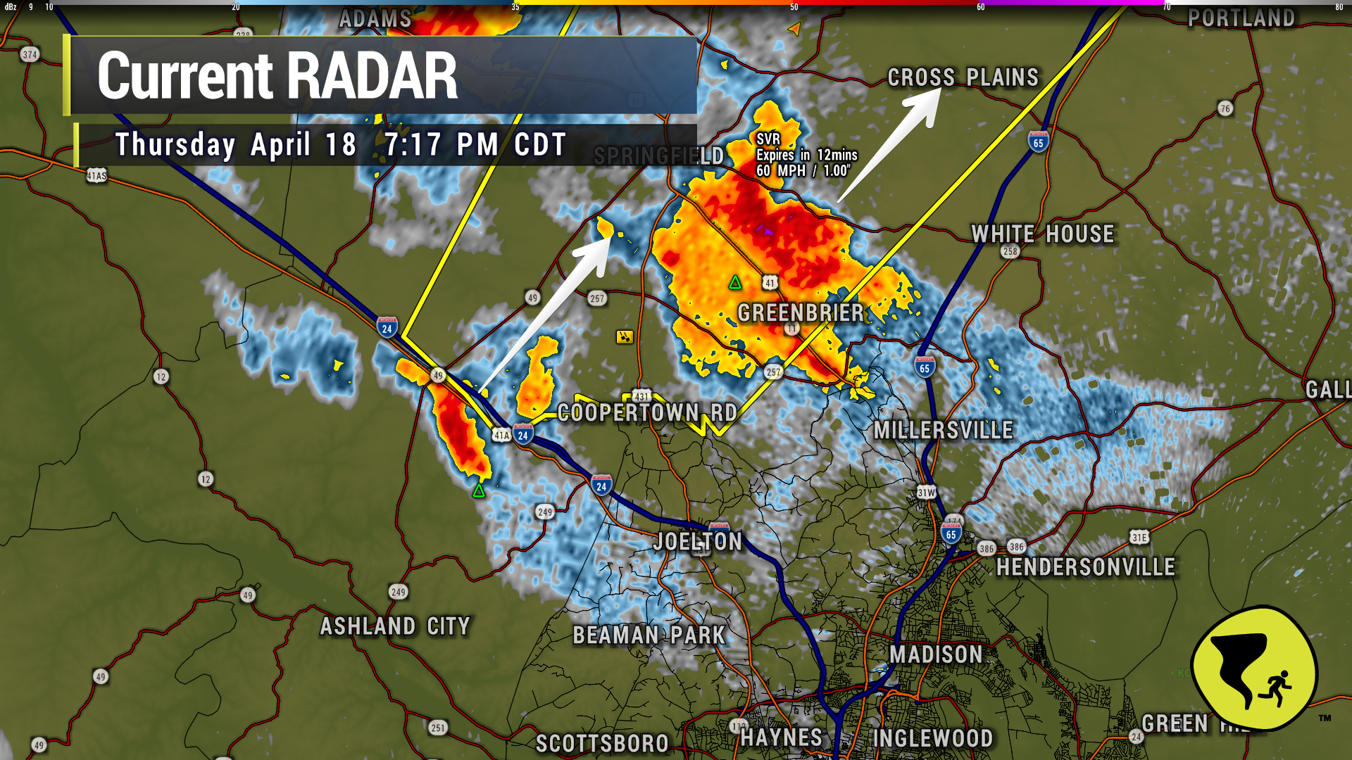
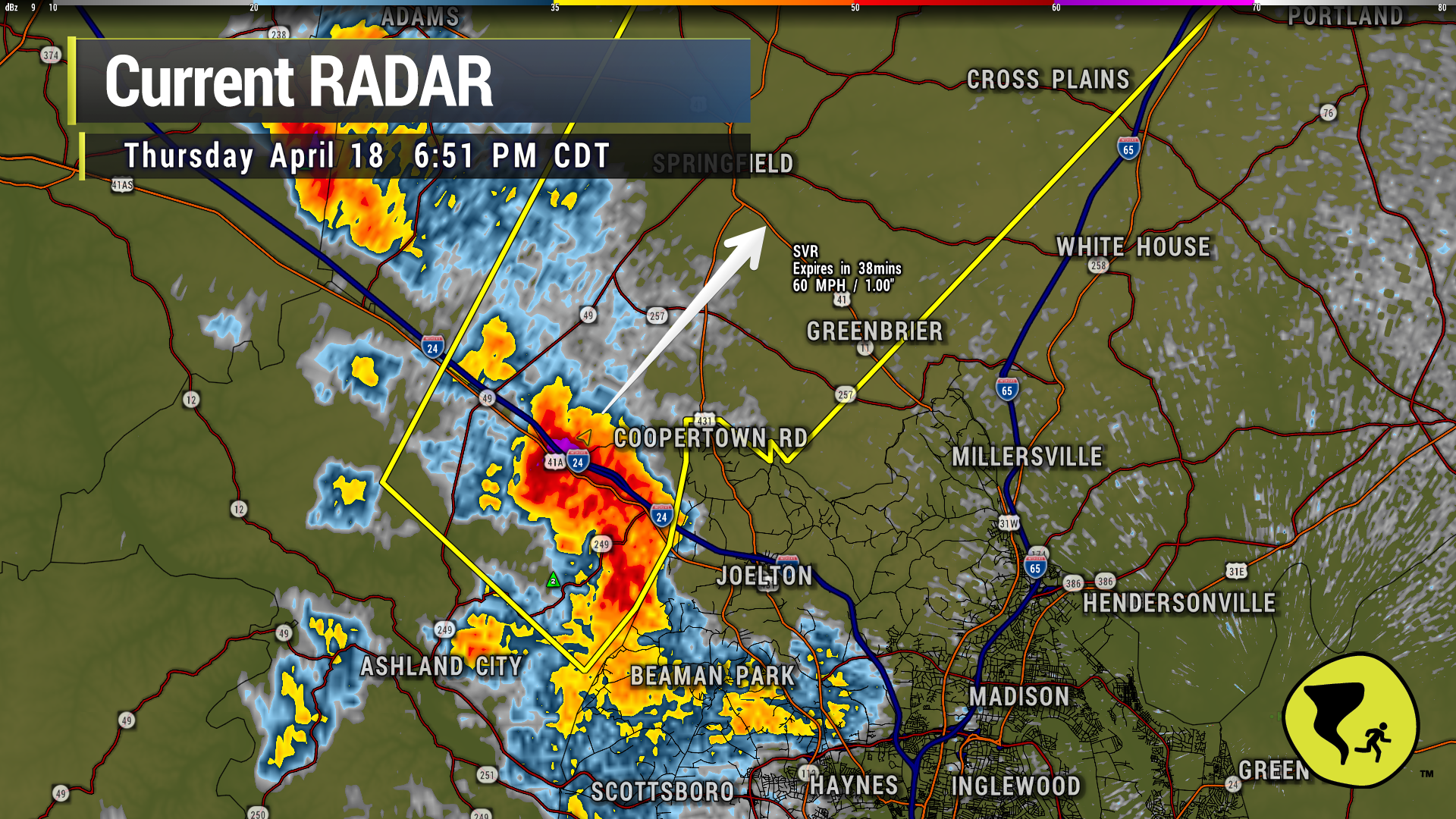
Severe warned storm to our north is moving away from us, but lightning still an issue near these storms. If you hear thunder, you’re in range of being struck by lightning. Penny-size hail reported a bit ago in this storm. We’ve been spared by this one. 7:19 pmread more
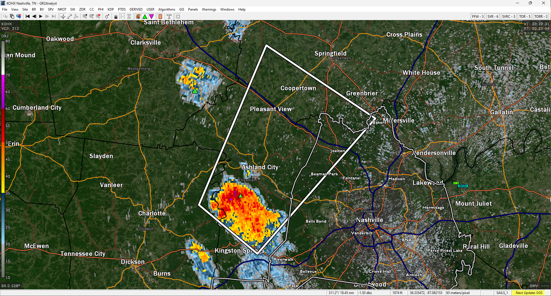
The cell clipping us on the NW side has gotten pretty impressive. Hail a good possibility. Possibly decent size hail. Watching it closely. Coopertown Rd area, heads up.
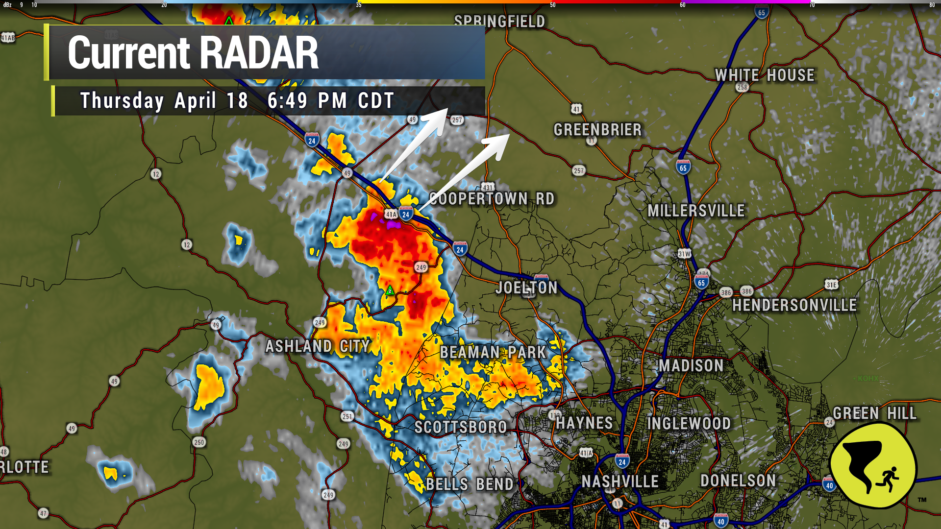
40 mph winds and pea-size hail possible inside the white polygon (Joelton) if this cell holds together, per NWS.
Subscribe to Blog via Email
Privacy & Cookies: This site uses cookies. By continuing to use this website, you agree to their use.
To find out more, including how to control cookies, see here:
Privacy Policy


You must be logged in to post a comment.