
Pockets of on/off rain continue to move thru the area, coverage will decrease as we head into tonight. Still can’t rule out some more brief graupel/small hail aka Sonic ice in some of the showers.
Temperatures on Thursday will be just as cool as today. Can’t rule out more showers during the day, but majority of the activity looks to stay to our north and east.
Overnight Thursday and Friday frost is possible, as temps will drop down into the low to mid 30s. If you have already planted, would probably be best to have a plan to cover those up. Although our official lows are 36°/35°, a few backyards could briefly dip below freezing.
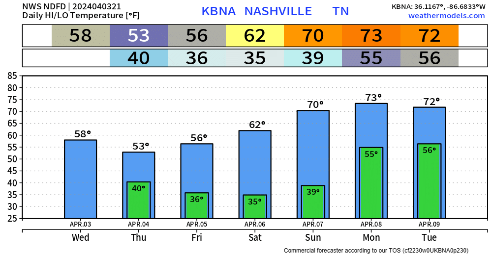
Friday and Saturday will be dry, Saturday will be a much nicer day as high temps return to the 60s.
70s return for the start of next week, along with rain chances. No severe weather is currently expected, but some thunderstorms are possible. More details on timing in the coming days.
Traveling for the Eclipse?
Although we won’t see totality here in Middle TN, the drive to it isn’t too far.
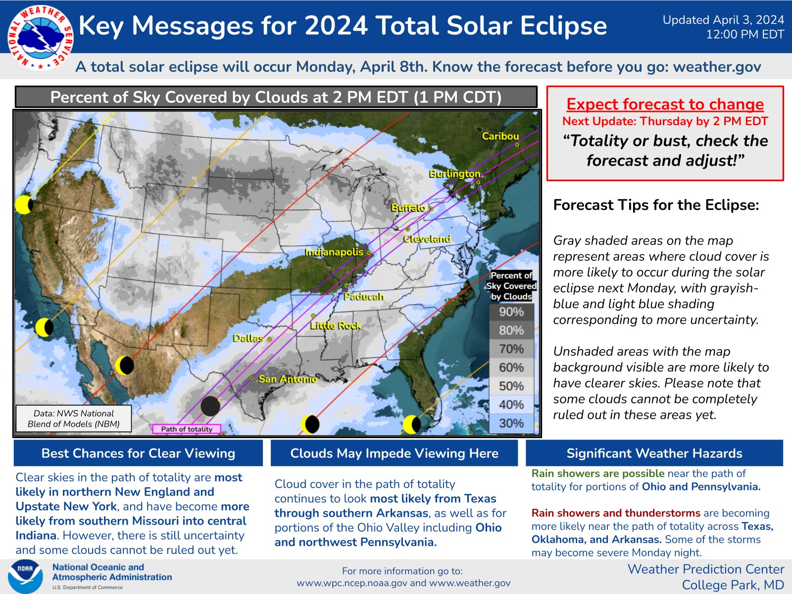
As of right now, SE Missouri, southern Illinois looks like the closest sweet spot, although this could change. A website we often use to look at weather models, Pivotal Weather, has put together a cool page to compare different models for the Eclipse. If traveling, this may be a helpful website! (or if you are a weather nerd like us and just enjoy looking at weather models in your spare time, no shame) Eclipse 2024 Cloud and Visibility Watch — Pivotal Weather
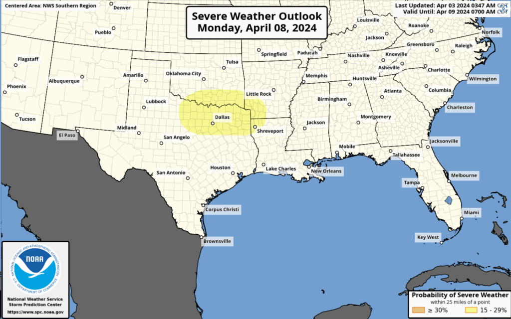
Another note if traveling, Dallas and surrounding areas don’t seem like your best bet, as the Storm Prediction Center has outlooked places in yellow in a 15% chance of severe weather within 25 miles. Thankfully, here at home, we are not included, although rain is in the forecast for Monday.
Categories: Featured Blog