
It’s that time of the year to start playing the Wattery. All will enter, few will win.
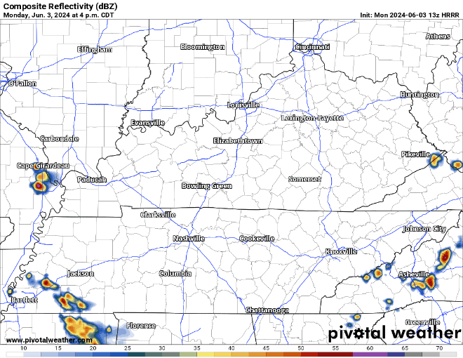
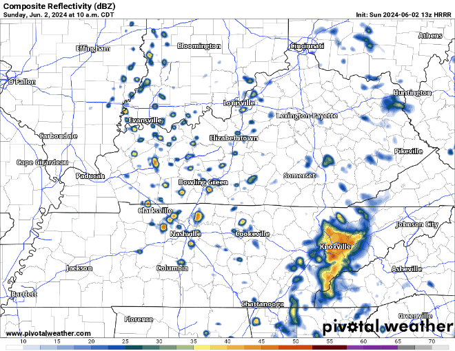
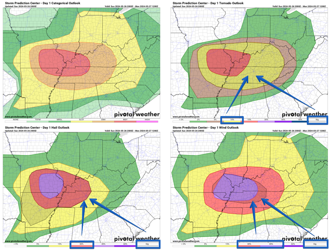
HRRR model suggests storms with lightning start popping up around 4 or 5 pm today, with activity slowing down after sunset. Not everyone will see rain, but those that do may have to temporarily relocate indoors and wait for the lightning to pass.


You must be logged in to post a comment.