
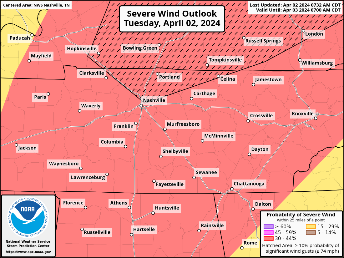
Our probabilities from the SPC remain unchanged for now. Within 25 miles of you, there is a 30% chance of damaging straight-line winds, a 30% chance of large hail and a 10% chance of a tornado, which could be strong (EF2+).


The most likely timeframe for severe weather will be around 1-4 pm TODAY. Check back for updates throughout the day. This could change! The HRRR model from noon-10pm:

No need to panic, but have a plan in place. Know where to go if a warning is issued for you (lowest level, most interior room of a sturdy building). Mobile homes will *not* be a safe place. Do not get caught outside or driving while this passes thru. More info here.
Have multiple ways to receive warnings today. Make sure the WEA alerts on your phone are ON, NOAA Weather Radio, apps like Storm Watch Plus. We will go live on our YouTube Live channel if a warning is issued for either one of our two counties. Be able to pinpoint your house/work/school on a map!
Remain weather aware today and check back frequently for updates. Those updates will be on Twitter/X @NashSevereWx. This is a low probability of a high impact event. There is a 90% chance there is *not* a tornado within 25 miles of you today. Glass half full. We’ll keep you updated.
Categories: Featured Blog