
Temperatures will dip into the mid 30s tonight, which may bring some frost to the area. A few backyards may dip below the freezing mark.
Friday high temps will reach the upper 50s, but Friday night will have our coldest temperatures of the forecast, with temps in the low 30s. A few places may get down into the upper 20s. Good idea to cover up any loved plants.
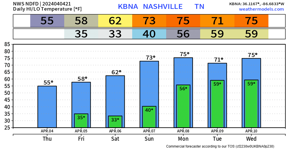
High temps in the 60s for Saturday, with 70s in the following days.
Sunday will begin the start of an unsettled weather pattern for us.
“Thankfully, we are not seeing severe wx signals at this time, just waves of showers with embedded thunderstorms and generally mild temperatures.” – NWS Nashville
Sunday afternoon/evening appears to be the ETA for on/off rain/t-storms right now. More details will be shared as things become more clear.
Eclipse Update
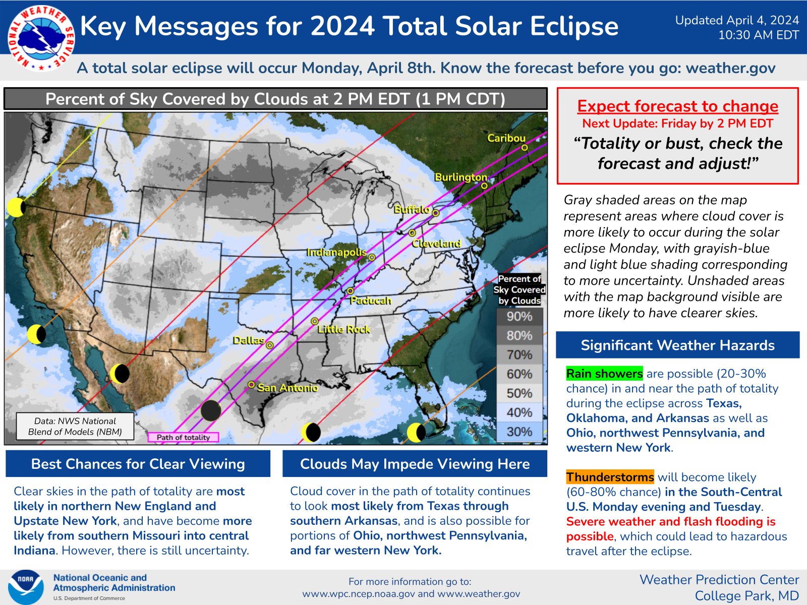
If making the journey to see totality, Missouri and Illionois still seem like your best bet locally. A plane ticket to Maine would work too. Severe weather is still possible in cities like Dallas and Little Rock, so probably not your best bet.
Here locally, conditions look iffy to see a partial eclipse, rain + clouds may rain on your parade.
Categories: Featured Blog