
The cold front has passed through, bringing in cooler air and signaling the end of our severe weather threat.
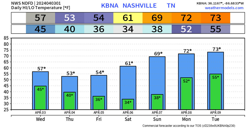
High temperatures Wednesday – Friday will be about 20° cooler than we experienced today. Gross.
HRRR model (above) shows on/off cool rain possible pretty much all-day Wednesday, as we get some wrap-around moisture from the low-pressure system to our north. The Plateau could even see some flurries, but no impacts expected here nor there.
Similar on/off cold rain chances Thursday, NBD.
Maybe some chances for a frost/freeze in some places this weekend. More deets on that in the coming days.
Cloud-Coverage Guessing for the Eclipse
If you plan on traveling to see another total eclipse, the WPC released this map today of the current expected cloud coverage.
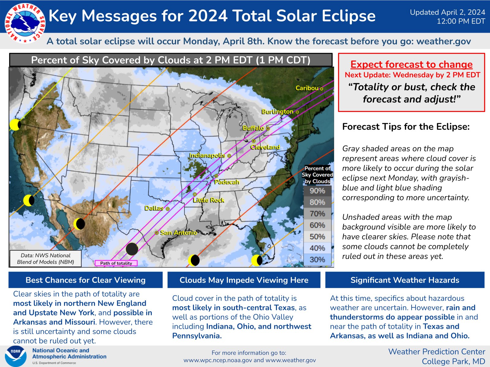
You may have noticed today that weather is hard to predict, even on the day of. So, this may change.
As a reminder, we will not experience totality here in Middle TN. The sky will look normal next Monday, unless you have the proper glasses, then you can see the sun being partially covered – that is if we don’t have any clouds. Arkansas/Mizzou looks like your best/closest bet if you are looking for totality and clear skies.
Categories: Featured Blog